
February is generally acknowledged as being the worst month of our winter in Paleochora, with the heaviest rainfall, temperatures often dropping below 10c, and sometimes cold northerly winds. Such combinations, together with limited daylight, require adapting walks to the conditions whenever the opportunity arises, often at short notice.
This circular walk from Kakopetros meets most of the above criteria, a short but enjoyable route in an area new to many, and which can be curtailed should the weather deteriorate. Kakopetros village is 35 km north from Paleochora, roughly the same distance from Chania, and on the main bus route.
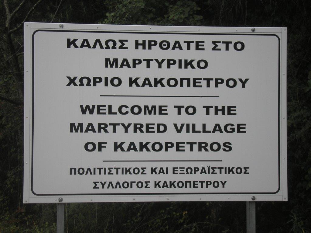 Its name translates as “bad stones”, but actually originates from the fact that in times long ago there was a difficult river crossing here (through boulders), on the ‘road’ between Kandanos and the north coast, across the gorge which runs down to Zymbragou. There is ample parking by the memorial, a reminder that Kakopetros has a troubled history.
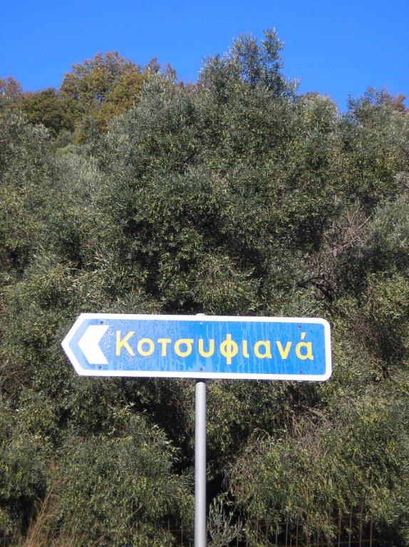
 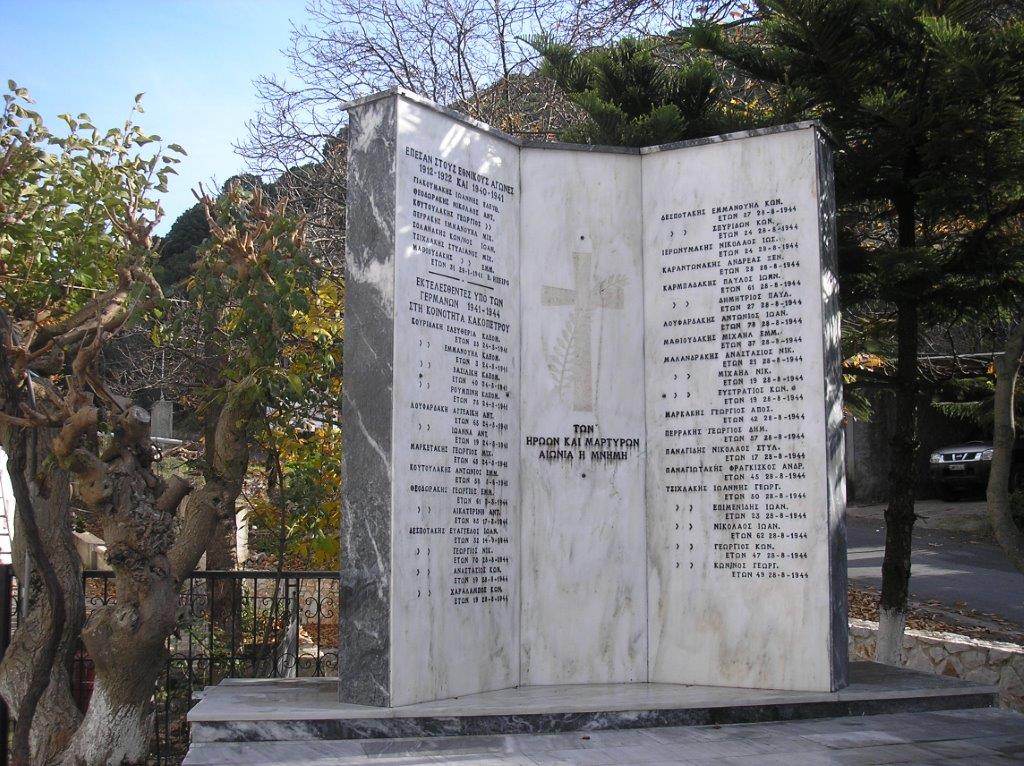 From the village ‘platea’ walk back 400m to the turning left, signed to Kotsifiana. The road winds steadily uphill, views improving with height gained. On reaching the small village, home to some 20 inhabitants, continue ahead, the road now becoming a rough track, and still climbing. ‘Kotsifi’ is the Greek name for ‘blackbird’, one of the most common European birds, and usually seen or heard in the woodland and scrub around the village.
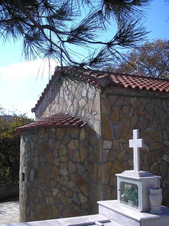
 Soon a diversion left leads to the church of Profitis Ilias, an option well worth taking. Churches so named are usually on hill summits, this an exception.
Return to the track, the gradient finally easing on reaching the masts, at 800m above sea level. Well away from any “madding crowds”, even those familiar with SW Crete will enjoy views from a different perspective.
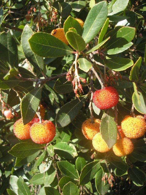
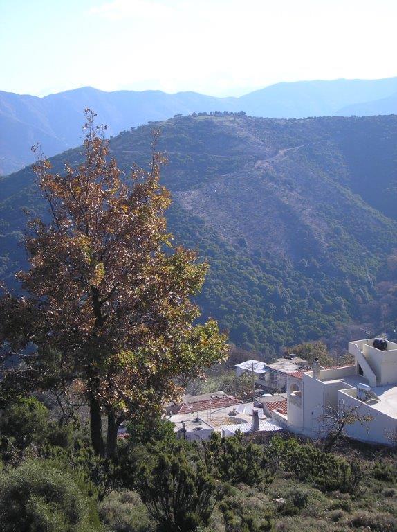 Now the track heads south, beginning to circle around and above the deep valley, with Kotsifiana far below. Avoid a track right, and soon swing eastwards, losing height. Views extend to the White Mountains, snow-covered often until May or early June. The profusion of shrubs trackside are Arbutus unedo or wild strawberry tree, the colourful small fruits both edible (but seedy) and used to make a type of ‘raki’.
Along the ridge, another turn right is ignored, as the track heads north, and drops down to aY-junction. A choice here, maybe depending on the weather. The left fork, an (extremely) rough track, descends to a goat/sheep enclosure, then through a gate and down to meet the surfaced road (to Palea Roumata), where you turn left for 500m back to Kakopetros.
Alternatively, fork right (easier walking) on a level track around the hillside, soon with views to distant Palea Roumata and some of the thirteen hamlets in this area. Go through two gates, and begin a winding descent to the valley, avoiding all side tracks to right and left, and keeping to the main “road” downhill. At a distinctive Y-fork, keep left on the concreted track, and very soon meet a wider road on the outskirts of Kechres. Left here, to join the main road at Pananiana, and left again for a short walk over to Kakopetros.
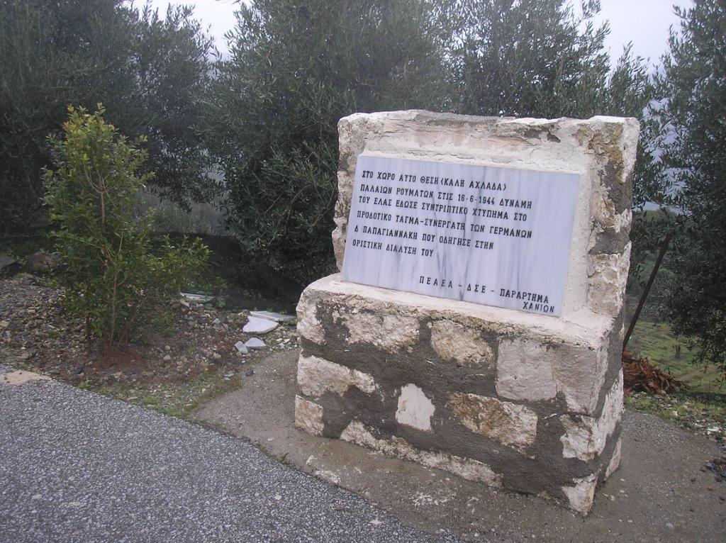 Two points of interest en route – the first a memorial to a Cretan partisan killed fighting the Germans in 1944, and close to Kakopetros are two deep caves (roadside), origins unknown, maybe used for cold storage?
In summer this walk fits in with the ‘bus timetables, and has often been, for me, a welcome and relaxing antidote to a stressful day in Chania.

7 comments
Skip to comment form
Thanks a lot for this Bob, it looks doable too given the bus timetable.
Thank you for the details on what sounds a lovely walk. Roughly how long is the walk in Kms or time please?
Many thanks
Hallo Bob,
thank you for the description of this walk that seems to offer beautiful views! How long is it, by the way? We have two children and have to persuade them to walk with us…
Warm regards
Üetra
Bob is away on holiday at the moment. I am sure he will comment here about the distance as soon as he gets back.
Seems like a fabulous walk and one to do in April hopefully. Thanks for sharing,
best wishes Shelagh
OK folks…Your intrepid admin had to find out for himself how long the walk takes. It was a perfect spring day today – not a cloud or a whisper of a breeze – so I took my twin 11 year old boys to time it.
It took us about 90 minutes to get up to the masts. (when you get to the village, bear right at the small concrete water cistern). It is an easy walk but your legs will feel it by the time you get there and “Old Mr. Sea Level” here was puffing a bit at 2,400ft.
We stopped for a bite to eat & a sit down at the masts for 15- 20 minutes.
On the way down we did get a tad confused as there were many stock gates not mentioned in the article and that led us to think we were further on than we were. We took the rough track option to the left which I think is the shorter route of the two simply because it was getting late.
From the masts to the car – 1 hour & 15 minutes.
The whole walk took us approximately 3 hours (without the diversion to the church). According to Google Earth, it is just over 9km (5.75 miles). Here is an approximate route loaded on to Google earth for anyone who wants a map of sorts: http://thepaleochorasite.com/Kakopetros%20walk.kmz
I don’t know what sort of coffee Bob drinks but if I attempted it after a morning traipsing round Chania, I reckon it would would do me in.
Well done Barry (and boys), and hope Dad’s recovered from the altitude sickness. Yes, distance for the shorter walk is 9/10km, the longer extension c.12km. Times depend on so many factors (weather, fitness, route-finding, etc), but usually 3km per hour, plus stops, gives an indication. On a recent damp, overcast and cold day the whole route (solo, without stopping) took me not much over 2 hrs. Re. stock-control gates, there are several, which may/may not be there by spring or summer, & difficult to indicate exact positions (which may change.) An extension to this walk is – on the longer route – to turn right into Kechres and follow the road through Lidhiana and into Palea Roumata, where there’s a small taverna. Currently there’s a bus (weekdays only) leaving at 1.45pm back to Kakopetros. Or, drive to Palea Roumata, walk the beautiful Vavouledo Gorge in the morning, then take the bus to Kakopetros and walk back. Also in the vicinity is the Trahinos Gorge, which I’ve not found yet – watch this space …..