
Always ready to find and travel the footpath less taken, one marked from far below Prodromi into the upper reaches of the Kakos Potamos valley leapt off the latest edition of the Anavasi Hiking Map for Sougia and Paleochora.
The map indicates a “faint path” leading south and south-east from Agios Georgios church, dropping steeply down into the long valley which culminates at Sougia harbour.
Familiar with this area from previous wanderings (ref. Explore ! in February 2015 and May 2021), this would make a fine afternoon walk, before taking the ferry home to Paleochora. Simply a matter of linking the path below the church with the route down the valley to Sougia, where a sign indicates ‘Agios Georgios 5km’. Well, as things turned out …. no.
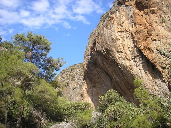
Leaving Prodromi alongside the pink-walled Archon Villa, a track rises to reach the ridge, and one of my favourite views – a panorama of the White Mountains, 2000m high above the Libyan Sea, with the coastline extending to Agia Roumeli and far beyond.
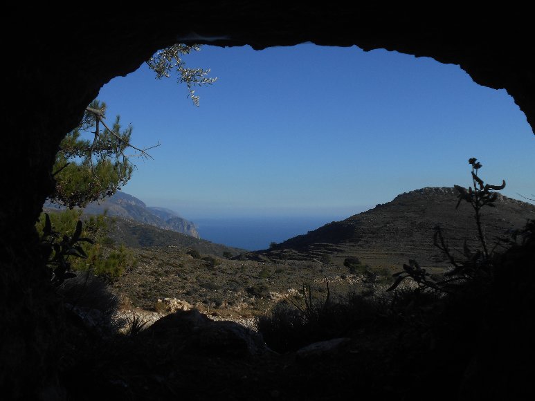
We paused at the (easily missed) Dorian grave, a “tomb with a view”, especially from the inside. Below here a track heads south to Agios Petros & Pavlos and on to Lissos, and another, an infrequently used mule trail, contours north around the hillside to the Selada pass, and on down to Kamaria.
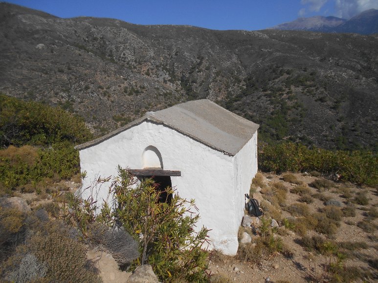
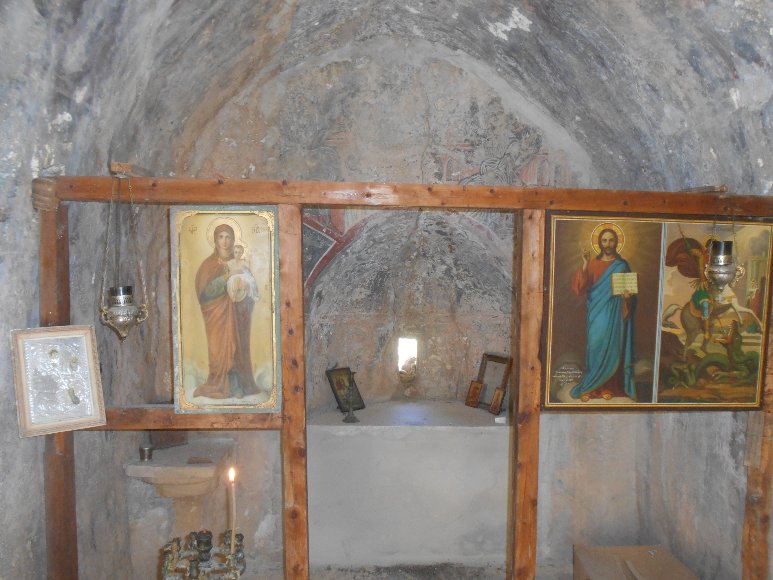
Our rough road went ever on and on, eventually reaching the small and isolated church of Agios Georgios, 14th century, with frescoes by the ubiquitous Ioannis Pagomenos, and the perplexing question – Why build a church here ?
We searched for the path, apparently due south from here, or signs of waymarking, but drew a complete blank. Just fences, walls and terracing, and largely inhospitable rocky terrain.
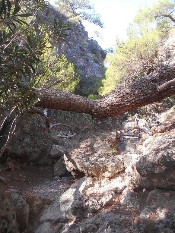
Frustrated, we walked on down to ruined shepherds’ huts and feeding troughs, repeated the process, with similar results. Rather than returning to Prodromi, we opted to find our way into the valley.
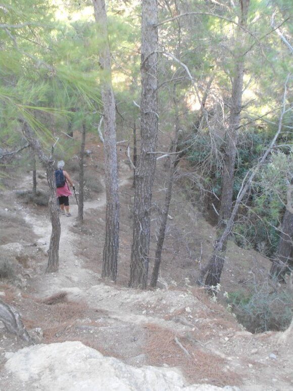
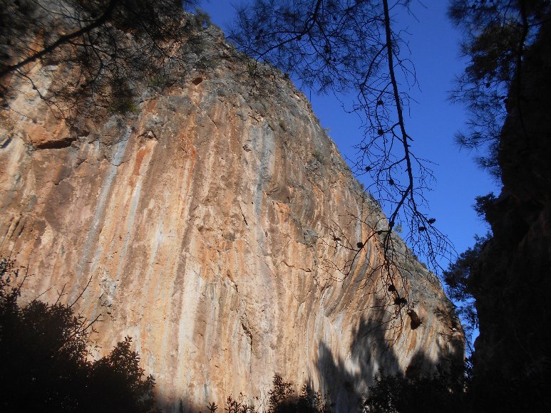
Through, over and under wire fencing, down terraces and often crumbling walls, waist-high undergrowth, into and out of a deep ravine, between pine trees, finally reaching the riverbed, where we found ….. waymarking …. heading further up the valley.
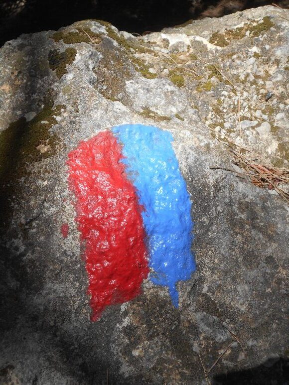
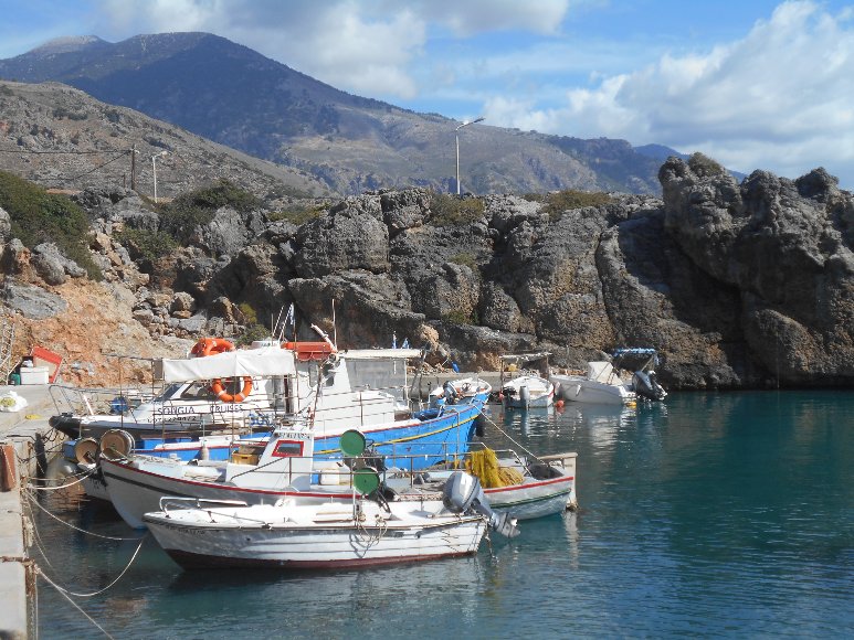
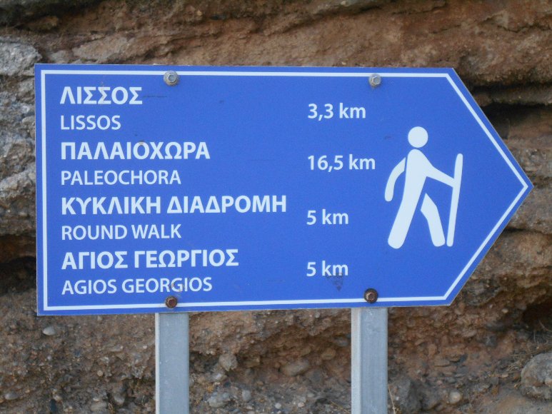
Time, tide and the Samaria ferry wait for no-one, we would return another day. The following week we drove to Sougia, past the encouraging sign ‘Agios Georgios 5km’, beyond the turnings to Lissos and the Sougia Round Walk, following the waymarking (red/blue, the colours of Crystal Palace AFC if you’re a supporter, but who is ?) to our previous location.
And on for c. 500m, where it stops; but from here a barely discernible path, marked by small stone ‘cairns’, winds SW and then W, through terracing, to end below the aforementioned abandoned buildings. We found no indication of the start of the route down, which begins approx. 80 degrees from here.
Vindicated, we returned leisurely down the Kako Potamos valley, which – even without the climb to the church – is stunningly attractive and rarely visited. This time we took the ‘Round Walk’ over to beautifully situated Agia Eirini church, and once again down into ever-welcoming Sougia.
Soon perhaps, the route will be waymarked down from Agios Georgios, or more clearly out of the Kakos Potamos valley. Currently, it’s advisable to walk from Sougia to Prodromi, although this will ascend almost 600m. If you attempt it in either direction, Good Luck, and let me know ….

3 comments
Kalimera, at the end of October I did the hike Aidoni – Seleda – Armos – Agia Irini – Sougia. However, I did not find the dotted path on the Anavasi map from the ridge on Armos to Sougia.
At the end of May 2021, I made the hike from Sougia through the beautiful and quiet Lissos Gorge to the church of Agios Georgios. But I only went as far as the shepherds’ structures. The section from the Lissos Gorge to the shepherds’ structures (2 striking trees and an old stone building) goes somehow through the machia. Nothing is marked here. The descent back to the Lissos Gorge is also easier, as you already know the “path” and the terrain. If you didn’t know the path, it would be much more difficult, as there is no sign at all of where the path goes into the Lissos Gorge.
It is a beautiful and lonely place by the shepherds’ structures. The peace and quiet is wonderful. To the north the impressive Selada mountain range and to the south the calming landscape of the Kakos Potamos valley and the Libyan Sea.
I think there used to be a farm or a small hamlet here. There are some very old olive trees and also stone walls.
Many greetings from Hamburg, kv
Hello. Hiked this route in 2016 and also never found the alleged descending trail south east from Agios Georgios. In 2016 the land south east of the Ekklesia was also scorched, which appeared to be controlled burning so it is possible there once was some kind of marking which was then immolated by such agricultural work which would have little interest in the meanderings of foreign tourists.
I too recall that frustrating off trail descent through woodland to get down into the Sougia-Lissos-Agia Irene loop.
Eventually I managed, but these posts here show there is little happening when Amavasi release new editions of their maps, as the trail still shows on both the paper and digital form (which I now use)
I meant to inform them was back in 2016 about this, but forgot. Currently back in Sougia in May 2024 and may revisit the Ekklesia in coming days. I recall hiking from another direction a year or so later with binoculars and looking up to see if there was any worn looking descent in view South East of Agios Georgos, but nothing was evident. As we all had found, a trail (of sorts) goes a small distance south East but then simply vanishes into undergrowth. The original word of mouth information given to Anavasi by shepherds may have been decades out of date. I have experienced similar in the high lefka ori before, so often these are not actual trails but routes based on someone’s GPS track. Once I revisit Agios Georgios, if the same issue persists I will inform Anavasi to update their maps.
Updating this in 2026, yes the easiest way to get to Agios Giorgios is from the Sougia side really. Keep in the Lissos gorge and just keep going through, following those red and blue painted stripes. The junction (so to speak) up to the shepherd area (going by the bookmark I made), is below:
35°15’29.8″N 23°47’05.4″E
It is fairly steep and pretty much on goat tracks once emerging fron the gorge, but you will see 2-3 cairns people have placed there. Eventually you’ll spot the walls of the shepherd building near, from below:
35°15’28.0″N 23°46’59.6″E
Coming up from the gorge, when you see the walls of this building it is easier to go around it on the left side and it will open up into the area on the map where the non existent black dotted trail on the map was supposed to begin. From there it is a zig-zag walk up to Agios Giorgios on the rough jeep track. The symbol for the Ekklesia is still shown in the wrong position on the map 10 years later. It is shown on the map as being lower down. It is not. Keep walking up the zig-zag road and its roof will eventually become visible. You can continue up on the zig-zag or just short cut up the terracing.
Coming down from there to Sougia, as we have all found, the dotted black line route on the map that joins the gorge mid way, seemingly no longer exists beyond a certain point and must be truly decades out of date. When you look at the topography in situ ,this historical path was badly positioned anyway. When the new red and blue path was created, I don’t know but it is a lot simpler.
Coming down from Agios Giorgios, to go towards Sougia, your starting point for descent is probably these coordinates :
35°15’27.4″N 23°46’58.1″E
That is on the right side of the shepherd area (when descending). Keep walking straight down and look for the cairns.
From Agios Giorgios I have continued onto Agios Pavlos several times and descended into Lissos, up from Lissos and back over the plateau then into the Lissos Gorge and to Sougia but that is a deceivingly long hike. Your next water supply is at Lissos, from what I have seen.
While the map shows cisterns and welks, these are either sealed cisterns or non existent historical wells which may have operated near now ruined buildings. In some cases they just refer to dry sheep troughs. I have seen some lush areas which would indicate springs but nothing accessible at surface level it seems.