
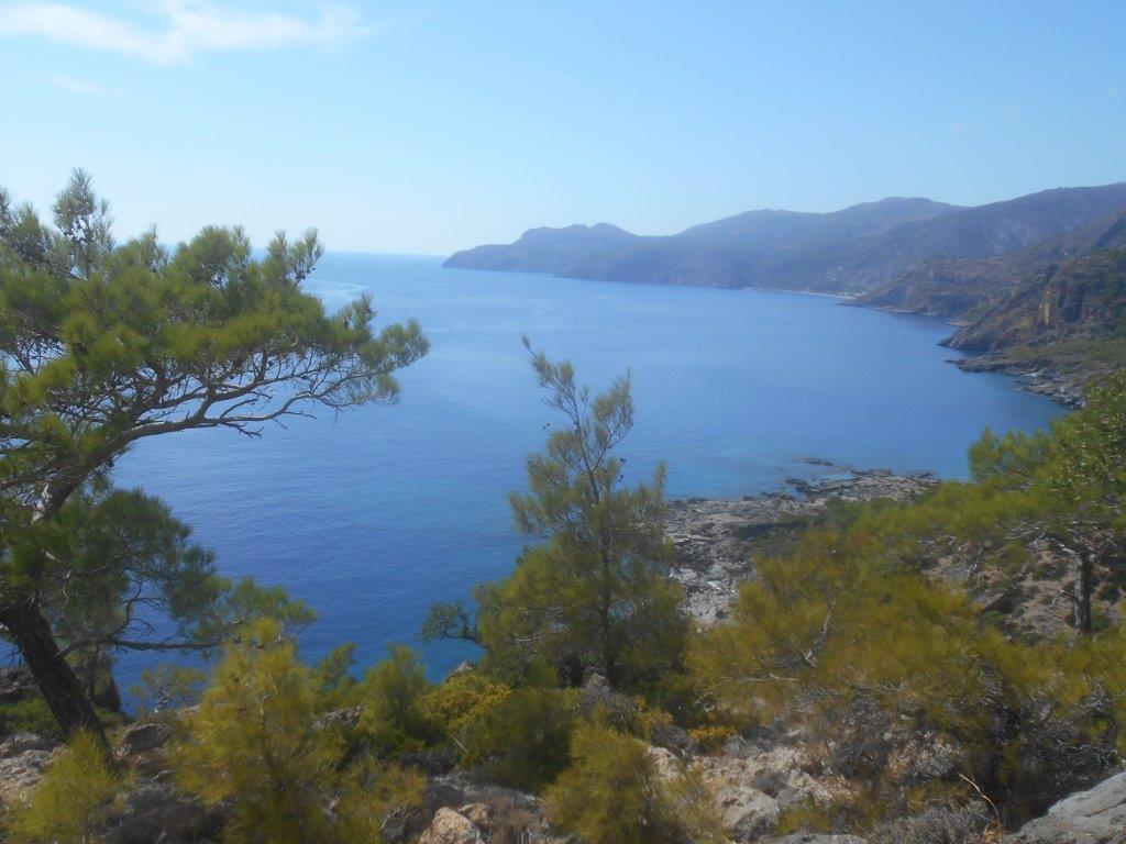
View to Sougia
As promised last November, here’s another section of the E4 path through Crete, and to complement the walk from Tripiti to Agia Roumeli (see Explore ! June 2017), this time it’s the route westwards from Tripiti to Sougia.
Allow 4 hours walking time for this, and another two hours for rests, taking photographs, and just enjoying the scenery, which is spectacular.
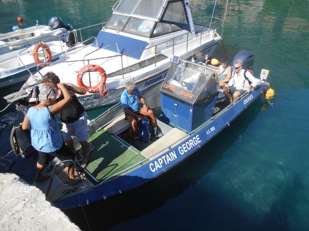
After the morning ferry from Paleochora, and a leisurely breakfast in Sougia, this time we took Captain George’s speedboat to Tripiti * – a fifteen-minute journey, and with the 50 euros cost split between five of us, a bargain.
Our plan to stay overnight in Sougia, and walk home the next day, gave an opportunity to walk some distance up the Tripiti Gorge, past the site of Pikilassos on its west side.
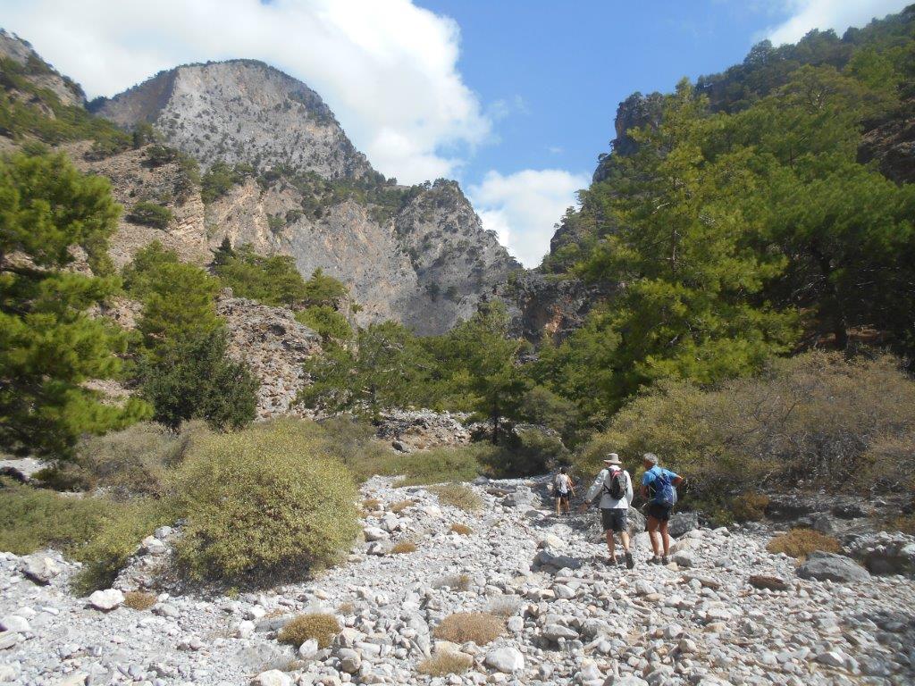
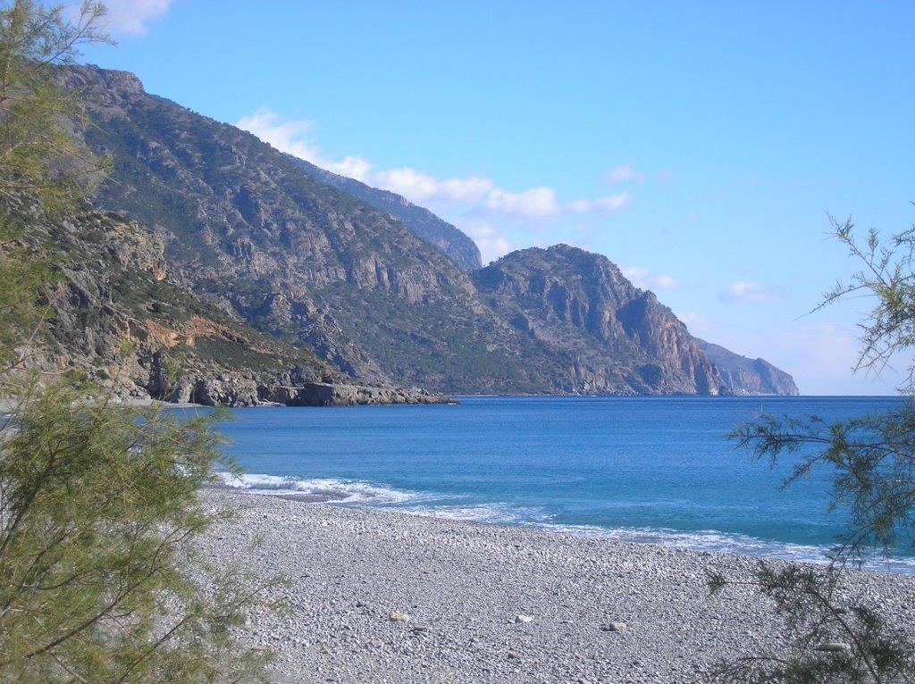
Tripiti Gorge
Little remains of this Dorian city, which together with Elyros, Lissos, Syia, Tarra (Ag. Roumeli) and Yrtakina, formed the Confederation of Oreioi c. 300 BC. The ascent of the gorge to Linoseli below Gingilos and Volakias is long, wild, unmarked and arduous, not to be attempted without a guide, and we returned after exploring only the initial stages.
Back almost to sea level, we began the relentlessly steep 300m climb to the ruined Turkish fort.
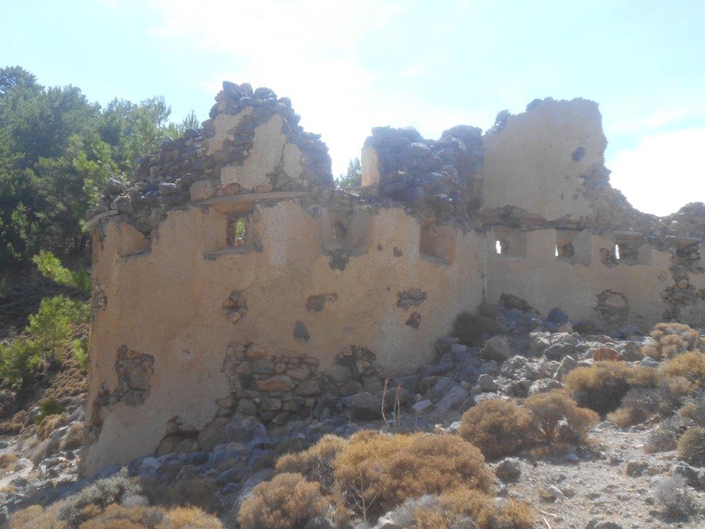
Turkish Fort
Arriving there breathless, it’s easy to forgo and omit a further climb to the church of Profitis Ilias Tripitis, another twenty minutes away, but don’t miss this on any account, the views transcend all else on this walk.
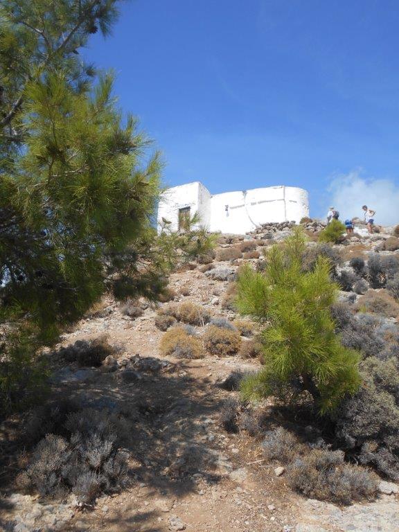
Profitis Ilias Tripitis
From Cape/Akrotiri Kalotrividis beyond Domata beach, west to Cape Flomes – our “crocodile” – a 20 km stretch of the south coast of Crete is 400m below you.
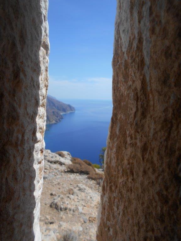
East from P Ilias
The annual Panayeri festival here in mid-July is a splendid occasion, well-attended, with participants celebrating and dancing long into the night. There’s a concrete cistern which collects rainwater, for use only in an emergency. Rest and enjoy.
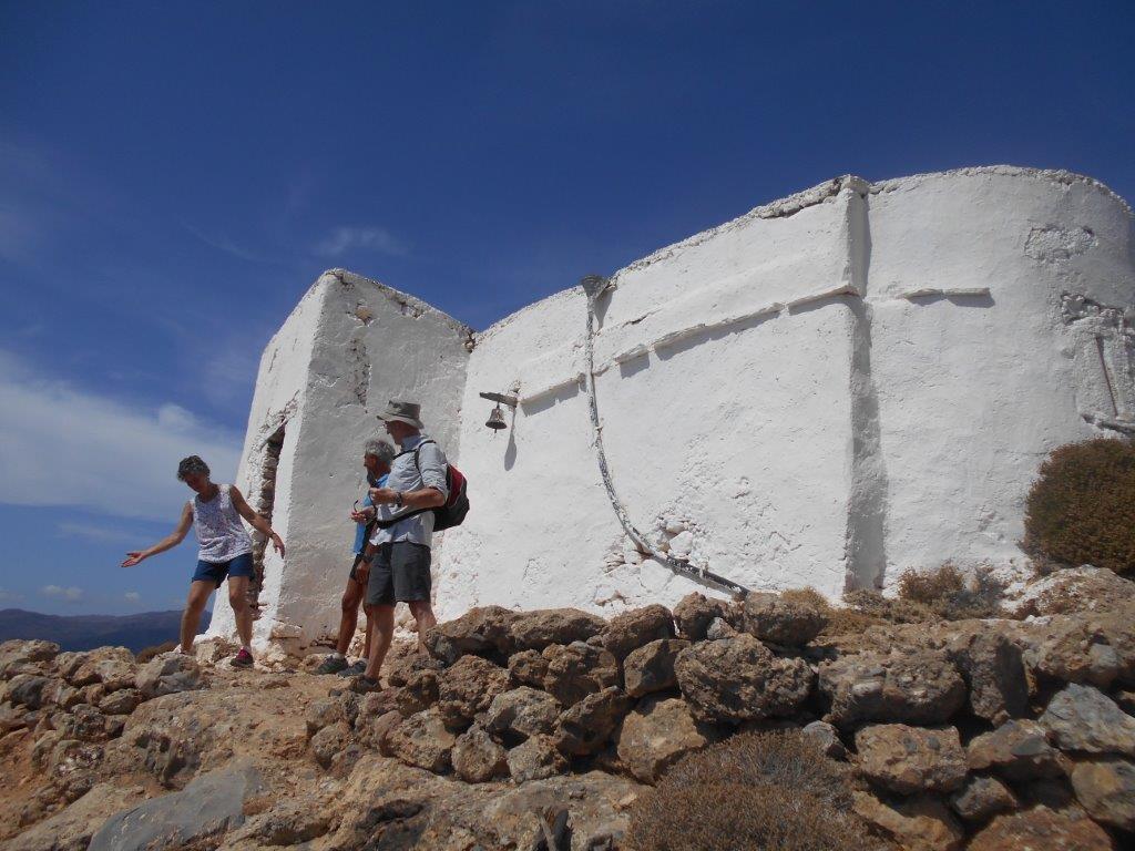
Profitis Ilias
From the Turkish fort the path winds downhill, easily at first then more steeply. Shortly after starting our descent we passed the Voukilasi spring, trickling into and filling our water bottles, but it’s an unreliable water source, especially during the summer months when it usually dries up.
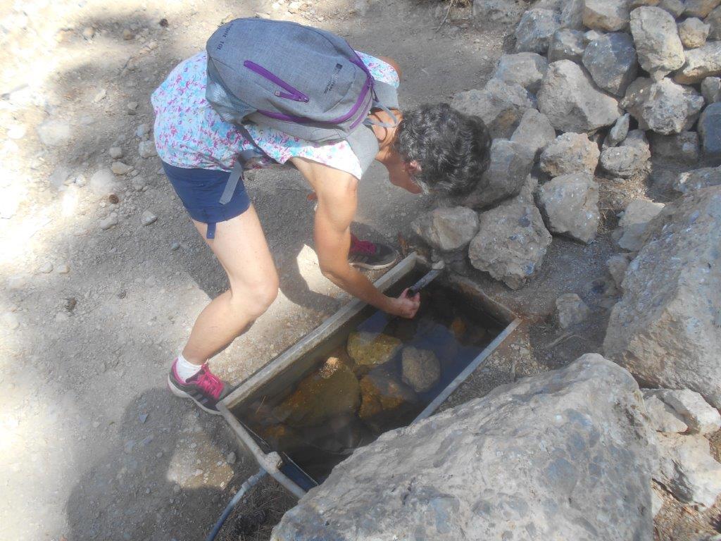
Voukilasi spring
The path down the rocky, tree-filled ravine almost reaches the sea, before turning westwards, but it’s possible to reach a small cove, below a recently built house, for a refreshing swim.
Sougia is still a couple of hours away, the E4 undulating pleasantly along and above the coastline. You might catch a glimpse of the double-roofed Ag. Antonios church at Hareis, below, but it’s not easy to reach by foot – and time-consuming – and my only visits have been by kayak.
Soon you’ll reach the foot of the Keratidias Gorge, descending almost vertically from Koustoyerako, and described in ‘Explore’ – February 2017. There’s a “sting in the tail” here, with a sharp climb from the gorge foot, then losing height again before the trail contours below rocky hillsides (which contain the “Cyclop’s Cave” – ref. ‘Explore’ March 2011) to reach a road-end high above Sougia.
There’s a short cut off the winding track – easily missed, though it’s marked on the Anavasi Hiking Map (Crete 11.13) – which will save time and energy, otherwise the longer way will take you into Sougia and its many rewards, one of which is to relax in the sea, or at a table above it, and look back along the coastline to Profitis Ilias church and reflect on a fine day’s walk.
East from Sougia
* Captain George taxi-boat : (0030) 28230 51133 Mobile 6947605802

1 comment
Hi Bob, Good to see you still active as ever. Your walks would be beyond us now, but pleasant to recall our visits and walks together. Let us know if you are visiting Uppermill at all. Spare room available any time. D&M