
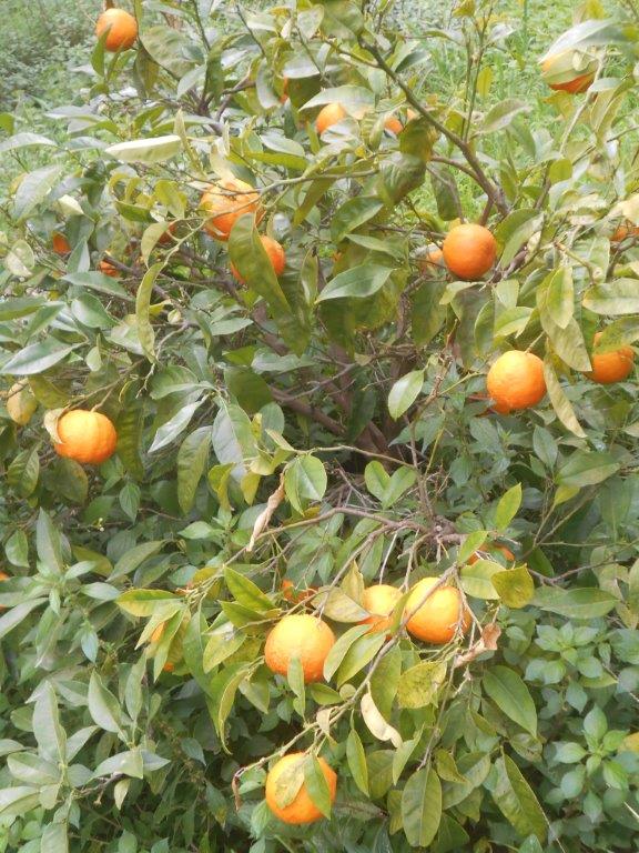
There are several requirements necessary for a consummate Spring walk in Crete. Wild flowers of course, with sweet-scented blossom of almond, wild pear – and that “loveliest of trees,” the cherry ; tracks, footpaths, and maybe an old ‘kalderimi’ linking small villages ; olive groves, with perhaps a wayside orange tree for a fresh ‘portokalada’ ; isolated but well-kept churches or chapels to visit ; a deep valley with a rippling river and maybe a waterfall ; views to distant hills and mountains ; some local history, and – not that we get them here – a location “far from the madding crowd.”
As a bonus, a cafenion to enjoy a coffee before, and maybe relax after the walk.
Wild flowers
Here’s a walk close to Paleochora which “ticks all the boxes” above, approx. 12 km and circular, which you could complete in around four hours, or spend most of the day …. You’ll need to drive, or take a taxi, to Voutas, 12 km and 20 minutes away from Paleochora. After a coffee in the platea there, continue 2 km on the Chania road to a junction under a huge rock, and park just below by a bridge, on the road to Moustakos.

Park near here
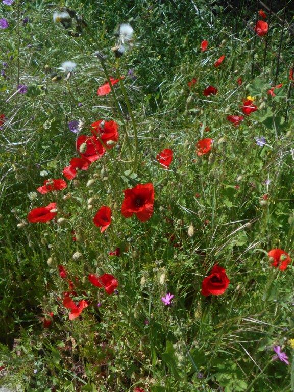
Start by crossing the bridge above the brook, babbling on for ever until it becomes the Pelakaniotikos river, reaching the sea near Plakaki beach. Then take the track left, alongside the valley, first dipping, then rising gradually through olive groves. Avoiding all side tracks, reach a sharp bend right (faded blue arrow), and continue uphill, the views north gradually opening up. Wild flowers will vary, but purple lupins, the bright yellow of gorse bushes, verbascum and Jerusalem sage, and white/pink cistus will be predominant.
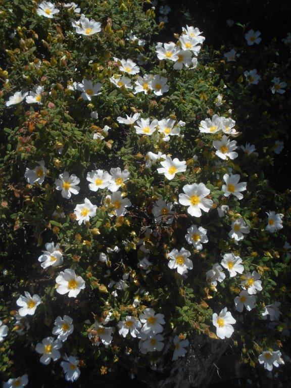
Cistus

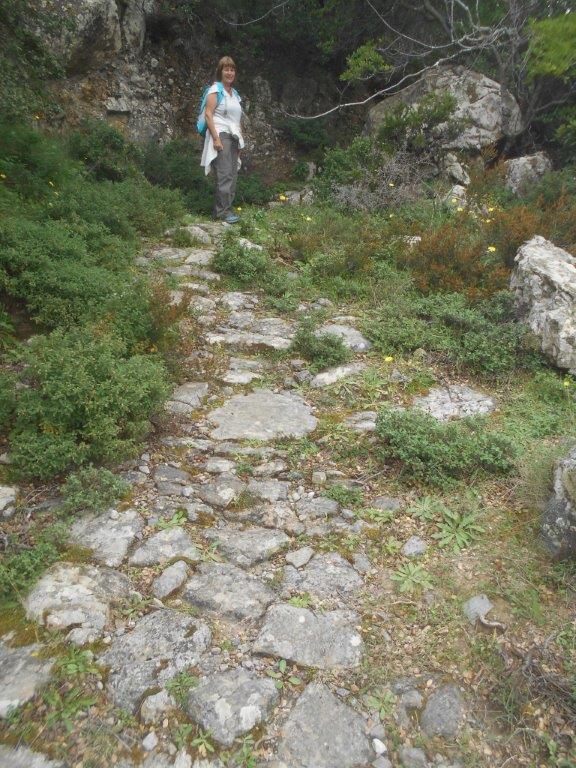
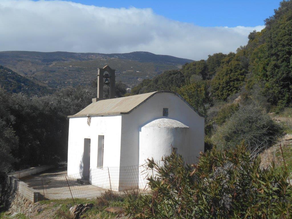
Eventually the track reaches another bend, this time to the left, but look straight ahead to find a narrow kalderimi – donkey path (see the image at the start of this article) – which leads to another track, and then walk left, up to the surfaced road close to the Kalamiou village sign. Just above the first house, turn right down into the platea where there is a cold water spring and a shady (and hollow) plane tree.
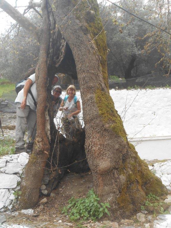
Kalamiou tree
As with many inland villages, the population here has declined, to now only four permanent residents. But there are signs of restoration and renovation, and at least in summer, Kalamiou will flourish.
After a rest, take the steps directly behind the plane tree (blue waymarking), but soon swing up right, on another old pathway which once connected here with Sklavopoula. All too soon the path ends, and you’ll need to scramble (easily) up to join a wider track, which leads once again to the road. A few metres on is a ditch/pond, often with croaking frogs and bullrushes. Turn right here, easy walking, slightly downhill, to reach a fork – the right leads past a derelict Fiat 500 to a house – but where you take the left.

Ag Astratigos
This doesn’t look at all promising, but persevere downhill, around to a wire gate and meet a wider track, which will take you to the little white church of Ag. Astratigos. En route is more open country and the views widen, to Moustakos village below the massif of Ag. Dhikeos, summit 1,181m, and across the valley to Vothiana, which we will pass by later.
The peaceful church makes an ideal lunch spot, after which continue ahead to shortly join a surfaced road. Left here, and after a diversion to tiny Ag. Giorgos, reach the “main” road, left again and walk up into Moustakos.
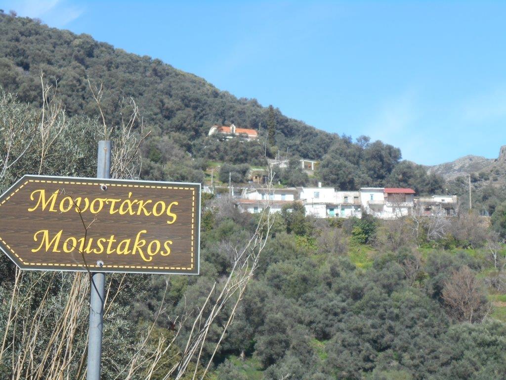
Moustakos, at 560m, has an “end-of-the-road” feeling about it, both literally and metaphorically. Pass by the olive press, still functioning in season, and climb (top road) into the village, now declined to twenty residents, mostly elderly, from a once sizeable population. Leaving the village, take steps up into the churchyard (spring water here, by the far gate, which you leave by), and then walk left, rising towards and above the Kousiakiotiko Gorge.
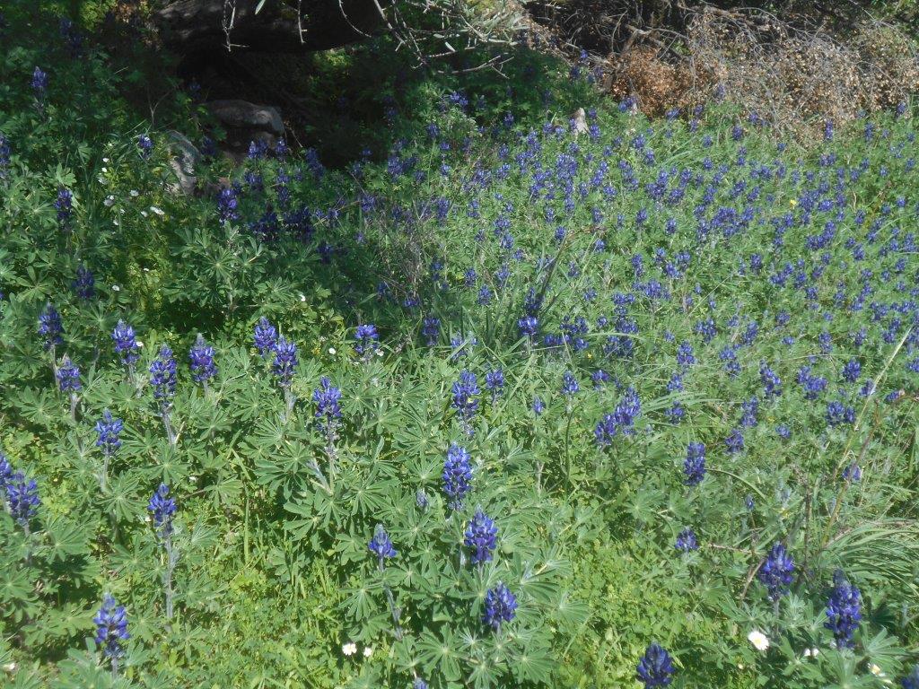
Lupin field
Some history now : several villages hereabouts sheltered Allied servicemen after the debacle of the Battle of Crete in May 1941 – Lagadas, Spaniakos, and especially Sklavopoula (see Explore ! June 2015).
The rugged, remote countryside was safe from German patrols, but local help was essential. In the winter of 1941-42, hoping to find a small boat to sail to North Africa, were two New Zealanders, John Kerr and Dudley Perkins. “Their hideout at that time was in the hills overlooking the west coast ; but their cave faced east with a view over a deep valley enfolding the villages of Vothiana and Moustako which were quite a brisk walk away. In Vothiana was a mill, whose owner had given invaluable help to stragglers. When he made contact with Perkins and Kerr he refused to give his name in the interests of his own security, but he agreed to supply them with what food they needed on condition that they did not show themselves in the vicinity by daylight, and did not come near the mill. The miller, or one of his family, was to take food up to the cave when convenient and bring information. Some New Zealanders knew the miller as Alex Makrakis … ” *
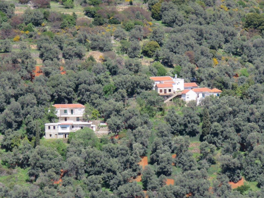
Vothiana
The churches at Moustakos and Vothiana hold no ‘Makrakis’ graves, but at Moustakos, interestingly, are several resting places of the almost homophonic Katrakis family, who may have been those who gave help. From the track, look across the deep valley to see a contouring pathway on the far side. The way ahead, a potentially rough walk or mountain-bike ride, leads over to Elos, but fork right, to cross a stream and begin heading south. Pause by a gate, and listen to, or scramble down to view a pretty 4m waterfall, one of several small cascades in the river.
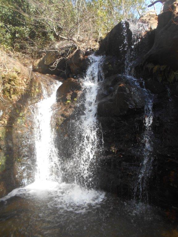
Moustakos Falls
Now comes around 2km of pleasant, almost flat walking, high above the valley, to reach the unpretentious church of Ag. Pnevma (Holy Spirit.)
Ag Pnevma
Approaching and passing Vothiana shortly after, below the track, you’re more likely to see geese and chickens than the few residents. Soon, rounding a bend, the Bouali gorge/valley comes into view, with Kamerata and Archondiko villages above. Leave the track (which leads on to Faragi) and turn sharp right, downhill.
Self-service
Descending to the valley, keep left at two junctions, always following the winding main track, and further down, keep right (ahead) – left leads to a house. More steeply now, then re-cross the river, climb up to the surfaced road, and ten minutes’ later you’ll be back to see your car, or a waiting taxi, at the starting point.
* From “Vasili – Lion of Crete” the story of Dudley Perkins, by Murray Elliot

4 comments
Skip to comment form
Perfect, as usually. But small map would be nice.
It’s long been a dilemma whether to include maps with Explore ! walks, the problem being that they can become outdated in weeks/months, thereby causing more confusion. The route described on this walk can be easily followed, but is covered by the Anavasi 1:50.000 Trekking Map 401 Crete (with the exception of the track above Kalamiou to Ag. Astratigos, which is easily located.)
Hi Bob! what do you know about the ‘Radar Station? above Moustakos? Is it still active? I notice that it s blurred out on Google Maps. Kind Regards John Pearce
I know very little about this, except it’s a Military Radar Station, at 1009m high above Sklavopoula and Moustakos.
Lights at night suggest it is still operational, but buildings are “blurred out” on Google maps. The road from Moustakos leads there, but Access is secure. A pleasant walk/cycle ride is along the track below, linking Moustakos with Sklavopoula.
Read more about Sklavopoula on Explore ! from June 2015 (under Archives.)