
It’s June, it’s Crete, and it’s hot. And with the Libyan Sea warm and inviting, and a dozen or more beaches close to Paleochora, there is understandably less enthusiasm for long walks. But I wanted to go to Argastiri, for reasons explained later. So here’s a walk of around 8km, taking less than three hours, perfect for early morning or late afternoon, before or after the heat of the day.
Park here ..
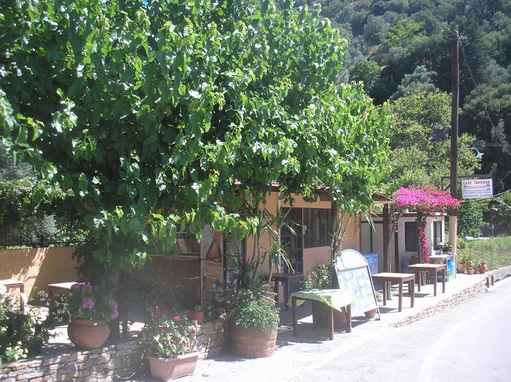
The start (and finish, the walk being circular) is at the cafe/taverna ‘Maganari’, just before Kambanos on the main road north beyond Rodovani. Distance is just 26km from Paleochora through Azogires and Strati, slightly longer and more tortuous through Anidri and Prodromi, but a scenic drive by either route. Park below shady plane trees beside the taverna.
Start this way …
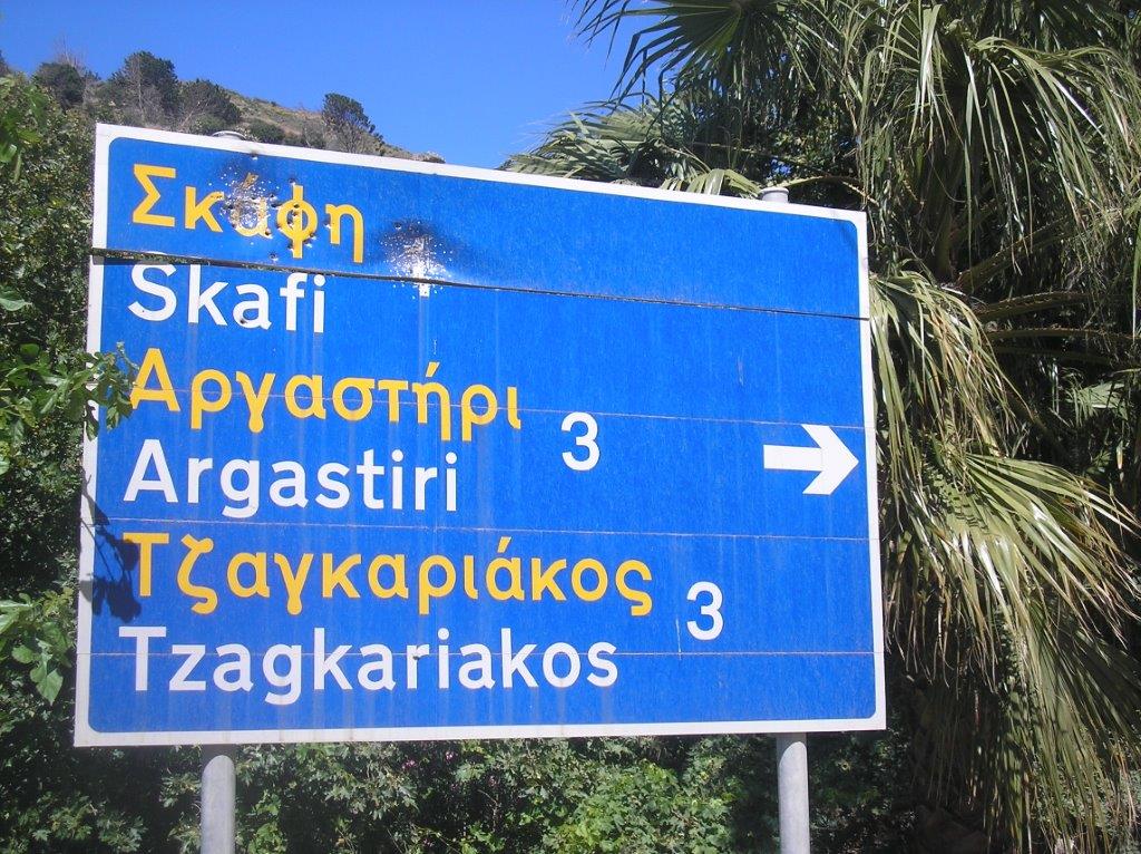
A few metres past the taverna, take the road (left) signed to Skafi, Argastiri and Tsagariakos, but after 400m, at the 2nd sharp bend, go right on a rough track through the trees. “Does the road wind uphill all the way?” asks Christina Rossetti in her poem. “Yes,” it does, “to the very end” at Argastiri, passing en route the church of Agios Vasilios, a plain building but with extensive views, to the hill villages of Koustoyerako and Livada, and the sea below Sougia. Turn left on reaching the surfaced road on the outskirts of Argastiri, passing the cemetery and Agios Giorgos, a far more attractive church, but without the views.

Agios Giorgos
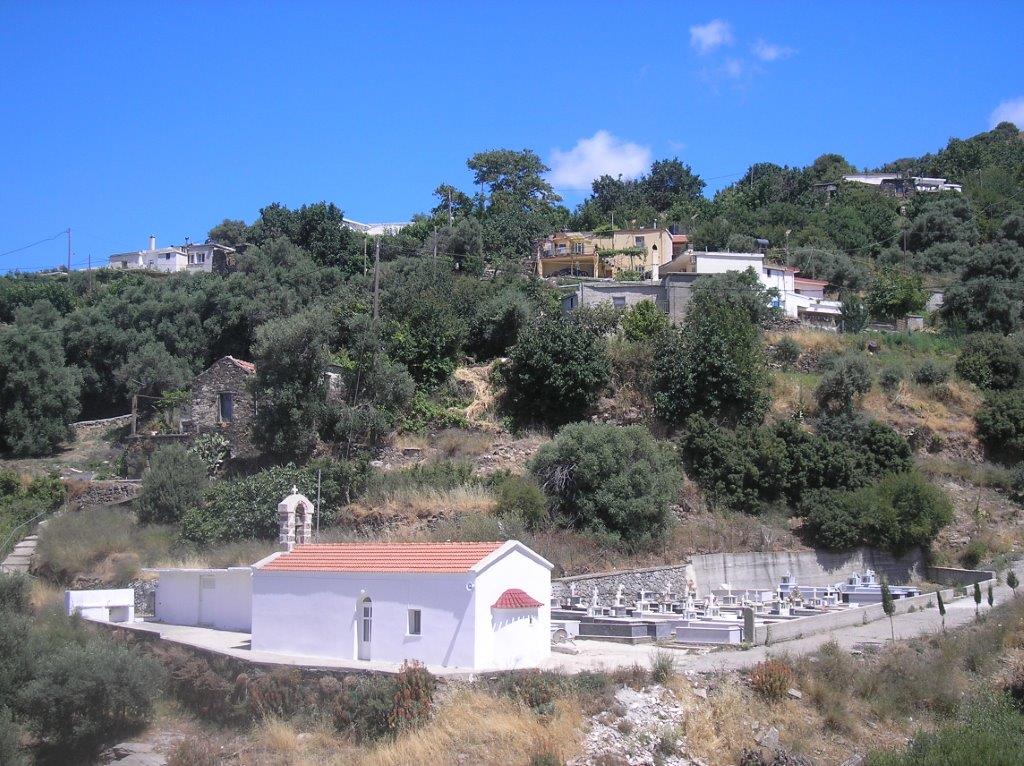
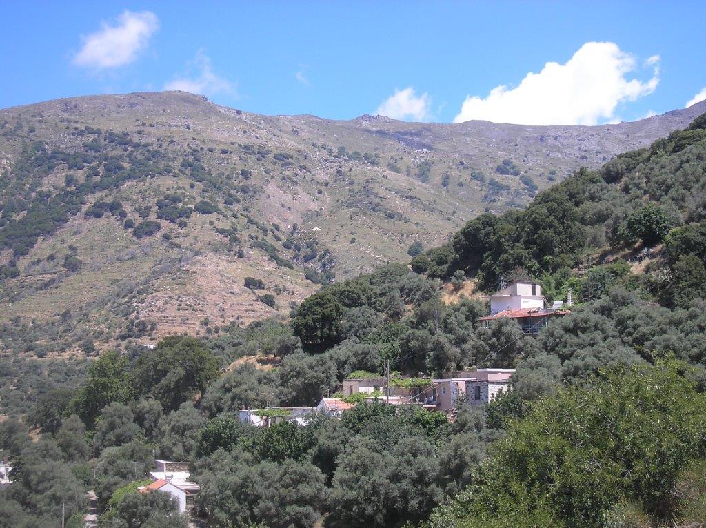
Argastiri, 650m above sea level, and now with a resident population of only 19 (2011 census), is an isolated village, the access road from Tsiskiana not surfaced until 1997, and only supplied with electricity and running water in the 1960s. It’s name is Greek for “loom”, and the village was famous for its weaving products. During the war, villagers sheltered many Allied soldiers, but did not incur the reprisals and destruction of homes suffered by many other local villages. It’s a very peaceful and panoramically situated place . And my reason for coming here – for the beautiful green stone on Lynne’s grave, found, polished and oiled by Costas, and engraved by Gerhardt, came from a stream-bed near Argastiri.
Argastiri village
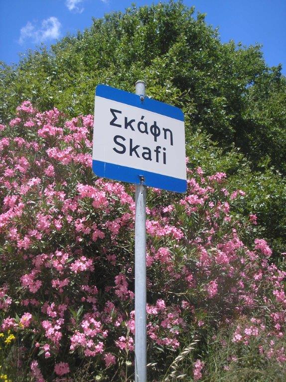
Follow the road downhill out of the village, heading NW after a ‘hairpin’ bend, with very soon the houses of Skafi coming into view.
Colourful Skafi
Below Skafi, where the road bends sharply, are two turnings – the first signed to Loukiana, and the second (take this) to Tsagariakos, rising alongside a shallow stream-bed. Spring flowers are all but over now, although the oleanders are spectacular, and the tall summer-flowering Verbascum macrurum were in yellow bud.
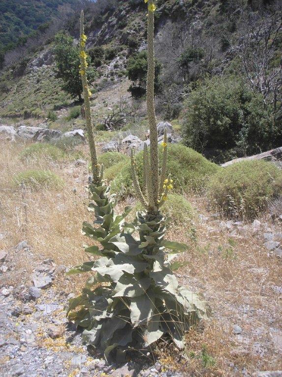
Verbascum macrurum
Soon the track, now surfaced, climbs away from the gully and heads south. From here, turn and look north, to the summit of Agios Zinas, 1331m, where a tiny white chapel stands out against the blue sky (already marked down for a future ‘Explore’.) Approaching both midday and 30c, I left Tsagariakos for another day, and forked left (it’s marked to ‘Astratigos’, but that’s some distance away), soon reaching Ag. Marina and some shade for an early lunch.
Skafi & beyond
Below the church, fork left as the track winds down towards Pera Skafi. “Pera” translates as “beyond”, “further”, and the English equivalent would be ‘Upper Skafi’. Go left again below the first houses, to join and turn right on the ‘main’ surfaced road, passing what may (or may not) be the village cafeneio, stores and Post Office, but was closed to all three. All that remained now was to follow the road south, gradually losing height. Soon Kambanos, the largest village hereabouts, appeared below, against a backdrop of the White Mountains outlier of Psilafi, 1984m, rising high above the Agia Irini Gorge. Gavdos Island, hazy in the distance, was reminiscent of South Pacific’s Bali Ha’i, with its “head sticking out of a low-flying cloud.” Turning left for 600m at the main road, I was soon back at the car.
If you’re hungry on reaching the ‘Maganari’ taverna (as I was), I can strongly recommend the ‘kalitsounia’ – cheese & spinach pies, accompanied by a somewhat inevitable Greek salad. The route is covered by the Anavasi Sougia/Samaria map (11.13) although the track from Ag Vasilios church reaches Argastiri on its east, not its west side. Please close and re-fasten three ‘gates’ on the ascent.

1 comment
Wonderful walk. You can find more about my village in my blog, dedicated to Argastiri: argastiri.blogspot.gr (in Greek, but with many pictures).