
The only drawback to the summer KTEL bus which runs to Omalos, leaving Paleochora at 6.15am, is just that – the early morning departure is not to everyone’s liking, especially after a leisurely meal and maybe some relaxing drinks in the cool of a late evening in our village. But if you can make it in time, as we did recently, and then stay awake, the journey is spectacular, as dawn spreads over the mountains and through the olive groves to the numerous Cretan villages passed en route.
Several passengers left the bus to walk through the Agia Irini Gorge, those remaining would be descending Samaria, and must have wondered where we were heading when driver Yiannis dropped us off, seemingly in the middle of nowhere, soon after 8am. We were actually at Agios Theodoros church, on the western fringe of the Omalos plateau, and our route was along an alternative section of the E4 path, to Koustoyerako, and from there down to Sougia for the ferry home.

Ag. Theodoros
This is one of three alternatives to the difficult (usually 2-day) coastal walk between Sougia and Agia Roumeli, the others being through Agia Irini/Figou gorges, or from Koustoyerako via Achlada and Linoseli, both reaching Xyloscala to then descend Samaria Gorge to Agia Roumeli.
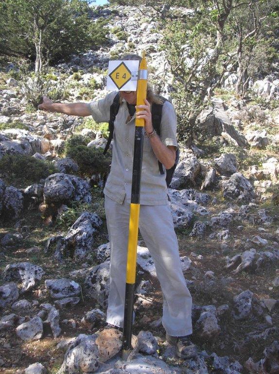
E4 path starts here
A short walk back along the road took us to a turning SW, the surfaced road climbing gently then falling abruptly to a sharp bend, and a water cistern, where the E4 path heads off south. But first we went to “inspect” the mountain hut at Ghreleska, one km further, where the road ends. Built as an observatory to watch the rare “kri-kri” (and we were lucky enough to see two), it’s a substantial building, and would make a superb overnight stay ; more of this another time.
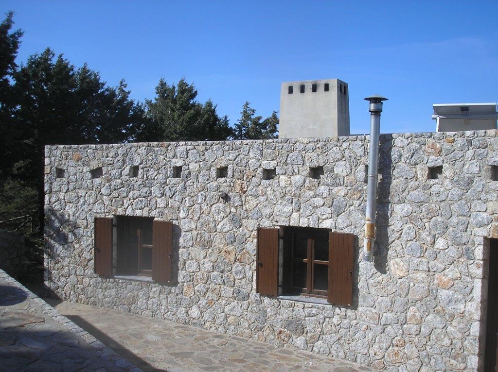
Ghreleska Hut
Back on the trail, the waymarking (red paint dots, but concentrate on route-finding, it’s not easy at times,) led us for some 3km, contouring at around 1200m height under shady trees and over rocky limestone terrain, then dropping down to Olisma, where the path from Achlada joins from the east. A break here, then on down a rather loose gully, which, around fifteen minutes later, the path crossed, climbing a well-defined “kalderimi” or mule-trail. All too soon afterwards the path ends, joining a rough track at Agia Ekaterini.

Ag. Ekaterini
A story about the church (St. Catherine) ; in 1943, after the battle at Achlada (see below) when a number of German soldiers were killed, a group of local resistance fighters (“andartes”) were hiding in a cave near here, as the enemy combed the area searching for them. One of the men had an icon of Agia Ekaterini, and they all prayed and swore that if they escaped the Germans, they would build a church in her honour. To seal the oath, they wrote their names on the icon. A thick mist descended on the mountain, forcing the Germans to abandon their search, and the ‘andartes’ were able to survive. A church was built after the war, this one more recent, and a festival held annually on the 25th November. Nearby is a memorial to those killed hereabouts.
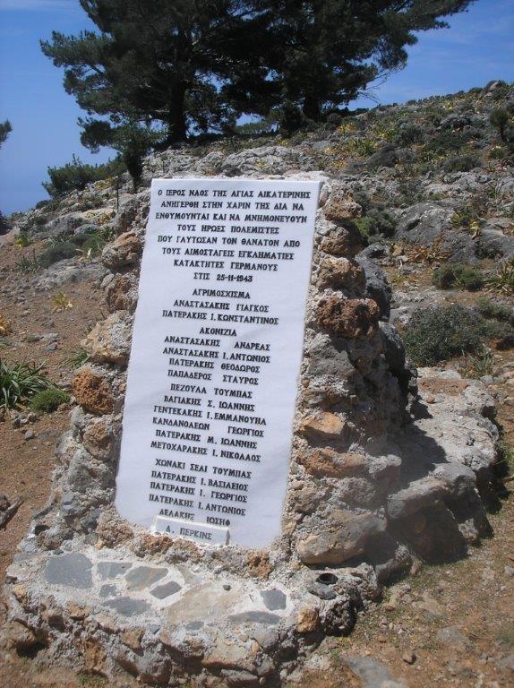
Memorial to ‘andartes’
Koustoyerako is still some way off, following the rough road (with some ‘short-cuts’) all the way into the village, which we reached some three hours after setting off.
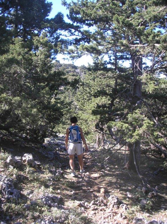
Path to Koustoyerako
And in the ‘platea’ is a ‘kafeneio’, – “Achlada” – where refreshing drinks were most welcome. Meals are available too, but call first (28230 51092) for special requests or a large group. The history of Koustoyerako has been well-documented, as the centre of resistance fighting in this area over centuries, especially during the last war. The best book I know is “Vasili – the Lion of Crete”, by Murray Elliott, which tells the story of Dudley Perkins, a New Zealander, one of many left behind after the German invasion of Crete in May 1941, and who joined local resistance groups. Chapters 7-13 are particularly relevant to this area. A film is currently being made of his life, to be called “The Straggler”, and filmed in New Zealand, which will be fascinating.
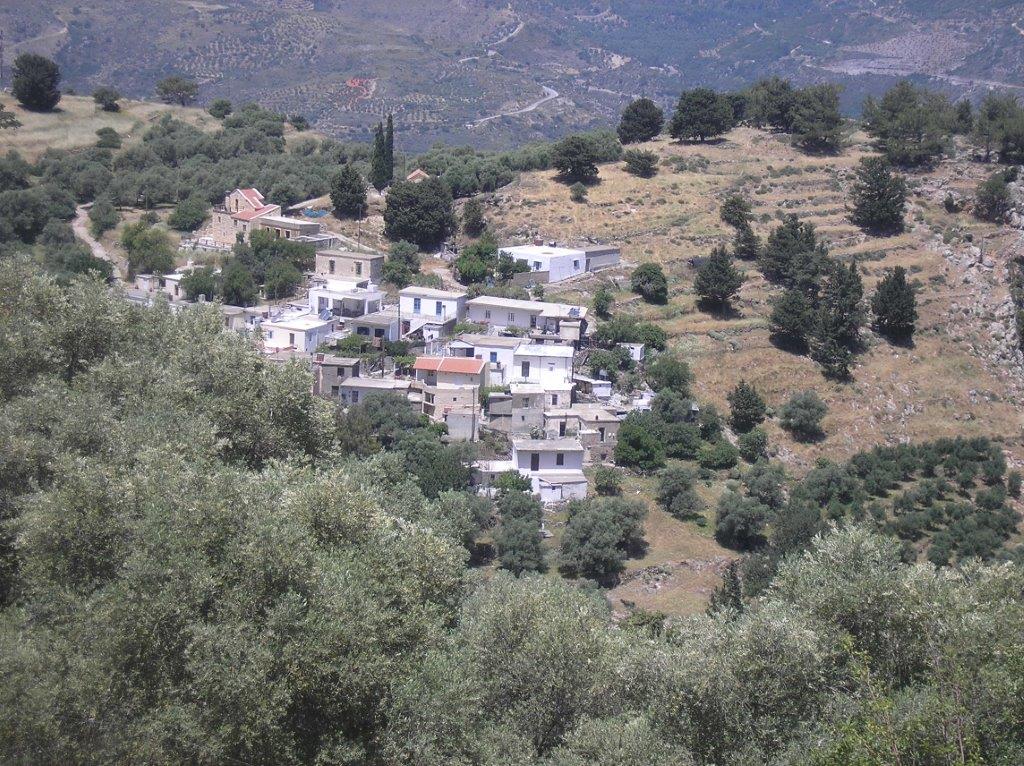
Koustoyerako
To the immediate left of the kafeneio is a footpath to Livadas, descending terraces of almond and later olive trees, which avoids a much longer road walk. Below the village, 1.5km later, we left the road to take a track south for the final 2 km into Sougia, tantalisingly in view for some time, with its promise of more cold drinks, ice-cream and a swim in the Libyan Sea, before a “mini-cruise” back home to Paleohora on the good ship ‘Samaria’.

For those interested, the ‘Samaria’ was built in 1986, length 48m, capacity 368.07 gross tons, and can carry 850 passengers, 40 cars or 12 buses (and several kayaks) at a top speed of 13 mph. And there’s a bar on board ….
A long and serious day’s walk, this route is covered by the Anavasi Topo25 map (Samaria/Sougia) and is described in “The High Mountains of Crete” (Cicerone), both available at ‘To Delfini’ bookshop in Paleochora.

Recent Comments