
EDITORS NOTE: As this article is published it looks most unlikely that any visitors will be able to arrive for at least the early part of the season this year. Hopefully, you will be able to enjoy this (and other) walks here again in the near future. Until then, stay safe and enjoy Paleochora through our site.
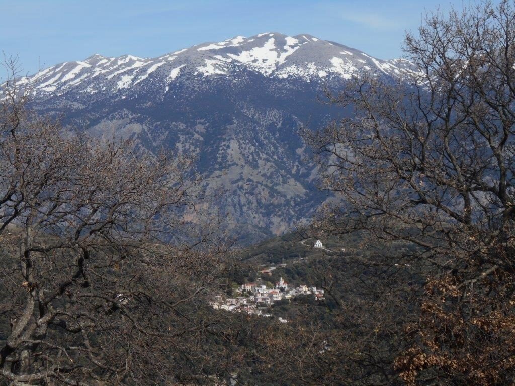
The 34km drive from Paleochora to Sougia passes through the high mountain village of Rodovani, at 525m above sea level, before the winding 11km descent to the coast. Slightly higher, and just 1.5 km away, is the hill-top of Kefala, 588m, the site of the ancient Dorian and later Roman city of Elyros.
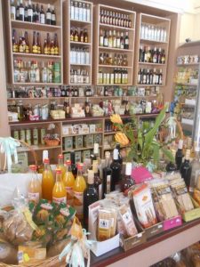
Rodovani was supposedly established in the early years of the Venetian occupation (c.1200 AD) by a Croat mercenary in the Venetian army, Rodovano, its important location at the junction of three routes, north to Chania, east then south to Sougia and west to Selino. Park in the small ‘platea’ overlooking the deep Kamariano valley; look at the memorials opposite, then visit the amazing grocery store or ‘pantopoleio’, full of enticing Cretan produce, which owner Sofia will encourage you to sample. Buy graviera cheese from Omalos, with local honey and raki, which, my friend Michelle maintains, go together well.
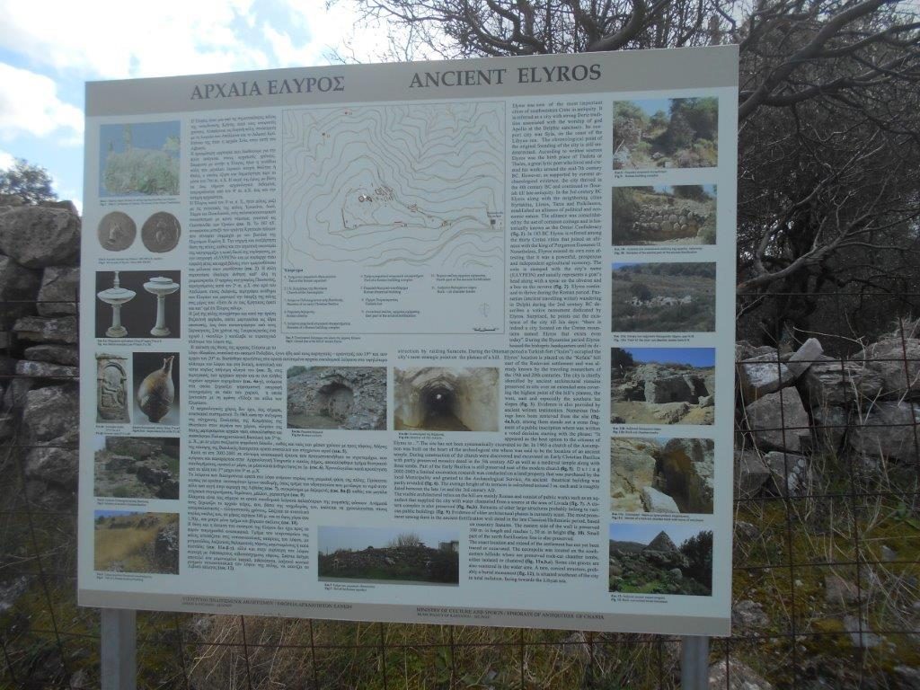
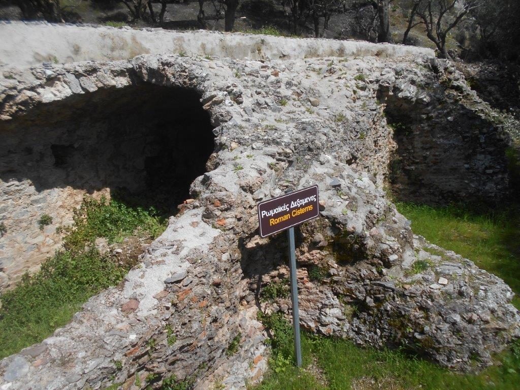
Drive or walk 400m up to the road junction, turn right towards Sougia, passing two information boards, to a road leading up to Kefala. Elyros was the most important Dorian city of Western Crete, the centre of an industrial and commercial area which included nearby Tarra, Pikilassos and Yrtakina, and flourished from the 4th century BC to 5th century AD. Mainly agricultural, it had trade and merchant/marine shipping through its ports of Syia (Sougia) and Lissos, its own currency and an estimated population of 16,000. It was destroyed by the Saracens in AD 823.
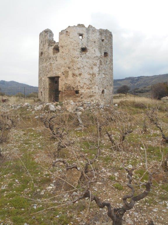
The track, rising, passes a ruined windmill and the modern church of the Panagia. Some 700m from the main road it falls away left, with a grassy track heading off right; take this, leading up to the ancient site.
Disappointingly, there is little evidence of a large and prosperous city; we’ve explored extensively around the olive trees and wire fencing (take care), followed the walls, found a possible grave (or water source,) but not located the Roman temple and theatre reputedly here.
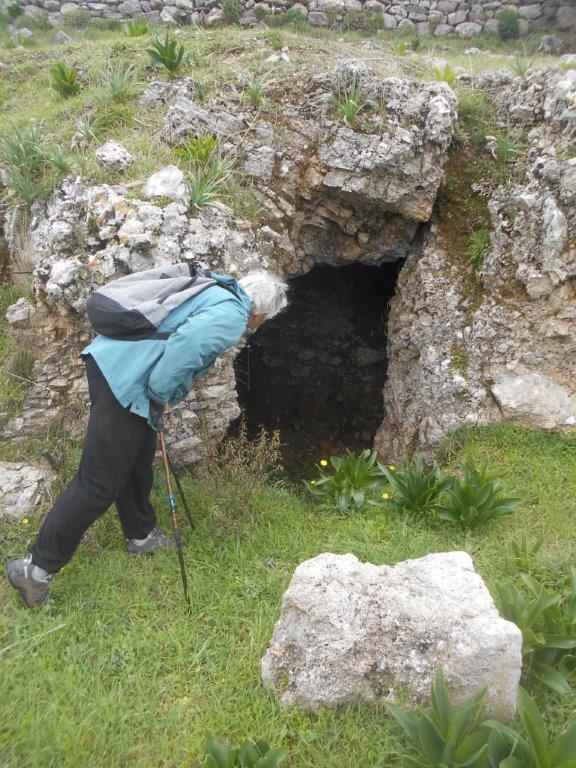
The cemetery is some distance down to the SE (ref: Explore! – April 2011) But the views are extensive, the spring flowers – red poppies especially – are stunning, so enjoy the atmosphere and just imagine ….
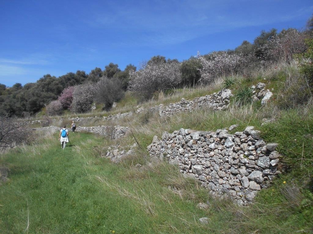
Either return the way you came OR extend the walk by another hour or so, to be recommended. Retrace back to the track junction, and turn right; as you wind down around the hillside, if you have a map, or know the area well, try and identify the distant villages – Agriles, Argastiri, Kambanos, Prines, Epanochori, and beyond the defile of Agia Eirini gorge, Koustogerako, Livadas, and later down the valley to Sougia and the sea. Several side turnings should be avoided, keeping on the well-used track, climbing a slight incline as it bends westwards, with Kamaria far below.
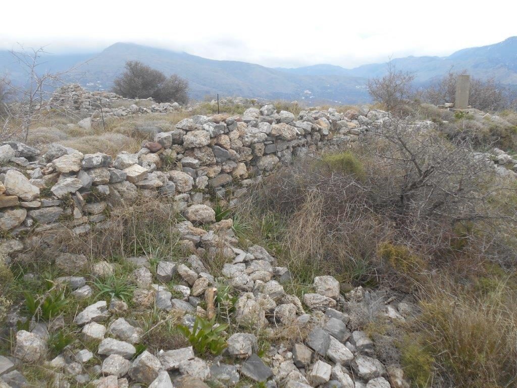
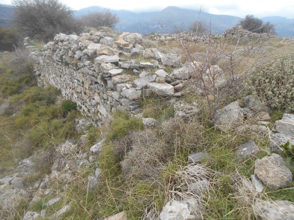
When it appears to fade and give out, don’t panic! Ignore a path left/downhill, and press ahead, threading a level way between olive trees, passing a ruined stone house or well, until you can see terracing ahead and below; you may need to drop down to reach a faint path running alongside a 1-m high stone wall (see photo.)
This becomes more defined and leads easily to the Roman cisterns. Built during the Roman occupation of Elyros from 67 BC – 330 AD, water emanated from a source high in Livada, 2km to the NW, and ran through clay pipes and via an aqueduct into the cisterns, to supply the city’s water requirements.
A little further on, the path will bring you back to the track and Panagia church, and a return to the starting point. With only a slim chance of an open Kafenion in Rodovani, drive 1km along the Chania road to Agriles, and the recently opened ‘To Palio Benzinadiko’ cafe/taverna * before starting the drive back to Paleochora.
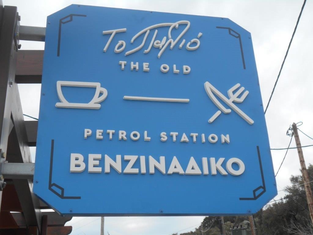
Over excellent coffee, Eftichia told us there once was a garage here, with petrol pumps outside, hence the name – ‘The Old Petrol Station’. “ I remember it well,” I told her, “about thirty years ago ?” “I would have been just a small baby,” she replied. O dear … Virgil, writing over two thousand years ago, was correct – “Meanwhile time is flying – flying never to return ….” So – Carpe Diem – “Seize the Day” …. and quite possibly Virgil wrote that too…..
*Under current restrictions the cafe, if open, is allowed to serve ‘take-away’ drinks only, which you can enjoy on the terrace, overlooking one of the finest views in South-West Crete.

2 comments
Loving looking at the photos ………we were expecting to return in May but we will return to Paleochora as soon as is possible ……..we will so miss the Spring flowers ……..please post us more photos to look at !
Sadly, for those unable to be here, and almost predictably, the wild flowers around Paleochora seem to be more abundant and glorious this spring. The small pink and mauve anemones appeared early, in late November, and lasted well into the New Year, followed by the purple & blue iris, now many varieties of orchid, especially bee orchids and monkey (pyramid) orchids. The first white ranunculae (buttercups) are here, and soon masses of cistus, purple lupins and field gladiolus. Almond trees are in blossom, apricots in bud, and loveliest of all, the cherry. God willing, they will all be here again, together with our visitors, next springtime.