
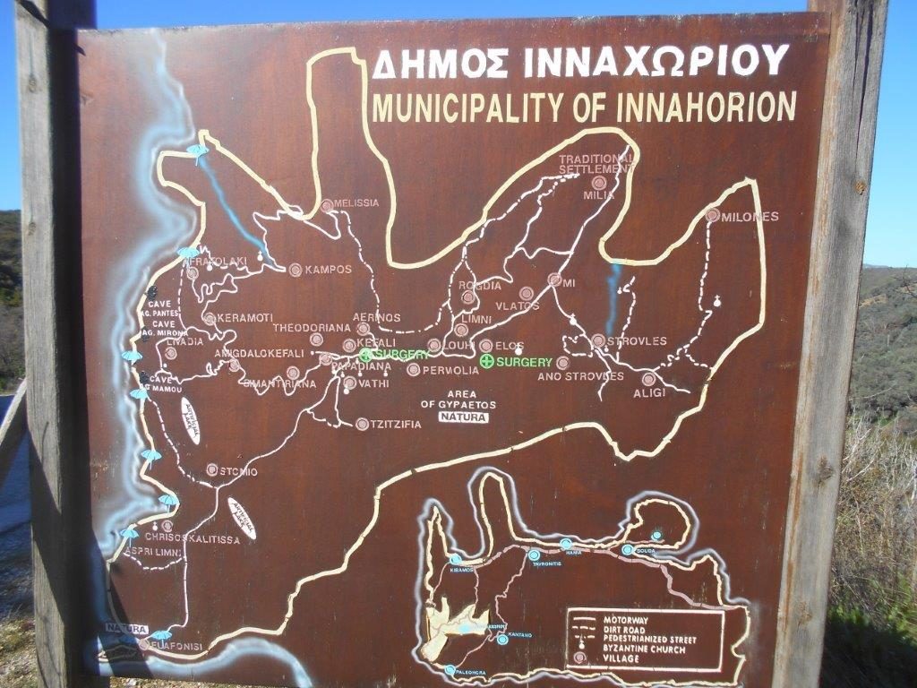
Innahorion is an area covering 169 square km of South-West Crete, and consists of 10 municipalities, the largest of which is Elos, and 34 villages/settlements. Deriving from “Enneia Horia” – nine villages – the nearest to Paleochora is Strovles, a scenic drive of 23km through Plemeniana, Dris and Aligi, and starting from Strovles is a straightforward and very varied circular walk of 7km, which will fill 2.5 hrs of a Cretan day.
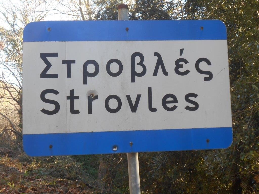
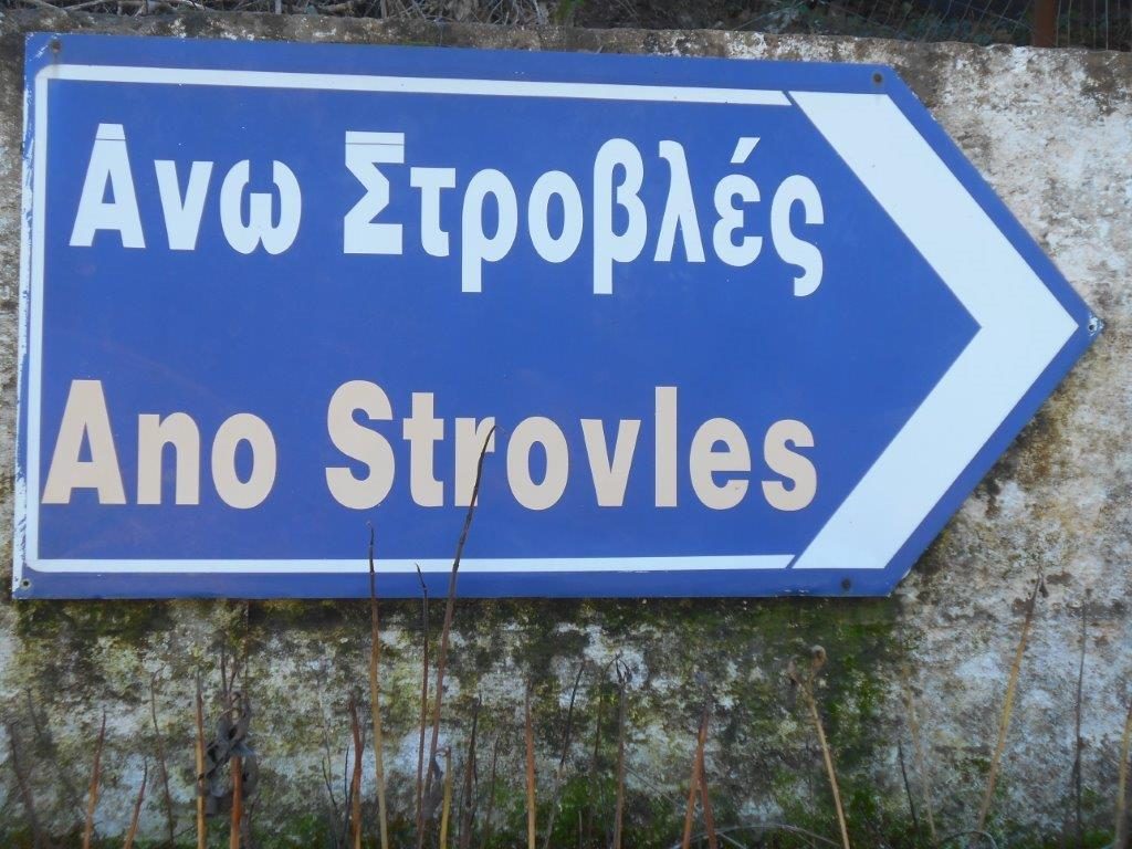
Park in the village centre, close to the kafenio, and set off along the adjacent side road, signed to Ano (Upper) Strovles. This leads over a bridge and alongside a stream, which later becomes the River Tiflos, flowing through the Topolia Gorge to reach the sea at Kissamos Bay.
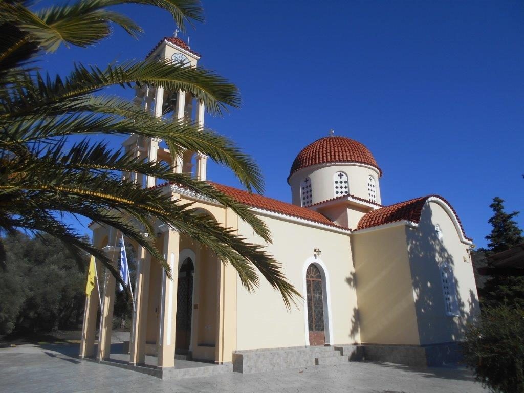
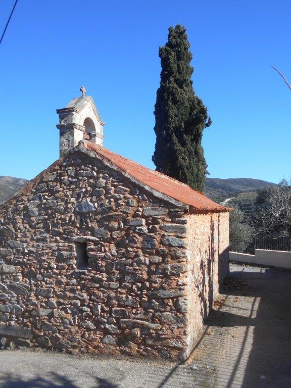
After a sharp bend, and passing houses, divert right to the impressive modern church of Ag. Panteleimon, with a smaller, older chapel nearby. Return to the road and turn right, keeping ahead to the 14th century Agios Timeos Stavros, a beautiful stone church, with small Ag. Rafael next door.
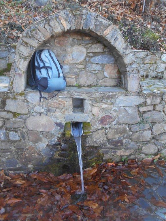
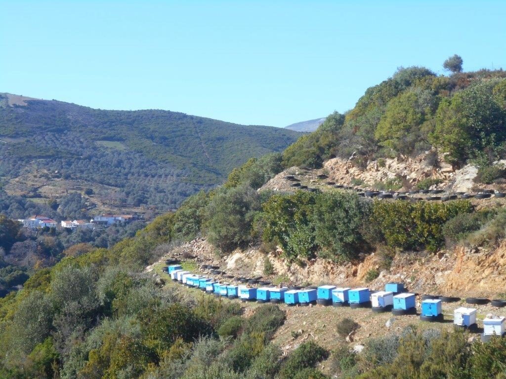
Head on uphill, keeping left as the road bends, and passing what – once upon a time – may have been a kafenion & shop, but I’ve yet to find it open. Now the road levels, with extensive views over the valley to other Innahorion villages of Rogdia and Vlathos. Pass a freshwater spring as the road rounds the head of the valley and crosses a low col, with beehives nearby.
There are distant views of the White Mountains, before joining the road to Voutas. Turn left here, between vineyards, and in 150m reach a second junction (Strovles is only 1 km away if you want to return directly.)
Walk right towards Paleochora, but almost immediately turn left up a concrete track. This is the steepest part of the route, so you have an excuse to stop, rest and enjoy the views. When the concrete ends, carry on between olive groves to reach a cross-tracks ; turn left here, initially downhill. Now comes a pleasant 2 km or so, as the track winds easily through olive groves and around the hillside. Soon you’ll pass above a discarded KTEL bus – how on earth did that get here ? It’s a remote bus stop, and hopefully with no umbrella necessary ….

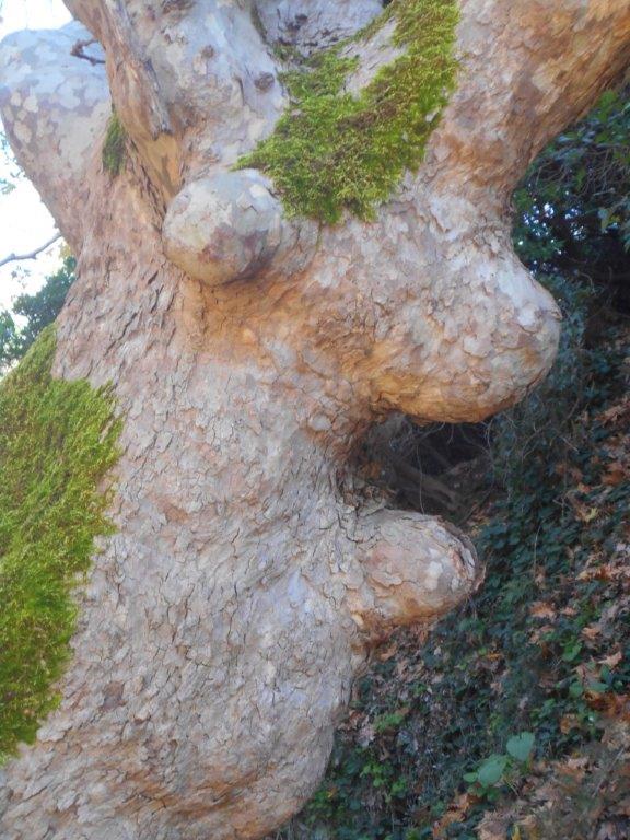
Good views all along here, especially westwards over Strovles to the heights of Agios Dikeos above Elos, the highest summit in Innahorion at 1181m (more about this in the summer.) Look out for the ‘scary monster’ in the plane tree.
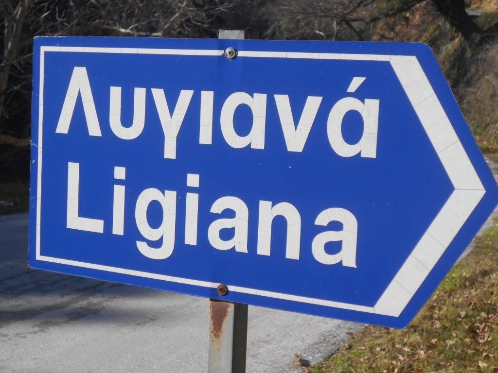
Ignore all side turnings – if in doubt always keep left – until the track, losing height, bends left and drops to meet a surfaced road. Turn right here, down a ‘hairpin’ bend into and through the hamlet of Ligiana. Continue downhill as the road meanders towards the valley, and when it meets the main road, walk back up into Strovles, 400m away.
The village kafenion, usually but not always open, has cold and limited hot drinks, and in summer offers local produce – honey, raki, and of course olives.
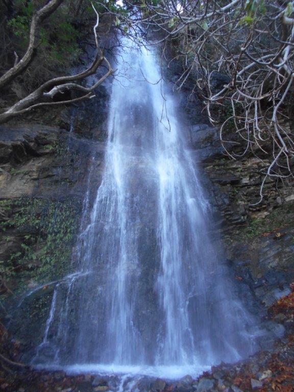
Waterfalls
Heavy rainfall in late December and January has made our local waterfalls even more impressive than last winter, and are well worth a visit. See Explore ! – February 2018 – for more about Strati, and March 2019 for how to get to Retzakas waterfall.


Recent Comments