
It started with an enquiry from Barry, who had heard of possible Roman remains called Kalamyda, close to Paleochora, did I know anything about them?
No, and neither did any knowledgeable local historians I asked. Some time later, I found references in Robert Pashley’s “Travels in Crete – Volume 2”, published in 1837, and there begins an interesting story.

Pashley’s travels in our area began in 1834, from Kambos on the west coast, by horseback and on foot. First south to Amigdhalokefali, then through Makeriana, Vavuliana to Kunone (I can’t locate any of these). After which, guided by a shepherd, “the mountains become barren” and “for some time without knowing whither we are going” they reached Sklavopoula. From where “we descend gradually to Pelekanas (Voutas) … and enter a valley which runs down to the African sea.” Soon “We pass a few cottages, called Tzaliana, and I learn (from Sfakian shepherds) that there are ancient remains on the summit of a hill to the south-west of Tzaliana.” And “sometime before sunset, we come in sight of Selino-kasteli, (Paleochora) to which we immediately descend.”
Pashley, a don at Trinity College, Cambridge, knows of the existence of Kalamyde from the ancient Stadiasmus Maris Magni * which places it “between Kriu-metopon ** and Lissos”, and believes its location as Paleochora. But he finds the Venetian fort is “in ruins and uninhabited”, discovers only fragments of pottery, and concludes “probably no ancient city ever existed here.” And the following day he moves on ….
The next stage of Pashley’s journey takes him through Anidri to Prodromi, and, with great difficulty, down to Lissos, “the site of an ancient city, in a small plain running down to the sea,” about which he writes extensively, describing the churches, ‘sepulchres’, and temple.
From the Stadiasmus, Pashley has a list of ancient cities along the coast “ in succession and under forms slightly altered: Phoenix (nr Loutro), Tarrha (Agia Roumeli), Poekilassos, Suia (Sougia), Lissos, Kalamydes and Kriu-metopon.” He has located Lissos, but where is Kalamydes ?
“We shall find,” he wrote, “that if Kalamydes was not at Selino-kasteli, it was a little inland and very near it.”
Pashley’s ensuing days’ travels make me exhausted just thinking about them, envisualising the Cretan landscape nearly two centuries ago… He reached Sougia on foot – the horses returned to Prodromi then through Kamaria to Sougia – then climbed to Livadha and on to Krustogherako (sic), down to Moni, up to Rhodovani, where he explores the “most important ancient city Elyros”, – where the remains must have been more than today, virtually nothing exists. On to Temenia, where he visits Hyrtakina (see our own ‘Explore !’- Feb 2011), then to Strati, over to Khadros, down to Spaniakos, and to Vlithias. Here he visits, and sketches the Dorian tower, which he (wrongly) believes to be a burial mound (see ‘Explore !’ – January 2017), and “had also the satisfaction of learning that the distance is not very great to the ancient site, near which I had passed without visiting it, between Pelekanos and Kastel-selino.”
Next morning he leaves Vlithias at 6.30am, crosses the river, and the col above, to reach Kontokynghi at 7.20am ( in 50 minutes, I can’t do that now ! ). They climb to Ag. Antonios (at the high point on the road to Voutas) “after passing which I notice some tombs hewn out of the solid rock, a never-failing indication that an ancient site exists somewhere near.”
Excitement must have been intense. “About a mile from the church I arrive at another of Ag. Gheorghios and also at the ancient site of which I am in search …. situated on the summit of the ridge between the two valleys.”
Then follows a detailed description of the city – “the whole circuit of these walls cannot much exceed half a mile ..” and “foundations of walls of buildings are seen to the south of Ag. Gheorghios.” A drawing – Walls of Kalamyde – appears in his book.
Conclusion: “I suppose these to be the remains of Kalamyde, of which the Stadiasmus says that it was to the west of Lissos, and thirty ‘stades’ from Kriu-metopon . The site agrees perfectly with what we learn of Kalamyde from the author in question, who alone has recorded the name of this city.”
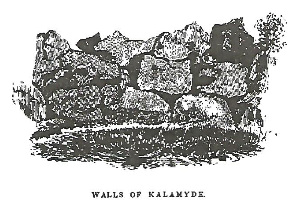
Pashley’s drawing of the walls
Pashley returns to Vlithias (by half-past ten !) and travels on to Kakotikhi, Plemmeliana, Kandanos, over to Skafi, Ergastiri, Epano-khorio, Ag. Irene to Omalos and Lakkoi, where we will leave him. If you can find a copy of the book *** it’s fascinating reading.
So, how to reach Kalamyde from Paleochora ? Very easily, by driving, or taxi through Panorama to Tsaliana (just 6km) to park by the bridge over the river.

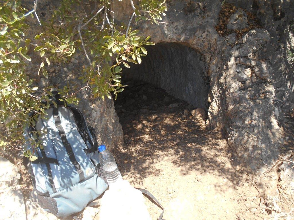
Walk on up the road for 300m, then through a gate and climb a rough track on the left. This winds up fairly steeply for 2km – passing a rock-cut tomb

Tomb on track
…just before attaining the ridge top – to reach Ag. Georgios, 15th C., currently undergoing restoration work.
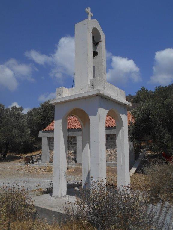
Ag Georghos
The track to the right (north) leads to several rock-cut tombs and burial chambers, the best of which is below, and right of the path. And a panoramic view, especially directly down to the deep valley of the River Pelekaniotikos, far below you.
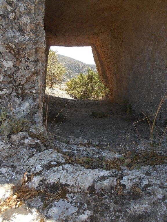
Open ended tomb looking east

Open ended tomb looking west
South of the church, a track leads to a rocky eminence with walls where “the style is ancient though the construction is not very massive; the chisel has not been used …. and they are all polygonal.”
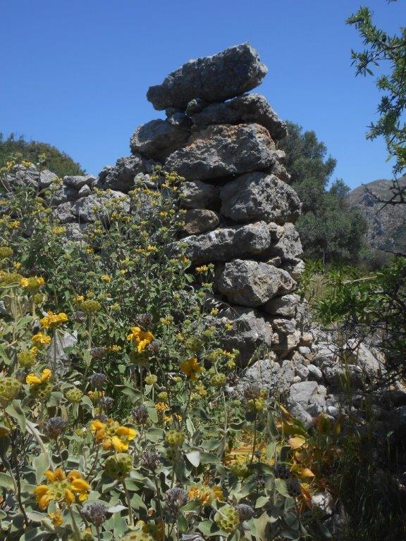
Kalamyde wall
In truth there is little to see here, and access is not easy, imagination required.

Part of the wall (similar to Pashley’s sketch)
Walk up here in the early morning, or at dusk; look around, listen to the wind soughing between rocks and whispering through the olive trees, perhaps hear voices from the long ago past, and – of course …. Explore!
* Stadiasmus Maris Magni – an ancient Roman manuscript written anonymously in the 2nd half of 3rdC AD, detailing the ports sailors encounter on the shores of the Mediterranean. Written in Ancient Greek, it provides distances, sailing directions and descriptions of specific ports. Fragments survive.
** Kriu-metopon (Krios) – defined as “ a high prominence with water & a small anchorage”
and nearby Biennos (Viena) – “ a small harbour with water.”
*** Robert Pashley Travels in Crete – Volume 2 (1837) Chapters 26-32

3 comments
Fascinating piece. I have asked you previously whether there was a settlement between Paleochora and Anidri. The reason I ask is that I have pottery fragments that were poking out of the ground which look Roman to me and were probably buried as a consequence of the Crete earthquake of AD 365.
Author
Hi David.
There’s the idea that the earliest settlement of Paleochora was to the east of the river, Kerestides is the name of the area. Loads of pottery litters the ground. Hard to age it though.
There was also an ancient village (possibly Roman) not far from the caves at Azorgirez. There is a derilict church which itself is very old but that was probably built over a pagan temple given that is a few meters from a spring and has rock cut tombs near to it. Rumour has it there was a small ampitheatre around there before it was terraced in modern times to plant more olive trees. I have never been able to “see” it when I have been tramping around up there.
The place Barry describes is called ‘Loutra’, about 30 mins walk from Azogires, certainly Roman and before. As well as the ruined church, spring, and tombs, there is evidence of a Dorian tower which linked those at Vlithias, Spaniakos and Anidri (see Explore! Jan 2017)
Much of the area is now covered with olive trees, and the present owner is not amenable to visitors. Look out for a future ‘Explore!’ with photographs.