
We’ve been to the eco-village of Milia Mountain Retreat before – see Explore ! May 2016 – climbing up from Katsomatados, but this time we’ll drive there, and then go for a walk. And afterwards, if it’s winter, enjoy a warming meal of soup and chestnut stifado in front of the woodstove in the restaurant.
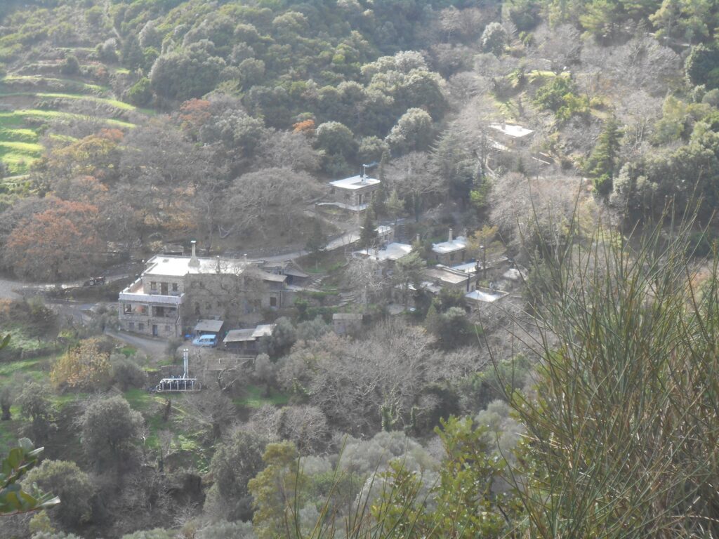
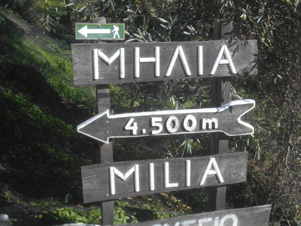
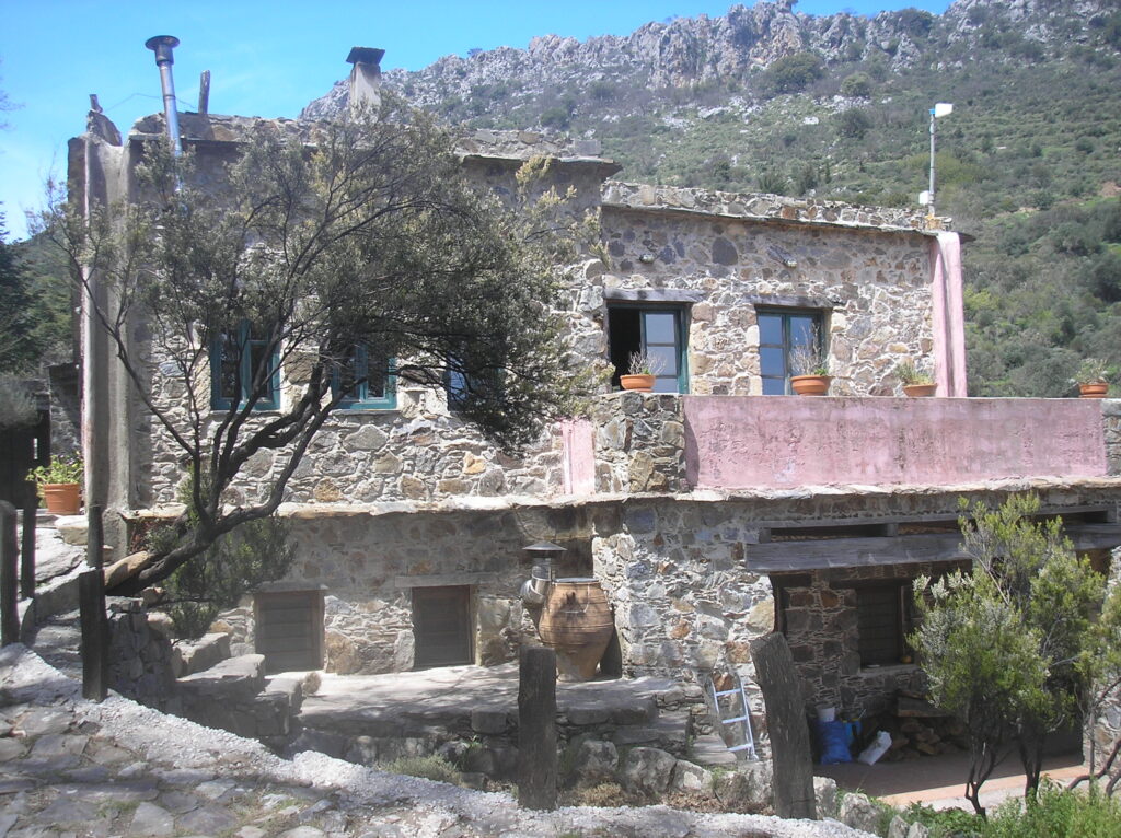
Milia is a scenic 35km drive from Paleochora, through Plemeniana and Strovles to Myloi, turning left up to Vlatos, and from there 4.5km on a mountain road, which becomes a rough gravel track for the final 2.4 km. The original village, which dates back to the 1500s, was abandoned in 1948, and restoration work began in 1982, with the eco-village opening in 1993. At a height of 535m, the Mountain Retreat offers simple accommodation, and the restaurant has a well-earned reputation for cuisine using local and home-grown produce.
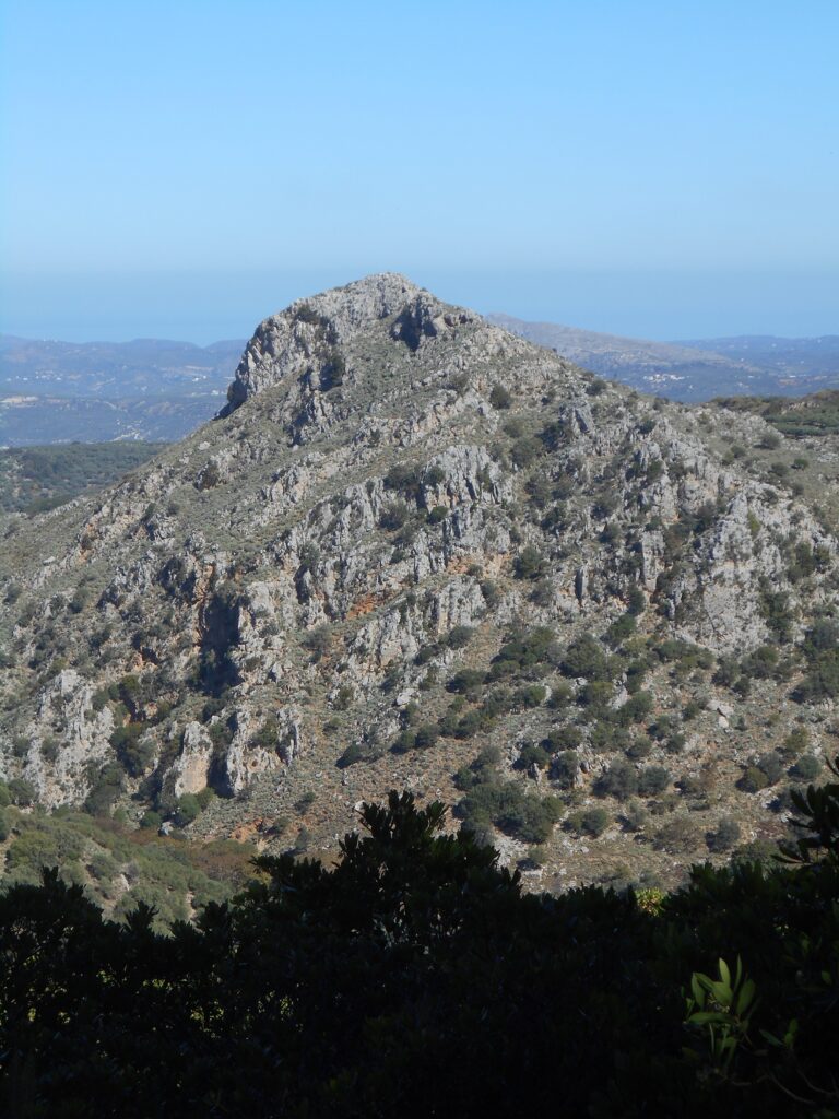
There are several way-marked paths starting from Milia – ask for walk descriptions and maps at reception. One, to the prominent rocky summit of Kastelos, is described in a previous Explore ! Another, far longer, climbs out of the valley over to Sirikari and descends the gorge to Polyrhenia, from where you can arrange a taxi back to Milia.
Two of the shorter routes, the Milia Circuit and Path of the Gods, can be combined to give a fine walk of up to three hours, superb views, and a healthy appetite. The latter is also known as the Chalepa’s Challenge – “ ‘chalepos’ in Greek means rough and tough, and the name of the area is Chalepa in order to describe the rocky wild terrain.” And so “we do not recommend the walk to visitors with disabilities and fear of heights.”
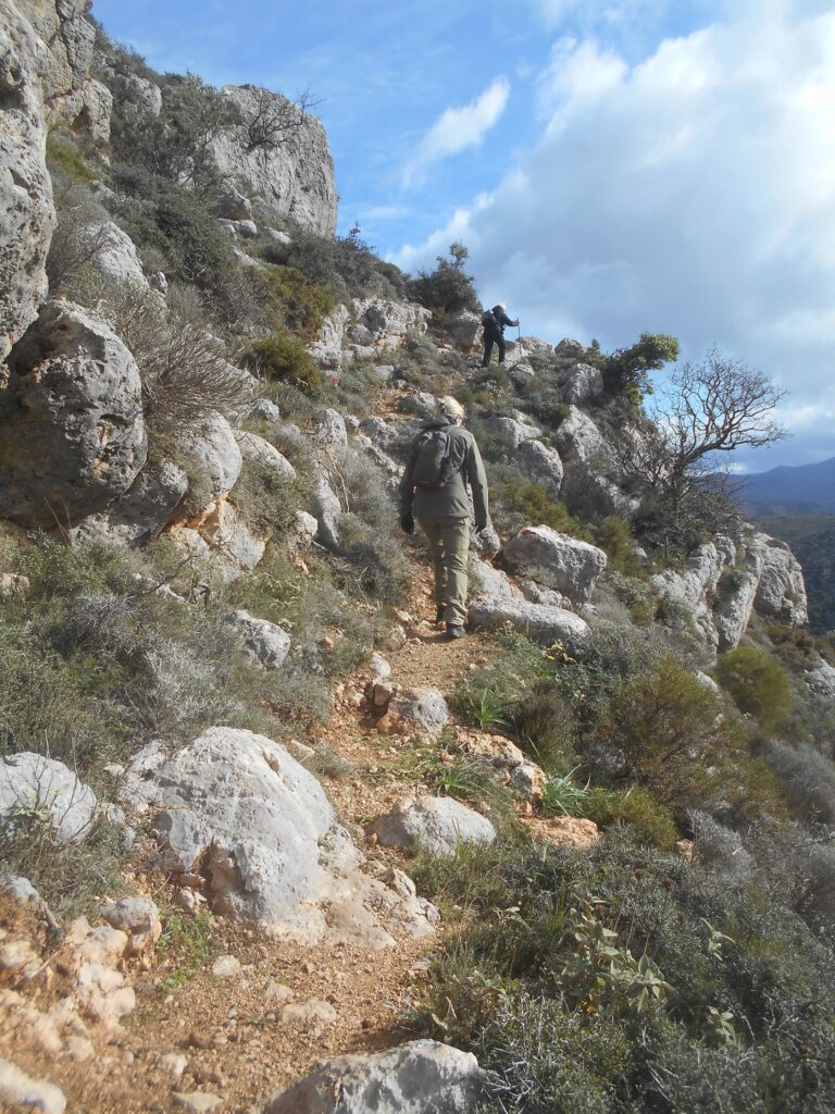
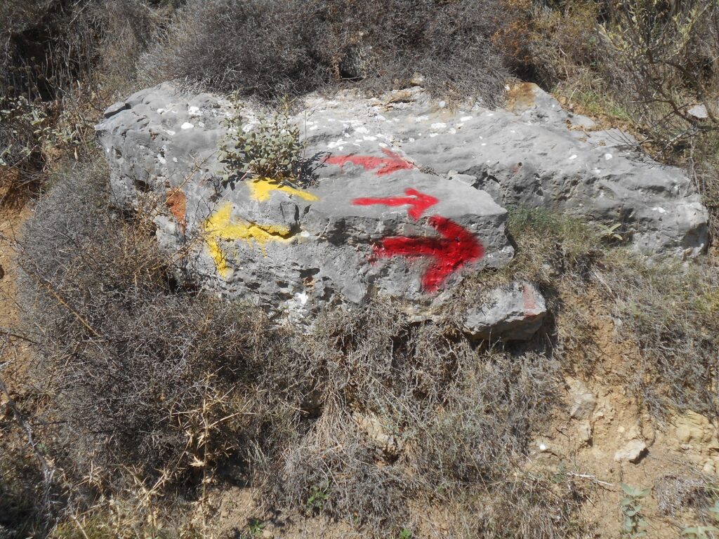
Both walks begin from the car park, 300m above the taverna, and are identical for the first ten minutes or so, following yellow and red waymarking. Across the bridge, and very soon a left turn, where the path rises and bends sharply left to reach a large boulder. Decision time here : the Milia Circuit continues easily ahead on a wide path, eventually reaching a metal gate, which you pass through.
Alternatively, take the Path of the Gods right, with now red marking, and the path, as promised, becoming more narrow, steeper and challenging. Several ‘rock steps’ must be negotiated, but always with sufficient hand/footholds. Milia, on either walk, is soon far below you ….
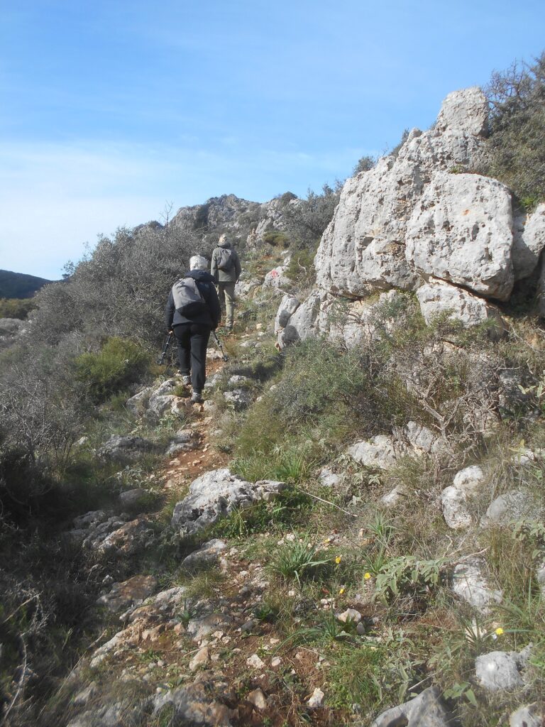
At its high point of around 675m, the path follows Milia’s boundary fence, and “ you will be two times at the back side of the big lime stones.” Then begin the descent, taking care to follow the waymarking, to reach the metal gate and rejoin the Milia circuit.
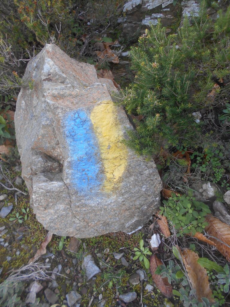
You could return directly from here, but as the terrain becomes easier, and the views more expansive, why not continue …. Pass through the gate, but then go immediately left, over a shallow gully and alongside a fence. Now the waymarking is blue and yellow, coincidentally the colours of my home soccer team, Shrewsbury Town, who after more than half a century are still waiting for the glory days ahead. “ Passing through chestnut and arbutus forest, you will be in an open sky, and always continue on the wider track.”
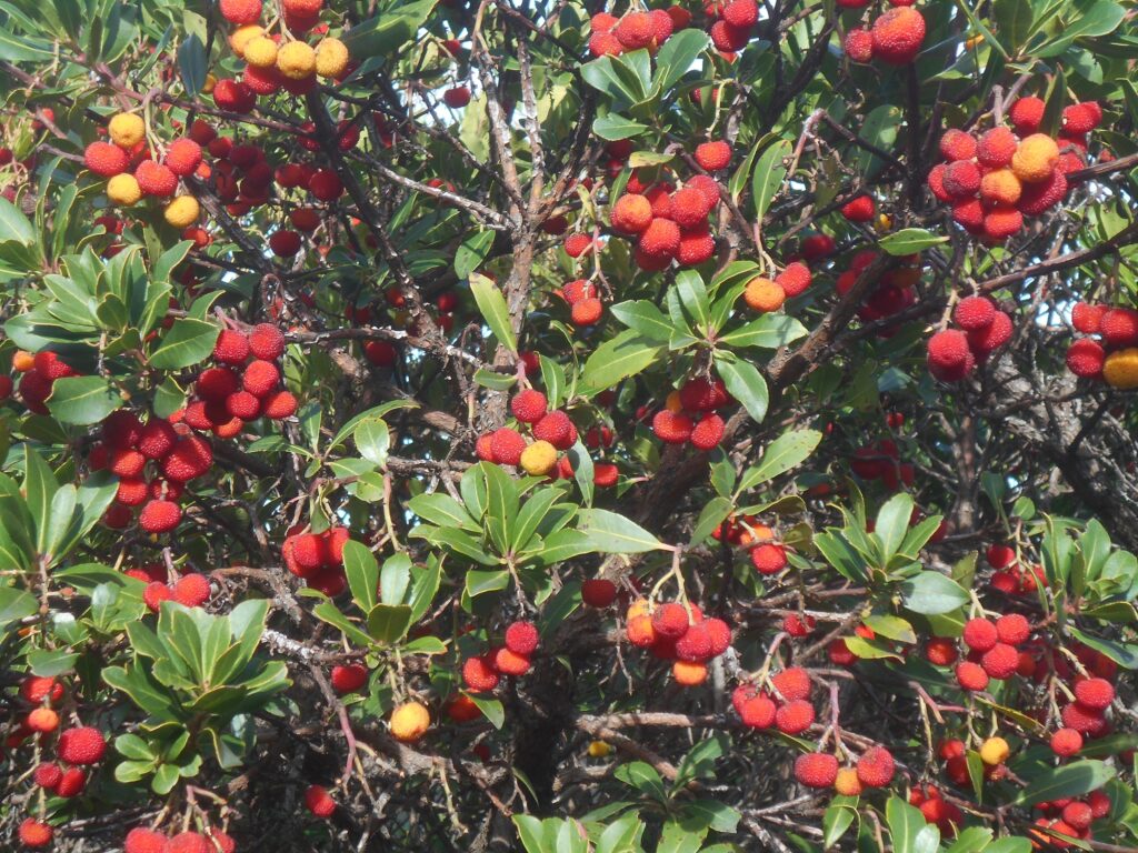
The ‘wild strawberries’ (arbutus unedo) are especially colourful in December, and can be used to make jam and marmalade, brandy, and an especially vicious type of ‘raki’. In late autumn there is a pervading aroma of heather blossom, with the somnolent sound of honey bees hard at work.
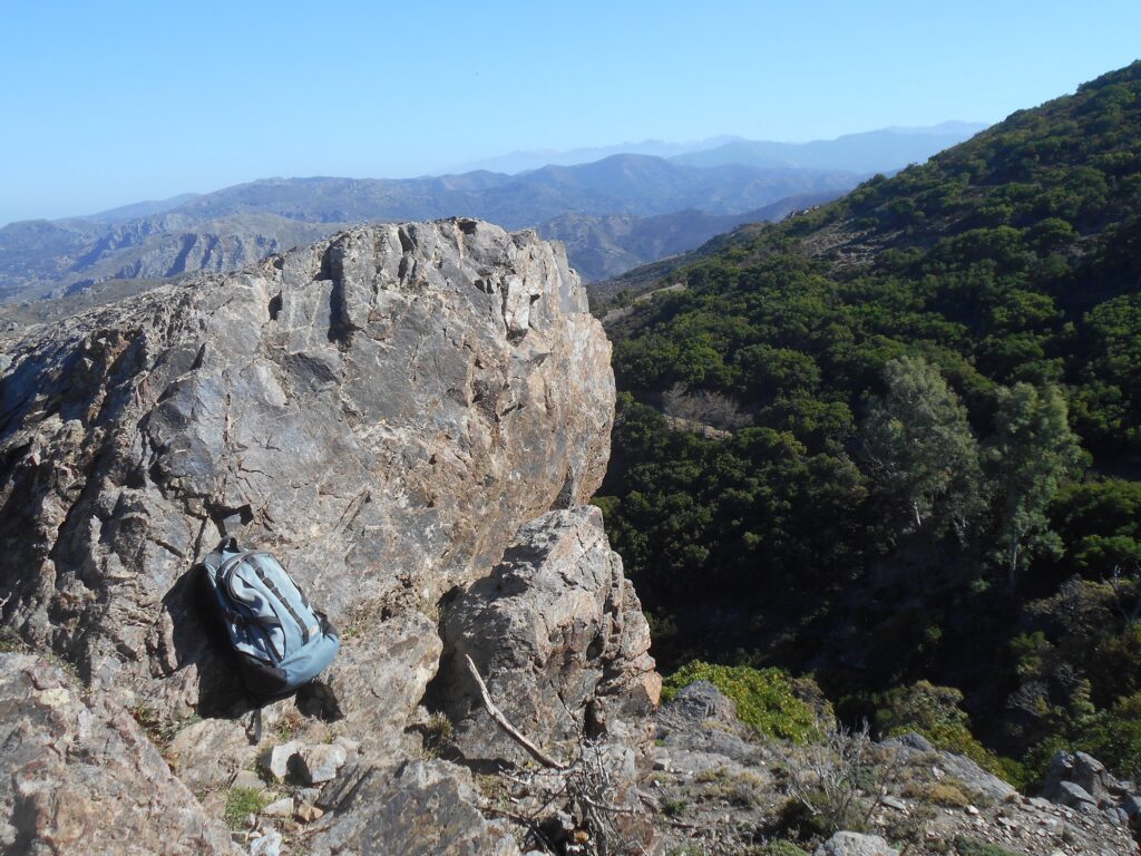
After a second wire gate, pause for photos at a prominent trackside boulder, fittingly known as ‘Viewpoint Rock’, from where on a clear day, successive ridges stretch away to where the White Mountains, often snow-covered from mid-November to May or later, are visible some 35 km distant.
Soon the path becomes wider, descending gradually. Two more gates need to be opened/closed, and soon … “ you will meet the dirt road of Milia again ; turn left, and in ten more minutes you will be back to the Settlement.”

Recent Comments