
Even regular visitors exploring the Paleochora area may not be familiar with the small villages of Kribiziana, Koudouriana, Despotiko and Fragoudiana, although they will have passed through the larger villages of Floria and Plemeniana on the journey over from Chania. Here’s a fine walk which links the latter two, passing through the former four, if you follow me so far ….
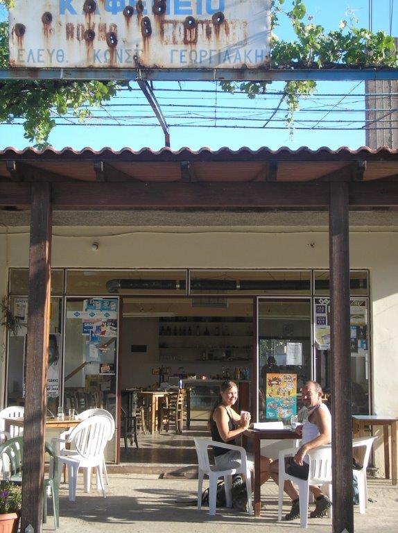
A running friend from my former UK life was here in June, setting up a holiday venture in Paleochora (see www.oppositesattractholidays.co.uk ) and eager for an early morning walk. Leaving a car at ‘O Milos’ taverna in Plemeniana, we jumped on the ‘bus (7.15am from Paleochora) for the remaining 12km up to Floria. And then straight into the cafenion for coffee.
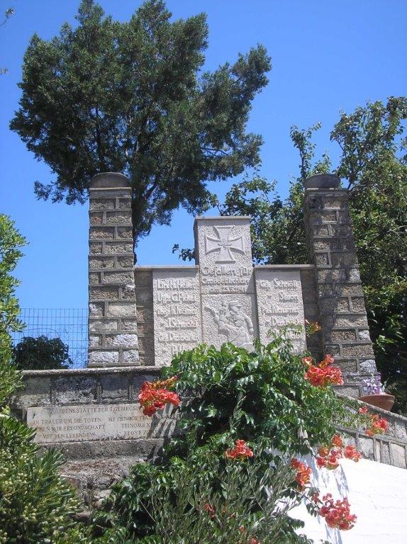
Floria, like Kandanos and Kakopetros, is a “Martyred Village”, and suffered badly in the aftermath of the German invasion of Crete in 1941. Two monuments on either side of the main road, one Greek one German, record the losses of both countries, and on the latter is engraved (translated) : “While mourning the dead we seek friendship with the living.” The cafe has a folder of fascinating wartime and post-war photographs.
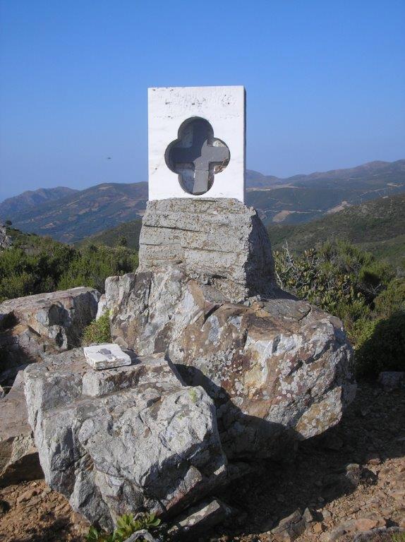
Leaving the cafe, we turned left (NW) on the road marked ‘Sassalos 7’, but very quickly forked sharp left, rising away from the village. The surfaced road soon becomes a rough track, winding out of the valley. Ignoring branches either side, we climbed to a distinctive fork, at 1.5km from Floria, and turned left. The track ahead leads to Milones and Aligi. Nearby is a deep crater (inevitably with dumped debris), and above it a memorial to a Cretan partisan, presumably killed here.
Another 1.5km, rising slightly, brought us to the ‘phone masts, and a nearby concrete trig pillar, 724m a.s.l. Superb views from here, including the sea on both sides of the island, as well as huge areas of inland Crete.
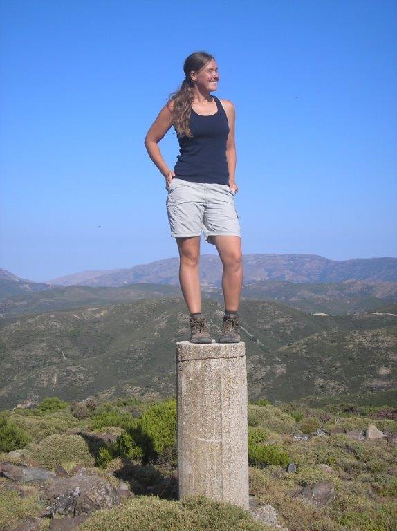
That trig point looks quite “Roman”
An even rougher track heads south from the masts, with broken ground crossed to reach it. We left it to the right after some ten minutes, (before a huge isolated boulder), following a fence over the crest of the ridge, then very steeply down the other side. A track of sorts is rejoined at the foot of the slope, which winds down above a ravine, and then becomes wider. Easy walking down the valley now, although there are three ‘stock-control’ gates to unwire and pass through.
The road passes below the first village, Kribiziana, now uninhabited, reached by a narrow track left, opposite a water tap. Further on, the road becomes surfaced at Koudouriana, below which is the church of Sts Peter & Paul.
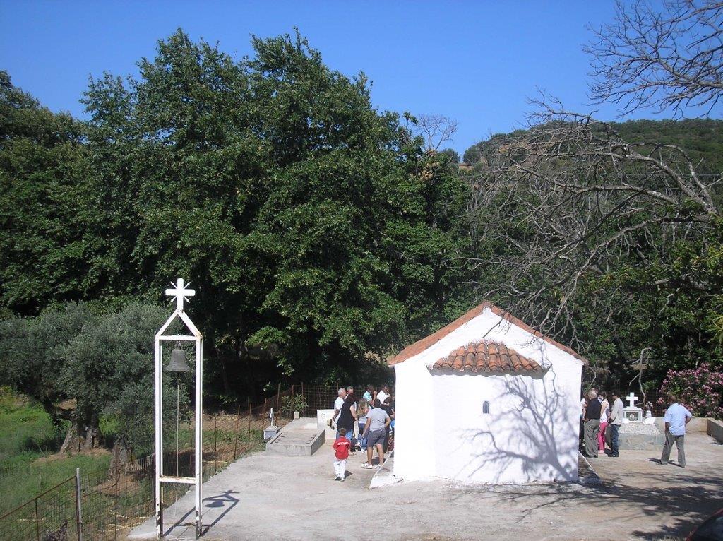
Unbeknown to us, it was the “Saints’ Day”, and a small group of people were celebrating the occasion. “Elate!” they called, “come and join us.” Shaking hands and giving us the traditional ‘feast bread’, they wished us “Chronia Polla”, or ‘many years’. The eldest, Thanassi, invited us to his home in the next village for coffee, impossible to refuse, and an often-met example of Cretan ‘filoxenia’, or friendship to foreigners. The 16th century church was beautifully decorated for the occasion, and the whole experience just delightful.

Icon decorated with flowers
We enjoyed 40 minutes hospitality with our new friends in the next village, Despotiko, with iced coffee and “hand-made lemonade” pressed on us for the next part of our walk, further on along the road and then a left turn into Fragoudiana. Once through the village, the road appears to end, but a grassy track leads on, through olive trees to join the main road at Dris, passing the former village school en route.
The quiet main road leads to Plemeniana in 3km, but there is a more interesting way. Cross the bridge, then go almost immediately left, on a road rising between houses, and later alongside a valley with a shallow stream below you. After some 10 mins (not before), when the roads bends round almost 180 deg, look for a rough track up between olive groves to the right. Keeping right, below and between the trees, eventually reach a narrow path left, between bushes, the start marked by a large stone ‘cairn’. In only 60m this joins a wide track, with an overhead plastic water pipe. Go right here down a long winding track, avoiding any side turnings, to reach the little village of Terediana where you turn right, to again meet the main road, and a short step back into Plemeniana.
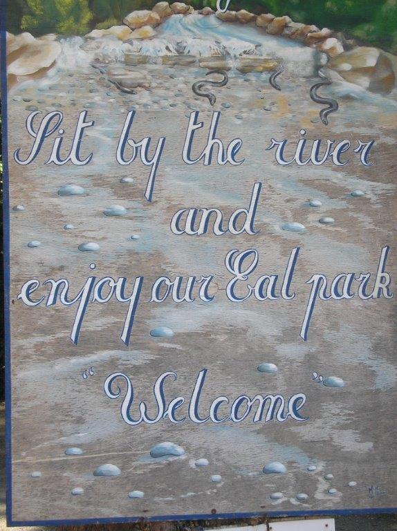
Eels sign at Milos Cafe
We deserved and enjoyed cold drinks at ‘O Milos’, or ‘Eel Cafe’, under shady plane trees above the river. Just thirty minutes and 14km later, before the day became too hot, we were swimming in the Libyan Sea, having – to misquote Rudyard Kipling – “filled the unforgiving minute, with four hours’ worth of distance walked.”
[important]
– Don’t forget , Bob Tait’s Explore! book is now on sale detailing some amazing walks in the close proximity of Paleochora. Click on the book cover below for more details…![]()
[/important]

2 comments
Your friends new venture (oppositesattract) web site shows as “account suspended” good luck
Author
No idea what you are talking about, but thank you for your comment, Peter