
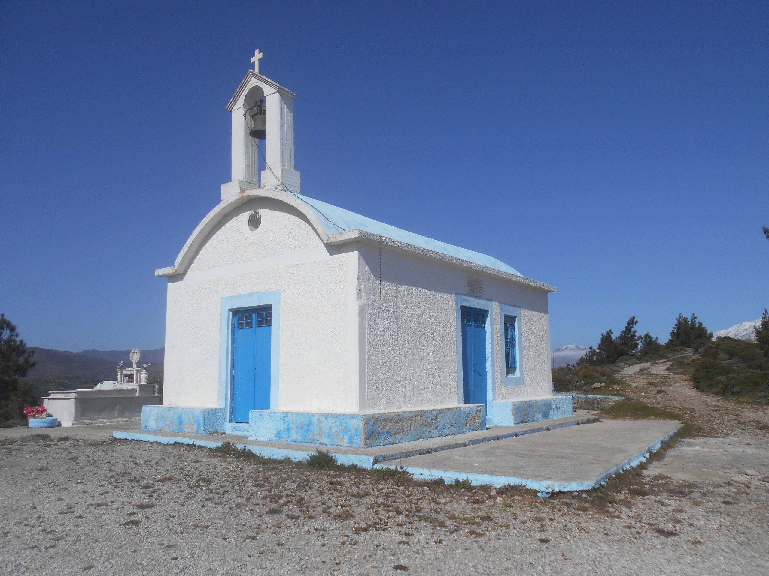
At the beginning of April, restrictions on travel were lifted, albeit at weekends only, to allow driving “for exercise” within the Chania prefecture. We took full advantage, and on the first day possible, drove the 18km through Prodromi and on up the many ‘hairpin’ road bends to the pretty little church of Agios Ioannis, at the highest point, 800m, on the road over to Temenia.

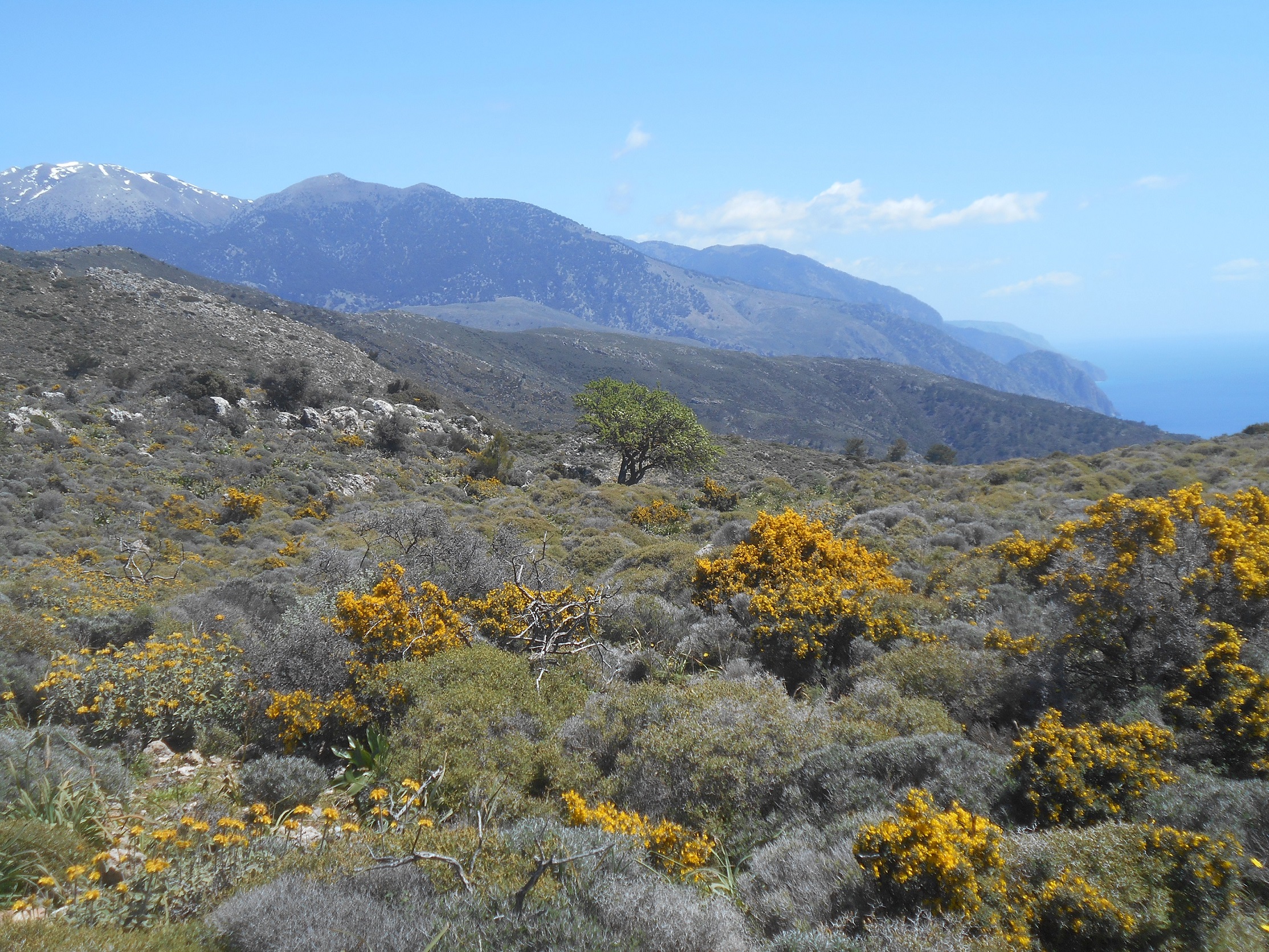
From the church, a shepherds’ road meanders east along the Armos ridge for some 3km, ending above the col/saddle at Selada. The landscape along here is always stunning, over and above the pine forests of the Kamaria valley to maybe a dozen small villages in a wide arc from Temenia to Livadas, above Sougia. But on this day views were sensational. After five months of local confinement, bliss was it to be alive, and our eyes were inevitably lifted unto the hills …
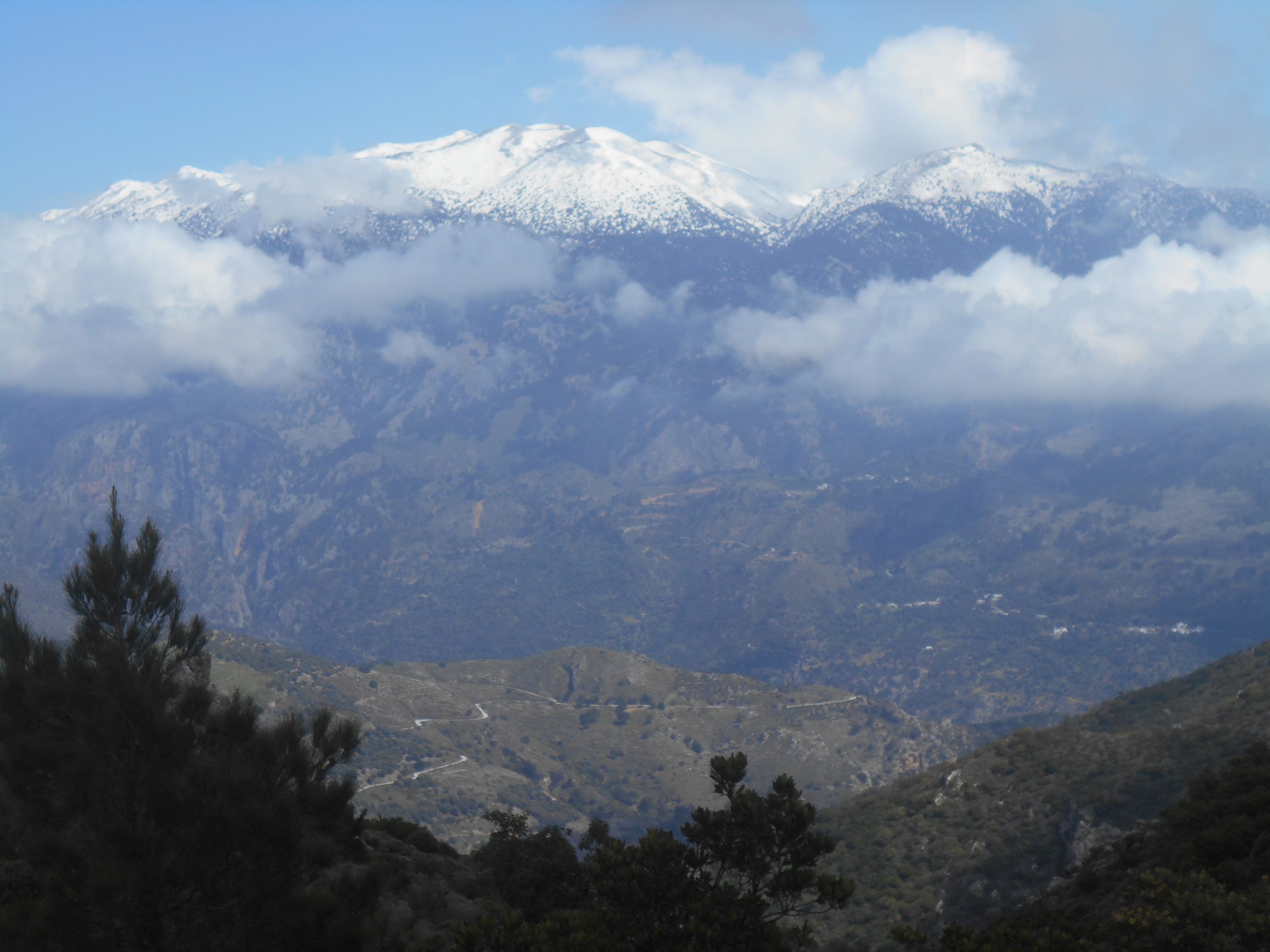
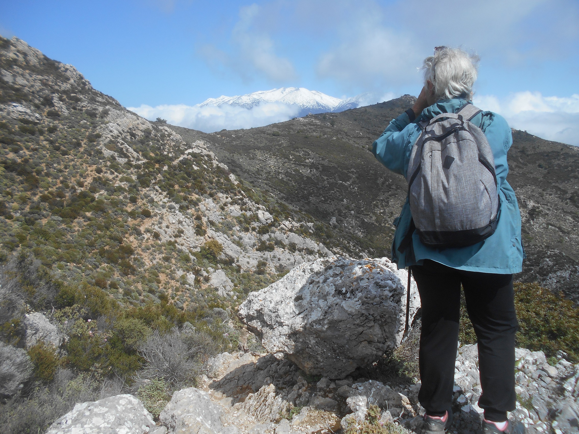
Recent storms had covered the White Mountains with fresh snow. Distant, less than 12km away direct but seeming far closer, were Psilafi (1,984m) and Ghourghoutha (1,675m), and between them the Achlada Valley (ref Explore ! – November 2017) beyond which rose the higher summits of Gingilos and Volakias, glistening icy white. Occasional clouds of warm air rising gave additional “moments of being,” and with ample time to stand and stare, and take photos, it took us an hour to reach Selada, and by then it was time for lunch.

Selada (at c.650m) is one of my favourite places, with high mountains on one side, sea to the other, and two deep valleys in between. A trail continues along the ridge before dividing, one path descending steeply into Sougia, the other – equally if not steeper – into the Kakos Potamos valley (see Explore ! September 2013). The centuries-old mule trail from Prodromi to Rodovani crosses here before descending (waymarked but becoming overgrown through lack of use) into the Kamaria valley.
Michelle and I would turn SW here, while Shelagh wandered back along the track to Ag. Ioannis, then drive down to Prodromi to meet us. Once on the path, it’s easy enough to follow, though not marked in any way. In parts narrow and rocky, and contouring into and out of two ravines, it’s difficult to imagine mules traversing these slopes, as they did, carrying heavy loads of salt from the Anidri beaches, destined for outlying villages in exchange for potatoes, beans and apples.
Looking back, it’s hard to see any evidence of a path, although it’s clearly visible on Google Earth. Christos, from ‘To Scolio’ in Anidri, is of the opinion that this route may date back to Minoan times, and was used for thousands of years until the modern road above Prodromi was constructed only in the 1950s.
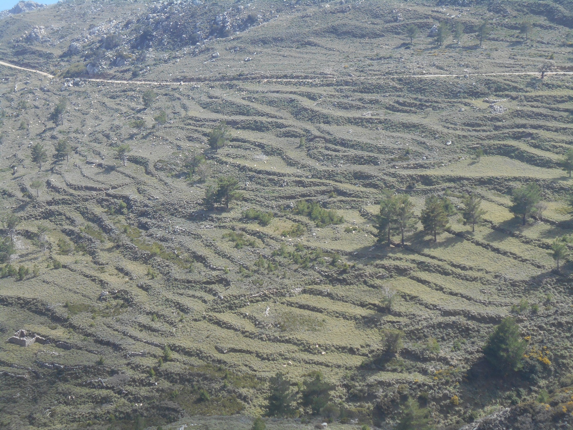
Now high above the valley, a difficult descent of which would bring you out at Sougia harbour, we paused to admire the many rows of ancient terracing on the hillside slopes of Tsarkou. Evidence here of a substantial settlement, possibly Dorian, with the “trademark” requisites of a sheltered position, easily guarded, good grazing with a plentiful water supply, and still some remaining carob and olive trees to provide wood for building, heating and oil.
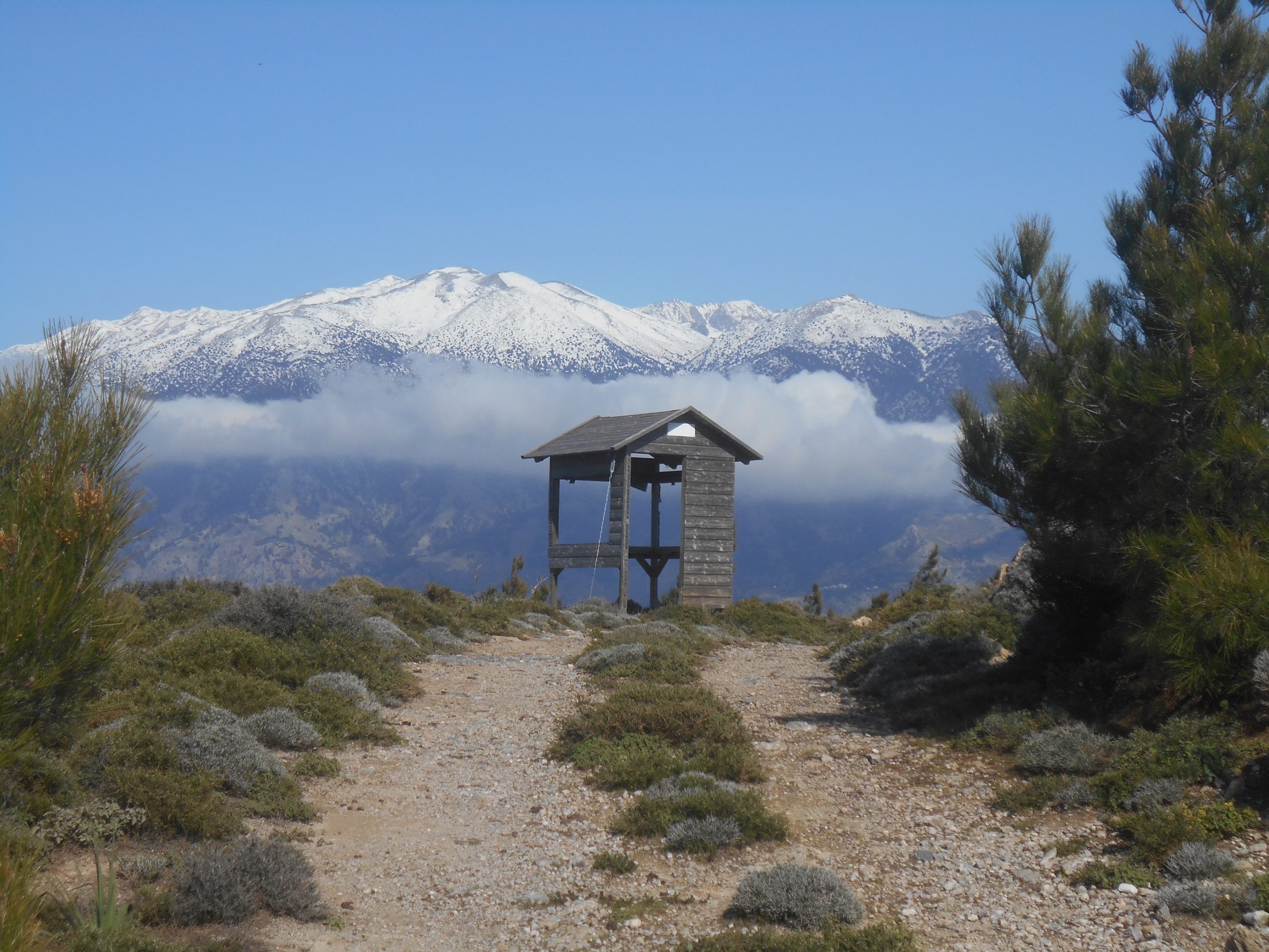
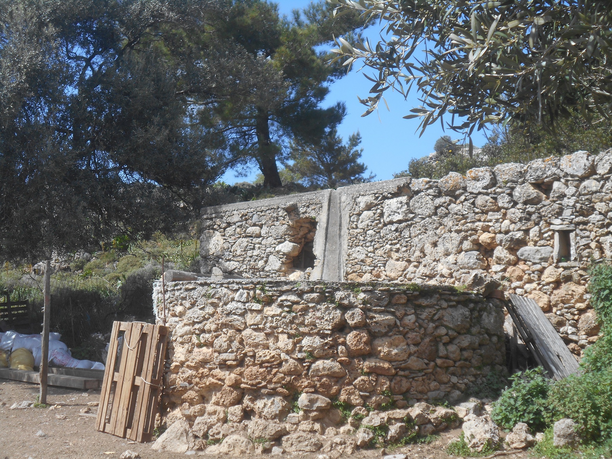
After crossing a final shallow gully, the path becomes indistinct, but keeping to the high ground, we soon reached the shepherds’ hut, and the track to follow over to Prodromi.
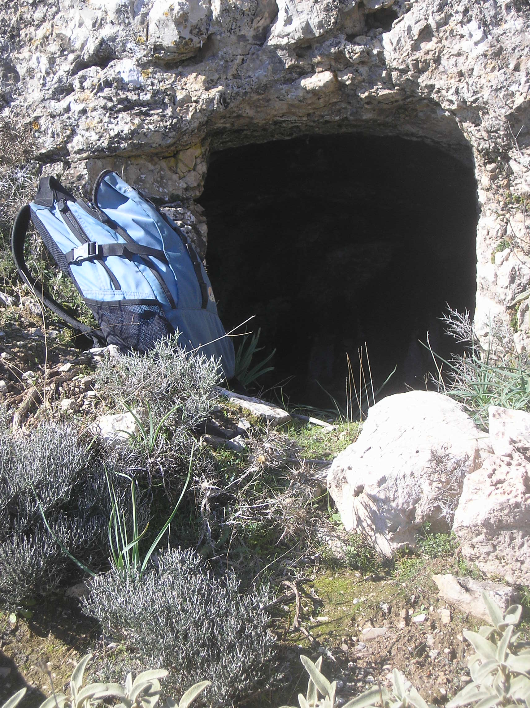
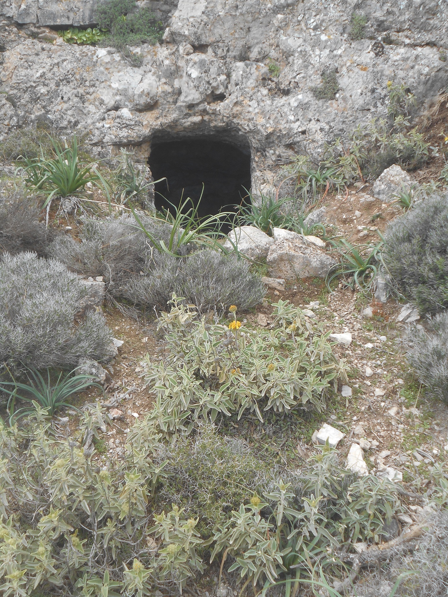
On the way there’s a fine rock-cut tomb, similar to those at the Dorian cities of Kadros and Kalamyde, another clue as to the history of what is a special, and rarely visited area.
From the high point of the track, before the gentle walk down into the village, there’s a view difficult to surpass. From the high peaks of the White Mountains, ridges fall over 2,000 metres to the Libyan Sea, culminating in the ever-azure, aquamarine waters off Domata beach and Cape Kalotrividis. I could sit here for a long time and enjoy this scenery, and very often … I do. *
The walk, the first outside our immediate area for five months, had taken us a little over three hours, and the enjoyment was immeasurable. Hopefully restrictions will slowly ease to allow more travel from Paleochora to other parts of Crete, Greece and the islands, and internationally.
Joni Mitchell was so correct when she sang : “ You don’t know what you’ve got till it’s gone ..”
* For the less adventurous, this outstanding viewpoint can be reached in less than 1 km by the track from the (pink) Archon Villa, in the centre of Prodromi ; keep right at a fork, and close the stock gate firmly en route.

1 comment
This looks like a nice one, I will try the drop to Sougia one day. Thanks Bob and other intrepid explorers.