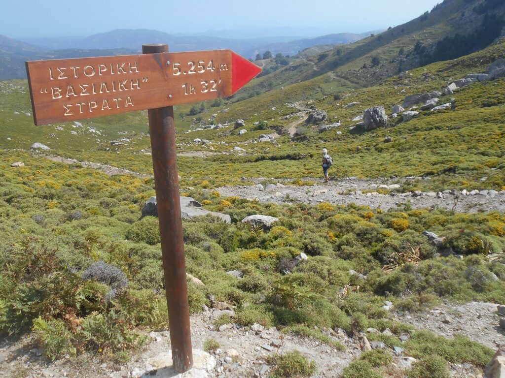
Long ago, before the establishment of any road network in Western Crete, there was a route for the inhabitants and goods of Selino province, and Ottoman troops stationed on the South Coast, to travel through the mountains to Chania. This became known as the Vasiliki Strata, or Royal Path, and what remains of it, or has been recently restored, is stunning.
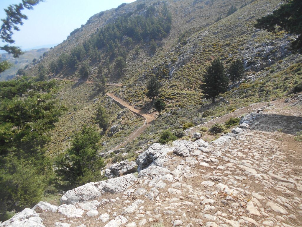
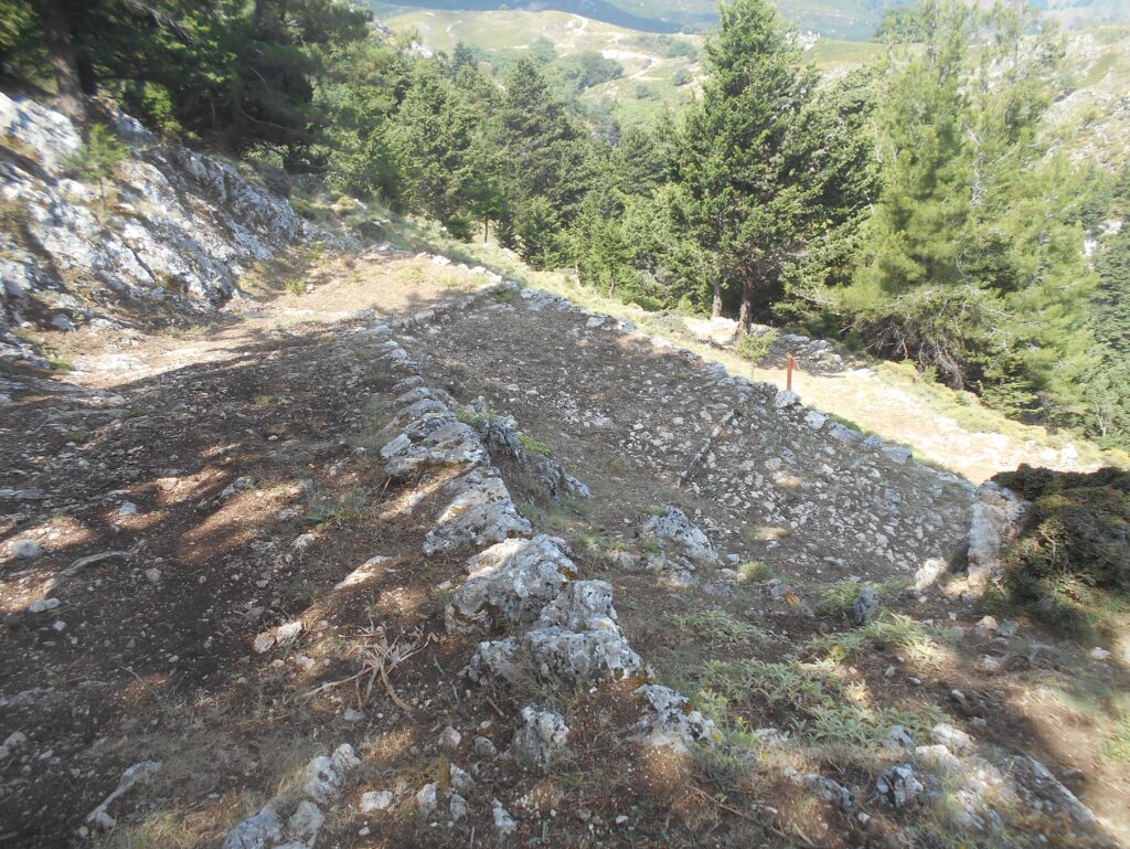
Michelle and I inadvertently ‘discovered’ part of the path several years ago, while looking for a way back to Omalos after walking through the Askidia Gorge. Although the route was obvious enough, parts of the ‘kalderimi’ * were loose and broken, the path overgrown, and fallen pine trees occasionally made progress difficult. Read the full story on Explore ! for October 2017. At that time I described the path as “ an absolute gem, which deserves to be better known and more frequently walked …”
Now, after restoration by the Municipality of Platanias earlier this year, it certainly will be. But first, a little about another part of the Vasiliki Strata which is well known and used regularly, both by walkers travelling through the Figou Gorge, and for centuries, and still today, as a transhumance trail to convey sheep and goats between winter lowlands, and summer grazing pastures at and above Omalos.
This begins in Agia Irini, close to – just a few metres away – from the entrance to the gorge.
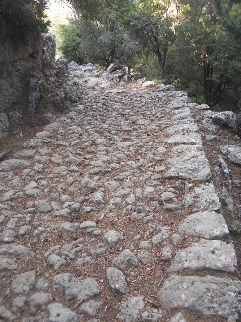
Take the road down to the river, over a stone bridge, swing left, then right (signed E4 path) and into the pine trees, where, after only ten minutes from the main road, is one of the best-preserved ‘kalderimi’ that I know. This fades as the path climbs a ridge, then with more excellent stonework towards the col, and after passing the head of Figou Gorge, again as the trail zig-zags up to meet the Omalos road.
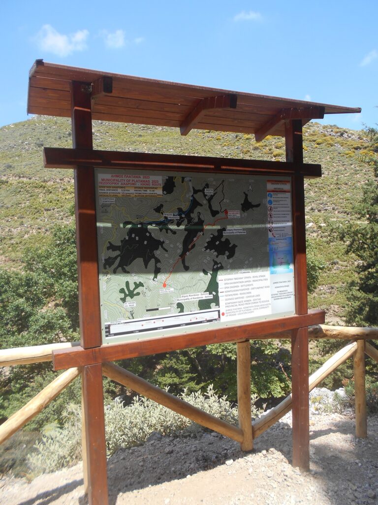
The “new” section of the Vasiliki Strata begins at Vatali, 3km east of the Seli junction, where the wind turbines stand tall. This was inaugurated at an Opening Ceremony in April this year, and the Information Board blew down in a gale two days afterwards. Details show the path as 4.75km, time 2.5 hrs, height difference 285m and Degree of difficulty 1/5 (Low). Strangely, the signpost at the walk start gives 5.254m, and 1.32 hrs, which is more accurate.
So, six years after our previous visit, and after an overnight stay at the ever-hospitable Exari Hotel at Omalos, Michelle and I set off on from here early on a July morning, cool at 935m (over 3000 ft.) Hopeful of making the walk linear, we had optimistically left a car earlier on the road down to Lakkoi, some 6km below the plateau.
Very soon the path, contouring high above the wooded Askidia Gorge, developed into one of the best I have ever walked along on Crete, the kalderimi a tribute to the craftsmanship of stonemasons ancient and modern. Posts at intervals indicate distance and timings, with occasional benches to pause and rest below shady pine trees. Prases was far below, the outlying villages of Askidia and Chosti closer, and the north coast hazy on the distant horizon.
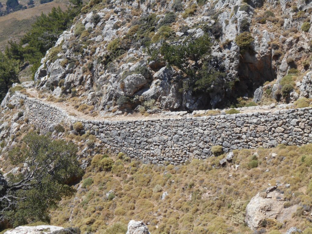
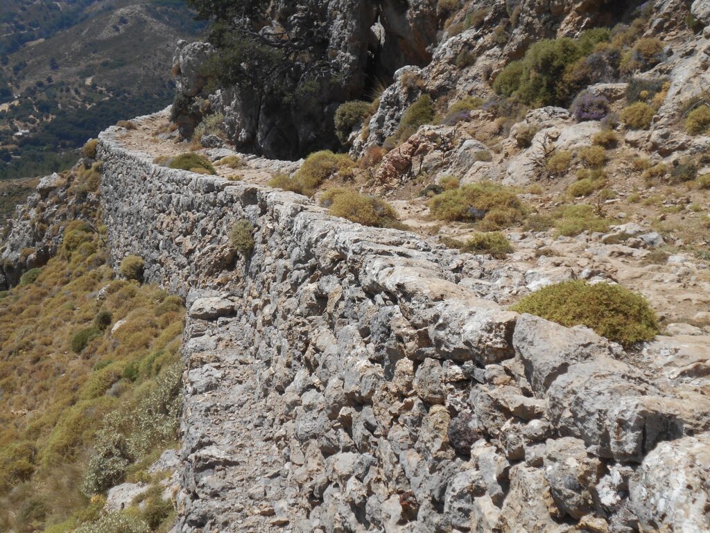
All too soon the path winds down into the valley, and after exactly 1.5 hrs we reached an identical (but still standing) Information Board which marks the end of the trail. Although Chosti is a c.30 minute walk from here, the optimum solution would be to walk back to Vatali.
But, ever adventurous, we thought to prolong the expedition by continuing east …. On leaving a car earlier, we had noticed blue paint markings, possibly denoting a route/path ? And here, encouragingly, were similar, although faint and infrequent. Nothing ventured, belying our ages and “living our days instead of counting our years” we followed the rough track out of the valley for 800m until it narrowed, then abruptly ended, at animal feeding troughs.
Searching around, we eventually located the onward path, almost indiscernible, but still intermittently waymarked, which climbed a narrow ravine, steep and rocky in places. After 500m it became easier, the gradient less, and we reached the main road, and our car, with some relief. This is not for the faint-hearted, and in reverse would be even more difficult.
* The word ‘kalderimi’ derives from the Turkish – ‘kalderim’, meaning a path/pavement connecting villages by foot, or for ‘hoofed’ animals, especially mules, and built with ‘cobble stones’. A large number were built on Crete (note especially those crossing the Aradena Gorge.) Some were constructed on existing Venetian routes using new paving ; our way up to the Omalos/Lakkoi road is marked on Google Maps as Enetiki Monopati, or Venetian Footpath.
Why ‘Royal’ Trail is open to conjecture, but possibly a reference to Venetian or Turkish nobility or royalty. What is certain, is that by following this path, recommended from the start at Vatali, to its end, and then back again, you will be treading the same way, and enjoying the same views as those who constructed the route several hundred years ago.
If you never do another walk on Crete, do this one ….. it’s that good.


2 comments
To clarify the photographs : 1, 2, 4 and 7 are on the recently renovated Royal Trail, leaving the Seli to Omalos road at Vatali. 3, 5 and 6 are on the path from Agia Irini which joins the Omalos road 1km west of Ag Theodorii church.
Yassau, it is always nice to read when the old connecting roads (Kalderimi and Monopati) are maintained or restored.
I walked from Agia Irini on Vasiliki Strata, through Figou Gorge back to Agia Irini in June 2017.
The Figou Gorge:
The name Figou means escape and refers to a result of 1821, when many women and children took refuge from the Turks in the gorge.
In the Figou gorge we pass several house ruins of Cretan partisans. The houses were guard posts against the Turks.
The gorge is relatively narrow, wild and very green. Many pine trees, some of them very old, oleander bushes and the municipality dragonwort, a genus of arum.
Starting point for the hike:
There are several options:
a) Starting point is the small Dof Agia Irini. You can stay overnight in the small villages of Agia Irini and Epanochori. In Agia Irini there is a tavern with rooms. In Epanochori there is also a tavern, a kafenion also accommodation.
b) or you can take the well maintained Kalderimi from the Omalos plateau (E4). Here you can stay overnight in Omalos or at the church Agia Theodori (1.100m).
Start of the hike:
I started in the village of Agia Irini (555m). The village of Agia Irini is well known, because the hike to the Agia Irini gorge starts here.
Here you don’t take the path to Agia Irini gorge / tavern Porofarango, but the path to the left of it. It goes over a bridge over the river Ageriniotis. After a minute the E4 is signposted The E4 goes up to the Omalos plateau.
On the Kalderimi Vasiliki Strata now follows an ascent of 300 meters in altitude. 5 minutes it goes uphill on the wide paved path.
After 5 minutes the paved path becomes narrower.
After 10-15 minutes you reach the row of pines. Here you can take a break.
After 15 minutes you reach the cistern. Here we leave to the right, because here begins the entrance to Figou Gorge.
Straight ahead the Kalderimi Vasiliki Strata goes to Omalos. It is probably one of the best preserved cobblestone paths/kalderimi of the island.
Now begins in the Figou Gorge the descent of a total of 300 meters in altitude, to the Agia Irini Gorge.
It goes sometimes right, sometimes left, always above the stream bed in the Figou Gorge downhill. A few places are a little slippery.
After 35 minutes 2 house ruins of partisans come. Right after that w6 more house ruins of partisans come. On the right side is a shelter. The refuge is open, there are many bats.
Immediately after, you come out into the Agia Galini gorge at the small wooden ticket booth.
On the left, in 7 kilometers, you go through the gorge towards Sougia. On the right you are in 1 kilometer at the tavern Porofarango and again in the village Agia Irini.
Conclusion:
I took the hike slowly and enjoyed the peace, solitude and the landscape.
In total I was 3 hours on the road, of which 1.20 hours hiked.
Super nice hike in a beautiful and lonely area. The well-preserved Kalderimi Vasiliki Strata and Figou Gorge have impressed me very much.
Ta Leme, kv