
If I live to be a hundred (and I fully intend to, at least …) there will always be places to discover and ‘Explore’ in Western Crete. It’s far easier these days, with several informative websites about Crete, the excellent large-scale Anavasi maps, and of course Google Earth. And that’s how we came to “discover” the Prases, or Askidia gorge. The excellent www.cretanbeaches.com website (look under ‘Nature’) lists no less than 46 gorges in the ‘Chania’ area, with far more under the Rethymnon, Heraklion and Lassithi regions.
Some are well known, eg. Samaria, Agia Irini, Imbros, and others – Maganistra, Chosti, Boriana and Kydoni – I had never heard of. Several, eg. Laggos, Tromarissa and Pigaidakia, are “canyons” requiring abseiling expertise and equipment, and interestingly three – Prines, Kambanos and Kamariano, described and descended in “Explore”, are not mentioned at all (ref Archives – Sept. ’12, March ’13 and May ’14.)
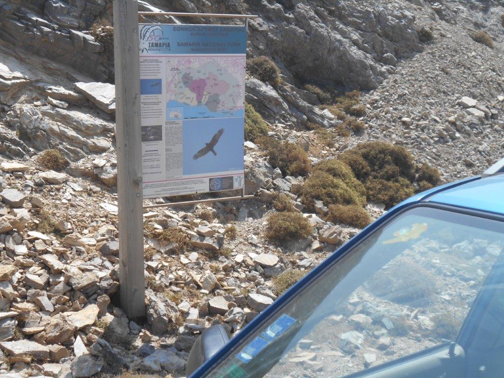
Park & Start here
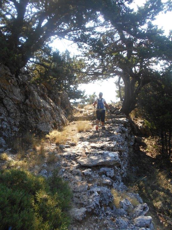
So, in mid-July, we left the heat of Paleochora far below and drove up into the mountains, taking the route to Omalos through Rodovani and Agia Irini, turning right at Petra Seli, and parking 3km further on, where a rough track leads north, downhill, towards the Prases gorge. It’s high here, at 1,098m, and was cool, and so, with several (‘just in case’) contingency items and several litres of water, we set off down to Platanos, at the head of the gorge – “an enchanting area with ferns and plane trees with water springs” informs the website.
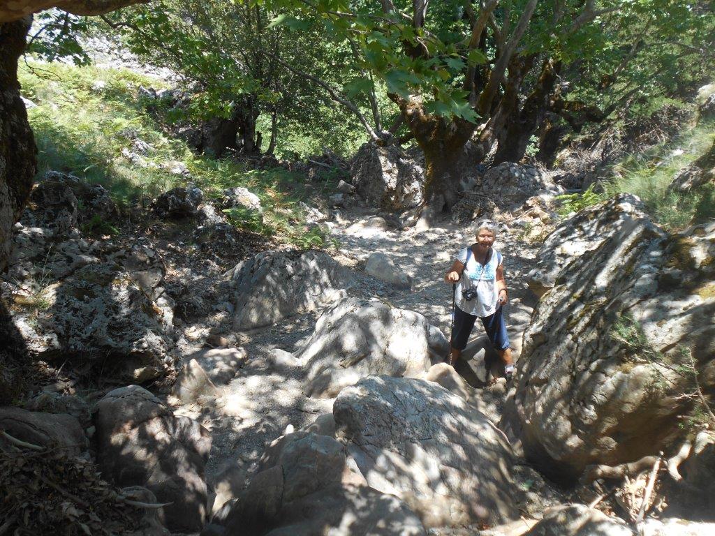
Gorge start
On the way, to our right and slightly above us, we identified a ‘kalderimi’ path contouring around the hillside. It’s clearly marked on the current Anavasi Topo 25 (Crete 11.13) map, and would, if it continued to the north-east, enable us to make a ’round-trip’ walk (as so it later proved.)
Access to the head of the gorge was easy, the little water flowing in the riverbed disappearing almost immediately. Then all was straightforward ; I’ve used this before, so – as the King advised Alice (in Wonderland), “begin at the beginning, and go on till you come to the end, then stop.” The end, in our case, was a bridge on the minor road from Askidia to Prases, which we reached in 1.5 hours.
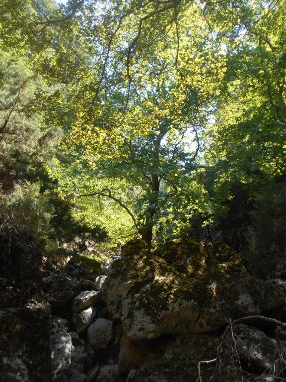
Mid-gorge
No real difficulties en route, although the gorge drops 323m (over 1000 English ft) in only 2 km, and in several places “scrambling” – the use of hands and feet to climb down – was necessary. More from the website : “the deciduous trees of the riverbed (maples and sycamore), form wonderful scenery, especially in autumn.” A huge boulder, left balanced by rockfall and not glacial, was of special interest – “une roche perche” insisted Michelle.

Roche perche
On the bridge, decision time, with four options ; we could return up the gorge, reach the car by possible tracks to the west, walk into Prases and hope for a taxi or hitch a lift, or try to locate the ‘kalderimi’ high above Askidia. And of course we chose the latter. Regaining lost height, we walked up into Askidia, refilled water bottles from a tap near the church, then more steeply up the track above. And from it, through binoculars, we picked out the ‘kalderimi’, crossing open ground before entering the forest, and heading exactly where we hoped it would.
This was confirmed by a shepherd, milking his goats in a pen at the track’s end, and who was totally astonished to see two strangers appearing in the early evening, calling to him in less than perfect Greek with English and French accents. I know places (in the UK especially) where farmers and landowners would be far less receptive to walkers, but he indicated where to find “gates” in the fence, pointed out a ‘goat path’ upwards, and waved us on our way.
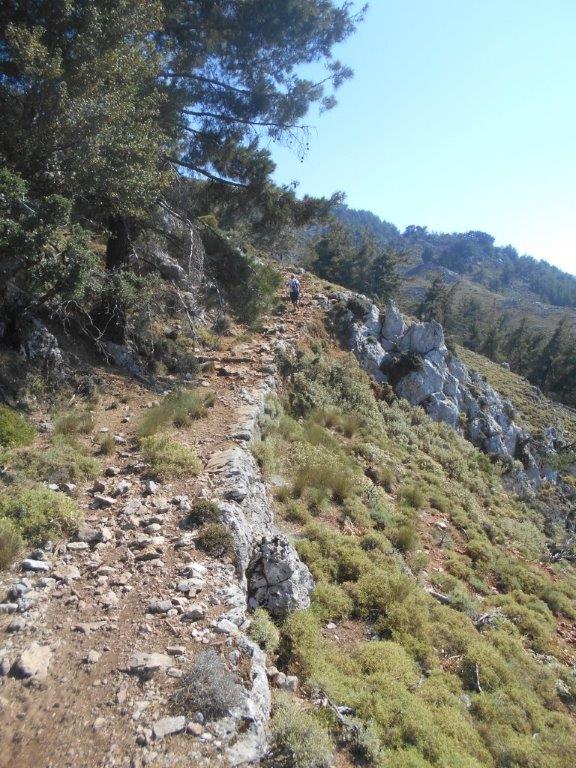
Kalderimi
We reached the ‘kalderimi’ 100m higher – a stone-built, paved, mule trail, still in excellent
condition, built centuries ago presumably to link villages to the north of Omalos with those to the west. It’s an absolute gem, and deserves to be better known and more frequently walked – I suspect we were the first in years, apart from shepherds. Holding close to the 850m contour, with just a few dips and rises, we followed the trail easily for 2km, high above the gorge we had walked through earlier.
Kalderimi
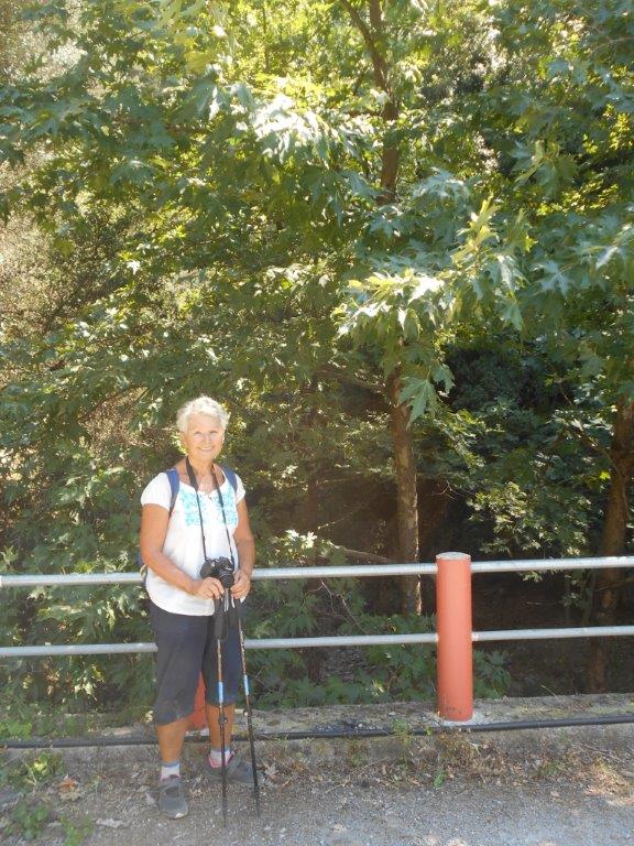
Only in the final 200m does the path become less discernible, by which time the end – the road and our car – was in sight above. A short drive later we were “checking in” at the Exari Hotel in Omalos, where – in mid-July – it was too cold to have dinner outdoors, and blankets were needed overnight.
Gorge end
Next morning we drove the short distance to Lakkoi, where we hoped to locate the Vrissi and Melisitis gorges. And we found both, but that’s another story, and you’ll have to wait until next year for more details ……

Exari Hotel
For fit, experienced, and adventurous “off the beaten track” walkers, the circular route described above, taking around five hours, is highly recommended. Rain and snow-melt in winter and spring would preclude access, so choose (as we did) a cooling afternoon and summer’s evening, or a mellow day in autumn, and enjoy …..

Recent Comments