
After two relatively easy walks earlier this year, here’s a longer and more challenging route – one that we used as ‘training’ for our trek in Nepal (see February’s ‘Explore’.)
It’s described in Loraine Wilson’s guide “The High Mountains of Crete” (Cicerone), where she writes: “This is an old transhumance trail and a direct footpath between Lakki village and the grazing pastures of the Omalos Plateau.” And I’d recently heard from the Chania Mountain Club that several overgrown sections had been cleared, the path well waymarked, and the route was “not easy, but not difficult.”

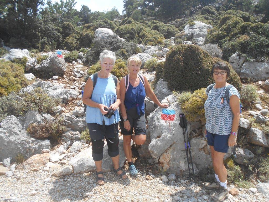
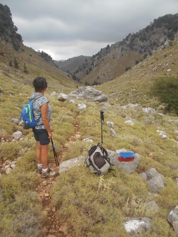
Path marking
This being a linear walk, we persuaded friend John to drop us at the start, then drive down to Lakki and await our arrival, some three or so hours later.
Start here
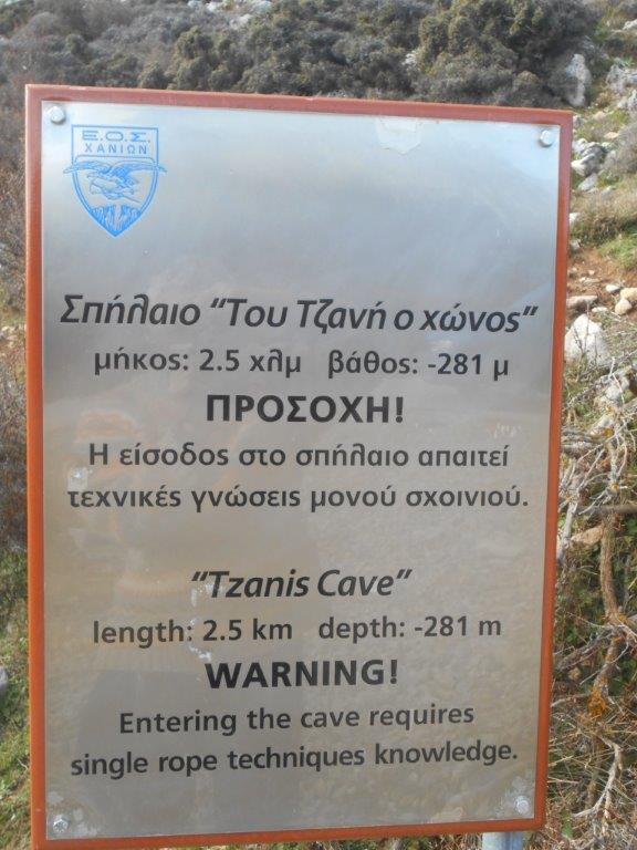
The path begins 2km north of Omalos “village”, just above a sharp bend on the main road, and marked on the Anavasi map as ‘Neradzoporto’. If you’re walking, look into the Tzanis Cave, which has a length of 2.5km, reaching almost 300m underground, but don’t go far, it’s only for experts, as a sign indicates.

Inside Tzanis cave
Legend tells us that Omalos was once a vast lake, whose waters drained out through the swallow-hole at Tzanis, and emerged once more as the source of the River Keritis and Agia Lake.
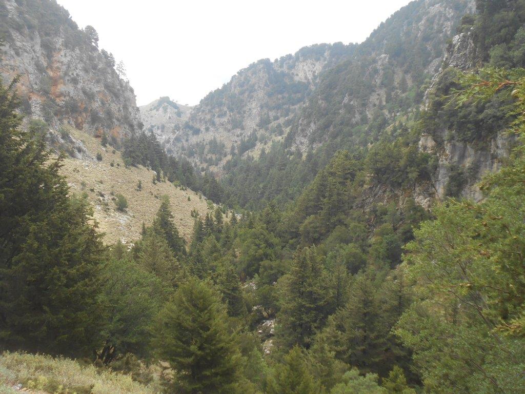
Starting at 1110m, and with Lakki at 508m, the route is practically all downhill, but no easier because of that; the first kilometre is the hardest, steep and rocky, passing below a stone ‘aloni’ to reach a track alongside Melisitis river.

Stone aloni
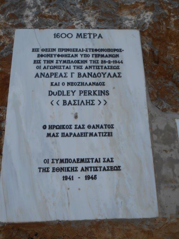
A brief rest and refuel here, then a level walk through stunning scenery to where the track bends sharp left below the conical hill of Stefanoporo. Some history here; on the 28th February 1944 the leader of the Selino “andartes”, New Zealander Dudley Perkins, was killed, along with Cretan Andreas Vandoulas, in a German ambush. The full story is recounted in the later chapters of “Vasili, the Lion of Crete” by Murray Eliot. A plaque on the main road approaching Omalos commemorates the event, and war hero Perkins rests in the Commonwealth War Cemetery at Souda Bay.
As the road bends west, our route heads north to begin the descent of the long valley towards Lakki. Initially contouring around the hillside, the path drops to the oleander-filled streambed, joins a smaller valley and then turns north-east.
Long valley
Wilson’s ‘time allowance’ from Stefanoporo to where the valley meets the Achlapidiotis river is 1 hr 15 mins, and another 20 mins for the “sting in the tail” climb of 115m into Lakki, but it took us much longer. A sudden, violent and heavy rainstorm – in mid-June! – resulted in us sheltering out of the wind and rain under a lightweight nylon (and super effective) KISU – ‘Karrimor’ Instructor Survival Unit – for 40 minutes until conditions improved. Always be prepared, even in Crete in mid-summer. But afterwards, the path was wet, and rocks slippery, so progress was inevitably slower and careful.
And then the final climb to Lakki, to meet John in the kafenion by the ‘platea’, where a thought-provoking statue commemorates Cretan resistance to three occupations – Venetian, Turkish and German. Less than an hour later we reached Chania, where not a drop of rain had fallen, and were amongst visiting summer tourists, in a different world…
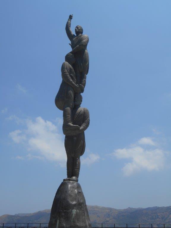
Lakki statue
This is a fine and satisfying walk, one of the best I’ve enjoyed in Crete, combining the best of wild mountain scenery, total isolation, but with the security of good waymarking.
Note
As far as I know, this route has not been affected by this winter’s heavy rain and flooding, although Lakki was evacuated because of landslips on the road from Chania. Any changes to the walk will appear here.

Recent Comments