
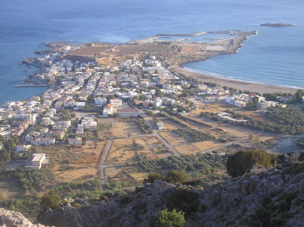
Many visitors to Paleochora, especially those who have followed Walk 1 in my recently published book of “Ten Walks around Paleohora”, will have walked up through Panorama and climbed to the masts high above the town to enjoy the magnificent views. But very few will have approached this viewpoint from the north, along the ridge which separates the two valleys running down from Kakodiki and Sarakina.
From the outset, this is more than just a walk, more of a mountain expedition. Paths are few, the terrain is difficult at times, and you’ll need to scramble over rocks on the climb to the summit of Kefala, 522m. You’ll need good footwear, and route-finding skills. But there’s a real sense of achievement in reaching Vigla, high above Paleochora, with the peninsular spread out far below you.

Kefala above Kondokinigi
Kondokinigi is 8km out of town, before the road splits for Voutas and Sarakina. Leave the road at a small white building, pass above the village church, and then turn left.

Start here!
Soon, as it bends left, leave this track and go right, to pick up a narrow winding path climbing, via a large, prominent boulder towards the ‘col’ above. This route, now little-used, connected Kondokinigi with Kalamos and Vlithias. Keep right of a wire fence to reach the top, and take a rest before the strenuous climb ahead.
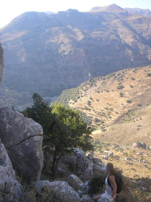
Ascent to Kefala
If you got this far, the way above is clear – south and steep, becoming steeper. Again keep right of a fence, which, high in a narrowing gully, is easily crossed. Now keep right over slabs and rock outcrops, to reach a subsidiary summit, and then walk and climb east to the stone cairn on top of Kefala, with views in all directions.
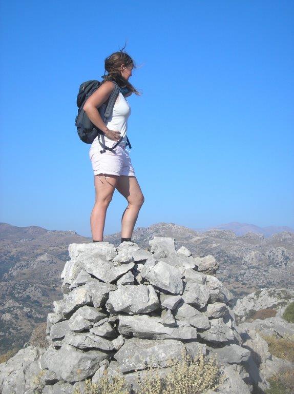
Kefala summit, 522m
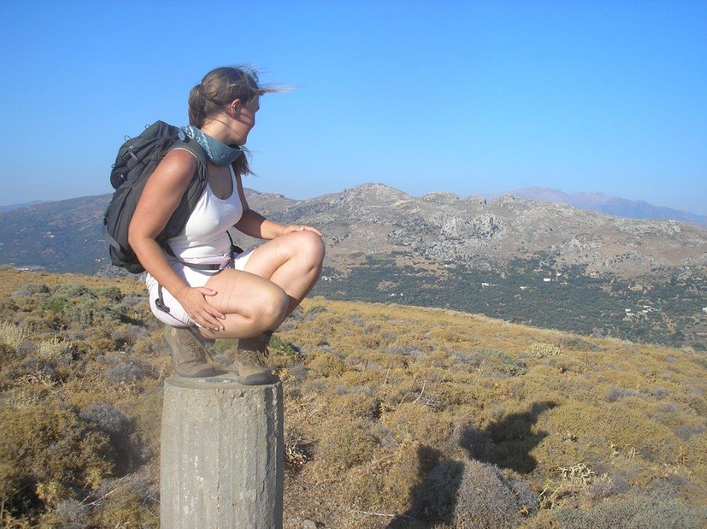
From Kefala the ridge curves, with occasional sheep/goat tracks through the thyme and leg-scratching bushes. Drop down sharply to reach a rough track, which is an “escape route” to take if preferred, leading to the hamlet of Vasilaki, and from there to the ‘main’ road back into Paleochora. Otherwise continue ahead, to reach a second summit, this one with a concrete surveying pillar.
Look out for remains of shepherds’ huts (‘koumi’) and former animal enclosures. Eventually, swing right to reach another fence, keeping left of this to a gate, and a (wired) opening to its right. The masts are in sight now, but still with route decisions to make before reaching them. The higher masts are at 335m altitude, at the end of a rough road taking you 100m down to the lower ones on Vigles ( a short diversion to here), and from there to sea level.
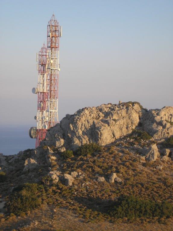
Nearing the masts
We enjoyed this route one summer’s evening, taking three hours from Kondokinigi to a car left in Panorama, but we’d been before and knew the way; a first occasion would take longer. A word of warning – on no account attempt a descent east from the ridge. The only safe ways off are from the masts, or by the track leading to Vasilaki.
To end on a sad note. The German occupation began in May 1941, and its end is recorded in “Paleochora, a Look Back into the Past”, a book still available. “ In October 1944 a rumour circulated that the Germans would withdraw from Paleochora, and this was actually true. Many inhabitants climbed the mountain to the north of their town called “Vigles”. The sight they saw was both shocking and haunting. Many homes had been destroyed, shops and storehouses had been set on fire, ammunition was being exploded. The Germans left hardly anything behind. Germany had lost the war; Paleochora was liberated, and its inhabitants returned ….”

Recent Comments