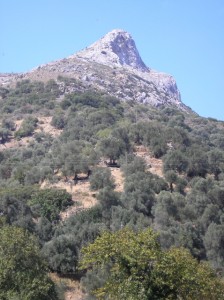
Sarakina Mountain
Over fifteen years had flown by since I last cycled up to Sarakina, a pretty village 11km north of Paleohora, and some 400m higher. That, and the need for some strenuous cardio-vascular exercise after an easy summer (and too many Amstels), was a good enough reason to ride there again in late September.
The first three kilometres on the Voutas road, through the Panorama ‘estate’ are steep, but from the col, at 200m, there’s a view many visitors to Paleohora never see – an impressive steep-sided valley with rocky mountains on either side, and you would never imagine the sea is so close. Five minutes and two hairpin bends later and I was down at Tsaliana, dropping into low gears for the steady climb to Kondokinigi. Now the gradient eases, slightly, for the next 4km into Sarakina. The road runs close to the river here, flowing all year round, and high above the river is the peak of Kastri, 819m, looking like a miniature Matterhorn from this angle. It’s best climbed from the hamlet of Stavros, although the south ridge, over a couple of other summits where rock-scrambling is necessary, is an interesting ascent.
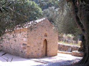
Sarakina Church
Just before Sarakina is the 13th century Byzantine church of Archangel Michael, beautifully situated among olive trees. If it’s not open, the key is easily located. Inside are many ancient frescos, and outside, in the shade, is the perfect place for a picnic lunch. Then into Sarakina, passing the olive mill and village hall, where stands the clock permanently at ten to one (although over lunch at the church it had struck twelve times at precisely one o’clock – in late October it will be correct!)
From Sarakina there are several roads and tracks which lead like octopus tentacles into even smaller villages, and a pleasant day can be spent exploring some or all of them – to Stavros (3km), Deliana (2km), Perivola (2km), and shorter walks to Platanos and Kefali, both about 1km away. But unless you’re adventurous, turn round and walk back into Sarakina, where there’s a pleasant little cafenion for refreshments before the ride (or drive) back to Paleohora.
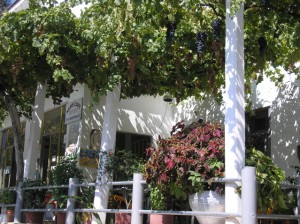
The Cafeneon
I continued beyond Sarakina, through Hondros, and turned right on the road less travelled up to Ghrighoriana, replenishing water bottles in both villages as both the gradient and afternoon temperatures climbed. Soon after the village the surfaced road ends, becoming a rough track at times too rough to cycle. (If you’re on foot – and it’s a fine walk from Sarakina to Vlithias – keep left at a junction, always uphill!)
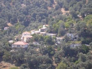
Hondros
At last the top, and a splendid view to the distant White Mountains and into the Kandanos valley, dotted with the villages of Plemeniana, Kakodiki, Kadros, and the Turkish fort above Spaniakos (all described in our book, see below). The long and winding track twists and turns as it descends, only becoming surfaced shortly before meeting the ‘main’ road, and a right turn into Mahia. More water from a spring below the village, then easily down to the River Kakodikianos and a last short climb up to Vlithias and the Chania road.
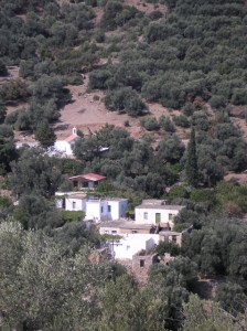
Tsaliana
The walk from Sarakina to Vlithias is approx. 14km, and hopefully a bus, lift or passing taxi will take you down into Paleohora. I had covered around 25km, and as a reward for cycling all the way from sea level to over 600m, I was able to freewheel all the way home.
‘Ten Walks from Paleohora’ available from ‘To Delfini’ bookshop in Paleohora.


Recent Comments