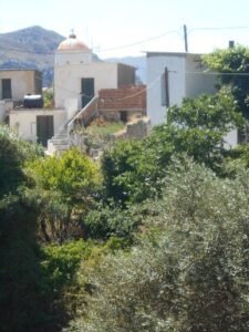
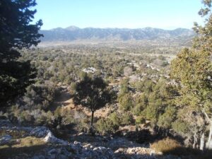
Simply Hike Voucher

Simply Hike (ad over on the right) are offering free delivery on all orders over £100 until 31st. March 2010. Just enter this voucher code when you make your order: MAR3P

Tags: crete, , greece, paleochora, paleohora, chania, holidays, hania

Posted by admin on March 6th, 2010 No Comments

Confronting The Crocodile

crocodile-and-kayak

Several readers (okay, three actually) left appreciative comments after our kayak trip from Agia Roumeli to Sougia (see ‘Explore’, June 2009), and others, local residents and visitors, have asked if we’ve paddled from Paleochora to Sougia around Akrotiri (Cape) Flomes - the head of the ‘Crocodile’. Yes, many times, and backwards too - not literally obviously, but the journey between Paleochora and Sougia in either direction, on foot or by kayak, is the ‘classic’ in this area.

But while the walk from Paleochora to Sougia measures 16km, with 560m of ascent, and takes 5/6 hours, the distance by kayak - on a calm flat sea - is just 14km (or 7.5 nautical miles), and at an average speed of 4 kph takes around 3.5 hrs. This is ‘kayak time’ of course, and breaks at Ianniscari (Anidri) beach, ‘Thunder Cove’ and Lissos, to stretch legs, picnic and swim, add as much time again.

Thunder Cove

Thunder Cove

An especially enjoyable voyage to Sougia was last June, with Dominique and her ‘crew’ of ‘Chausette’ on the bows of the kayak. We launched from Votsala (the ’stony beach’) around 11.00am, with just a slight swell on the sea, practically no wind and of course sunny. The long beach at Keratides was deserted except for Carol (Popi) waving us ‘Bon voyage’ or rather ‘Kalo Taxidi’ from the shore. Rounding the narrow spit of rocks beyond which are the two Ianniscari beaches, we looked up the gorge to the once little Cretan village, now sprawling metropolis of Anidri. The water is shallow here, but as clear as crystal, so ’siga ,siga’ - slowly, slowly - there is little danger of grounding. A few weeks previously I had floated close to a pair of black-winged stilts standing on the rocks here, beautiful wading birds with strikingly long pink legs, who had only taken flight when I was just metres away. Now they had migrated further north.

An hour after leaving Votsala we came ashore on the shingle beach, with onlookers amazed as always to see a small dog leaping from the front of the kayak. Ten minutes to stretch our legs, two and four, then on to ‘Thunder Cove’, a tiny secluded beach hidden away behind Cape Plakes. The name, we think, derives from the noise the surf makes, crashing through small caves in rough seas. Calm today though, and ideal for a swim and lunch in the shade.

An interesting digression here : in June 2008 two Italians, Salvatore Bartoli and Giacomo Della Gatta, set off from Myrtos to kayak (clockwise) around the entire coastline of Crete, returning there 19 days later after paddling 400 nautical miles (740 km). On Day 6 they kayaked from Loutro to Paleochora, 23 n/miles (43km), stayed the night with local fishermen, and next day continued around Elafonisi to Cape Mouros, a further 15m (23km). Their daily log, and some superb photos, can be seen on www.kayakextreme.net

There’s no possible landing between Thunder Cove and Lissos, some 6km and 1.5 hrs away around Akrotiri Flomes, or ‘Cape Crocodile’. The sea-cliffs here are magnificent, and not a little intimidating - impressive from the passing ferry, and even more so from a kayak floating directly underneath 100m of sheer limestone!

Approaching The Sea Cave

Approaching The Sea Cave

Once safely around the headland we made for the great cave I’ve seen referred to as ‘Elides’ or ‘Dinees’, only accessible of course from the sea.   Inhabited by nesting crag martins and pigeons, it measures some 30m deep, and gave us welcome shade on a hot June afternoon. Another stunning place to be in a kayak!

Inside the Cave

Inside the Cave

The beach at Lissos is set deep in Aghios Kirikos bay, and sadly is tar-polluted. We trod carefully and swam, and after Captain George’s taxi-boat called to collect some ‘day-trippers’, we had the place to ourselves. Tempting though it was to wander around the fascinating remains of Ancient Lissos in the late afternoon, journey’s end was still 2km distant. After half an hour’s steady paddling below sea-cliffs still sizeable, if not as dramatic as previously, we eased into the tiny harbour at Sougia.

Sougia

Sougia

“Dog days don’t come any better than this,” I remarked to Chausette as we relaxed on the beach, waiting for the ‘Samaria’ ferry to take us back to Paleohora. But Chausette only speaks French, and was in any case fast asleep.

I’m often asked if there are kayak hire facilities, or opportunities for day trips such as this in Paleohora. Unfortunately no, but contact www.seakayakcrete.com who run kayak holidays based in Loutro, further along the coast.

Tags: holidays, paleohora, paleochora, hania, chania, crete, , greece

Posted by admin on February 8th, 2010 No Comments

Discount

Quick note to say that Simply Hike (ad over to the right here) is offering a £5 discount to all orders over £50 until 31st.January. The promotion code to use is JAN50.

Tags: hania, , crete, holidays, greece, paleohora, paleochora, chania

Posted by admin on January 16th, 2010 No Comments

One Small Step for January

Some statistics : January, on average, has 14 rainy days (of over 0.2mm), more than any other month on Crete, although most rain falls in February (and last year we had 150mm in Paleohora, more than twice the average.) That leaves 17 days with no rain, and although perhaps with little or no sunshine either, at least there’s an opportunity to fit in a short 2-hour walk.

Vlithia gorge - a fine view!

Vlithia gorge - a fine view!

This circular route from Vlithias, 7km north of Paleohora, is ideal, and will fit in with the bus timetables. Take the 12.00pm bus * to the junction to Vlithias, a village largely hidden from the main road. (By car, park a further 200m on the main road, and walk down past the church of Christ the Saviour to join the minor road.) Follow the road out of the village towards Mahia, and after approx. 8 mins as the road begins to descend to the river, take a left turn. A small shrine (left) will confirm you are on the correct route. The lane winds between olive trees to a small, partially hidden group of houses. Continue ahead between rocks, but first climb up right to a fine ‘aloni’ (threshing circle) with a commanding view over the valley below. The track now winds down to the river, and in early spring there are masses of wild lupins (’Lupinus pilosus’) here - try and avoid treading on them.

Vlithias Bridge

Vlithias Bridge

Vlithias Aloni - Threshing circle

Vlithias Aloni - Threshing circle

Cross the River Kakodikianos by a concrete bridge, and then go left, below a wall (with orange & mandarin trees above), to reach a stony gully. A narrow path climbs the left side, then veers up left to meet a wider track, from where there are dramatic views into the deep gorge below. Follow the track to a junction, and keep left, contouring above the river below. Across the valley the rocky skyline dominates the view, from the hilltop church of Profitis Ilias (see ‘Explore’, September) to the ruined Turkish fort above Spaniakos. Eventually the track drops to re-cross the river. On the far side of the bridge, turn right, for a climb of almost 100m up to Vlithias. Pass an abandoned water-wheel, from a derilict water mill a little further downstream. Keeping left when the road bends, walk steadily upwards, passing three houses, one ruined and two inhabited (both with noisy dogs). Ignore a track leading left.

Vlithias Church

Vlithias Church

Approaching Vlithias, take a right turn (by a concrete water cistern) to the small ‘Assumption of the Virgin Mary’ church, beautifully situated among olive groves. An ideal place to pause, but keep an eye on the time if you plan to catch the bus! Return to the road and walk up into Vlithias ‘platea’, where there are fountains of fresh water and nearby stone sinks once used (and not too long ago) for washing.

The water fountains in the village

The water fountains in the village

The washing sinks

The washing sinks

Take a path left of the village church, and then turn right up to the main road. The bus leaves Chania at 12.45pm, and will pass at approx. 2.15pm. * Later in the year, the 7.15am bus from Paleohora, returning by the 8.30am bus from Chania (passing at c.10.00am) will also give ample time to enjoy this walk.

Congratulations to Eevaliisa Koskela and Carol Vardoulakis who correctly solved in December’s Christmas Puzzle. Both win a signed copy of our book ‘More Walks from Paleohora’.

Tags: paleohora, holidays, chania, , crete, paleochora, greece, hania

Posted by admin on January 8th, 2010 No Comments

Bob’s Christmas Paleochora Puzzle

paleohora-overview

South-West Crete - an area of rugged high mountains, a rocky wild coastline, narrow winding roads through pretty, colourful villages, spectacular scenery, and our home in PALEOHORA.

To reach this little town, “our island home”, where many fellow ‘lotus-eaters’ live, head west from CHANIA along the coast or National road, then south over the hills above KARES, dropping down to FLORIA, past SPINA into KANDANOS, then along the valley through PLEMENIANA, KAKODIKI, and KADROS, above MAHIA and VLITHIAS, finally below SPANIAKOS and through KALAMOS to the sea.

plemeniana

Plemeniana

Or drive further towards the west coast, then through TOPOLIA, MILI, towards ELOS, and by way of STROVLES, ALIGI, PSARIANA and DRIS, or take the high mountain roads through VOUTAS or SARAKINA.

Spaniakos

Spaniakos

Alternatively, travel south from Chania, above KARANI to OMALOS, then down below SKAFI, through AGRILES, RODOVANI and MONI to SOUGIA, or on to MAZA and TEMENIA before turning south, either through AZOGIRES, or PRODROMI and ANIDRI to the South Coast, with views to the island of GAVDOS. East
along the coast is LISSOS, and to the west is KRIOS, at the end of the road.

Beware of flying bullets!

Beware of flying bullets!

All the 37places in BLOCK CAPITALS can be found in the Word Square (vertical, horizontal diagonal, forwards or backwards), with the exception of TWO.

Use this puzzle grid

Use this puzzle grid - print it first!

What are the two missing places? E-mail your answers to : info@thepaleochorasite.com
All entries received by December 24th will go into Barry’s largest curry pan, and a draw made by Jenny on Christmas Day. First correct entry wins a (signed!) copy of our book ‘More Walks from Paleohora’ (see below).

Paleochora Xmas tree 2008. Ahhh..pretty.

Paleochora Xmas tree 2008. Ahhh..pretty.

Happy Christmas!

(If you’re unlucky in the draw, copies of our two books, ‘Ten Walks around Paleohora’ and ‘More Walks from Paleohora’ are on sale at ‘To Delfini’ bookshop in the village.)

Tags: crete, paleohora, hania, greece, paleochora, chania, , holidays

Posted by admin on December 6th, 2009 No Comments

Vienna In Winter

The steady drone of chain-sawing from nearby and distant olive groves can only mean that winter is fast approaching. For (as Pooh would have noted) chain-sawing means wood piles, and olive logs, and wood stoves (zompas), with maybe a little something simmering on the top. And cosy evenings with shutters closed, and crosswords, music, books, or DVD of your choice as temperatures fall and winds rise outside.

Crete though has an average of 300 days of sunshine annually, and statistically 22 of these fall in November, so don’t put the walking gear away yet. But shorter days require shorter walks, and this one, from Krios beach over to Vienna, approx. 45 minutes each way, is ideal.

A View of Vienna Beach

A View of Vienna Beach

Krios is 9km west of Paleohora, at the end of the road, although the E4 footpath continues to Elafonisi (see below). There’s a twice-a-day bus (around 7.00am and 2.00pm, check in the bus station), or drive/take a taxi ; the 2-hour walk through Koundoura is uninspiring once the road leaves the coast, and not recommended.

As with Kadros, we first visited Vienna with Tony Fennymore, and his notes, included here, will provide much information as to what to see and look for there. From the car park and taverna on Krios beach, walk along the shore to a rocky promontory, and climb over this to a small sheltered bay with a rock islet offshore. At the far end of the beach the path heads inland, way-marked with cairns and E4 black/yellow paint, climbing to join a rough track. Leave the track at a cairn, and take a path, left, gradually losing height, eventually veering left down a rather loose gully to reach the sea.

Vienna is a fascinating place, where “there would appear to be a partially man-made anchorage out of a natural, protected harbour, and the remains of a Hellenistic/Roman sanctuary.” On the shore are the broken remains of several marble columns, which Tony believed once formed a temple here. “The actual building appears to have been located just a short distance back from the shoreline, where there is a raised platform for a room, with a ramp down to the sea, and the columns appear to have formed a portico/arcade at the front.” Where the columns came from, or how they arrived here, is a Stonehenge-like enigma, as they “are of marble or a type of red granite which does not appear to be of local origin.”

A Marble Column Lies On The sand

A Marble Column Lies On The sand

So why was a temple built here? Tony thought that it “could well have been a sanctuary or place of worship, and acted as a place of pilgrimage when voyaging around the headland”, and where libations and offerings were made before or after a long and hazardous sea journey.

vienna-pottery

Pottery Shards Are Everywhere


Shards and fragments of pottery are everywhere, the remains of vessels once containing oil or wine. Tony speculates on the importance of the natural cave in the outcrop high above the cove. “The cave is no doubt the ‘key’ to the site, although there is no evidence whatsoever of any human habitation or use of the cave as a place of worship. In ancient times it could have been deemed to be a ‘home’ of one of the Gods/Goddesses, and it may have been capable of producing natural sounds, ie. from the wind - a sign that the Gods were speaking, or a Siren.” The Sirens were mythical sea-nymphs who lured passing sailors to their deaths with their sweetness of song. Odysseus, who possibly passed this way, filled his crew’s ears with wax, and lashed himself to the ship’s mast, to avoid such a fate. The climb to the cave takes around 20 minutes, and provides a fine retrospective view of the bay, but nothing of historical importance.

The Cave Above Vienna Beach

The Cave Above Vienna Beach

The water level in Hellenistic times (323 - 67BC) would have been far deeper than now, due to the raising of the level of the shoreline at this end of the island. “The cove/lagoon has a natural mole to form this protected anchorage, and it would appear that rocks have been cleared away from the cove so as to facilitate the mooring of boats. No doubt the cove was an ideal lair for pirates, and the site would have been looted.”

A Safe Anchorage

A Safe Anchorage

Water was of course essential, and “to the east of the platform is evidence of a well or pit, an important feature insomuch as the anchorage could well have been a stopping place to replenish water supplies of the boats.”

So what happened here? “From the various positions of the columns, the sanctuary was either badly damaged by an earthquake, or some attempt has been made to remove the columns for re-use.” That is, the site was destroyed and ransacked. Quietly contemplating before walking back to Krios, sitting on a column brought here over two thousand years ago, only one thing is certain - we shall never really know ……

So, ‘kalo xeimonas’ - have a good winter, and remember the words of the poet Shelley:

“If Winter comes, can Spring be far behind ?” In just a few weeks time the almond blossom will be appearing, and soon afterwards the cherry trees will be “hung with bloom along the bough.”

The 10km walk from Krios to Elafonisi is described in our book ‘Ten Walks around Paleohora’, available from ‘To Delfini’ bookshop.

Tags: , hania, crete, greece, paleohora, holidays, paleochora, chania

Posted by admin on November 8th, 2009 No Comments

A Visit to Sarakina

Sarakina Mountain

Sarakina Mountain


Over fifteen years had flown by since I last cycled up to Sarakina, a pretty village 11km north of Paleohora, and some 400m higher. That, and the need for some strenuous cardio-vascular exercise after an easy summer (and too many Amstels), was a good enough reason to ride there again in late September.

The first three kilometres on the Voutas road, through the Panorama ‘estate’ are steep, but from the col, at 200m, there’s a view many visitors to Paleohora never see - an impressive steep-sided valley with rocky mountains on either side, and you would never imagine the sea is so close. Five minutes and two hairpin bends later and I was down at Tsaliana, dropping into low gears for the steady climb to Kondokinigi. Now the gradient eases, slightly, for the next 4km into Sarakina. The road runs close to the river here, flowing all year round, and high above the river is the peak of Kastri, 819m, looking like a miniature Matterhorn from this angle. It’s best climbed from the hamlet of Stavros, although the south ridge, over a couple of other summits where rock-scrambling is necessary, is an interesting ascent.

Sarakina Church

Sarakina Church

Just before Sarakina is the 13th century Byzantine church of Archangel Michael, beautifully situated among olive trees. If it’s not open, the key is easily located. Inside are many ancient frescos, and outside, in the shade, is the perfect place for a picnic lunch. Then into Sarakina, passing the olive mill and village hall, where stands the clock permanently at ten to one (although over lunch at the church it had struck twelve times at precisely one o’clock - in late October it will be correct!)

From Sarakina there are several roads and tracks which lead like octopus tentacles into even smaller villages, and a pleasant day can be spent exploring some or all of them - to Stavros (3km), Deliana (2km), Perivola (2km), and shorter walks to Platanos and Kefali, both about 1km away. But unless you’re adventurous, turn round and walk back into Sarakina, where there’s a pleasant little cafenion for refreshments before the ride (or drive) back to Paleohora.

The Cafeneon

The Cafeneon

I continued beyond Sarakina, through Hondros, and turned right on the road less travelled up to Ghrighoriana, replenishing water bottles in both villages as both the gradient and afternoon temperatures climbed. Soon after the village the surfaced road ends, becoming a rough track at times too rough to cycle. (If you’re on foot - and it’s a fine walk from Sarakina to Vlithias - keep left at a junction, always uphill!)

Hondros

Hondros

At last the top, and a splendid view to the distant White Mountains and into the Kandanos valley, dotted with the villages of Plemeniana, Kakodiki, Kadros, and the Turkish fort above Spaniakos (all described in our book, see below). The long and winding track twists and turns as it descends, only becoming surfaced shortly before meeting the ‘main’ road, and a right turn into Mahia. More water from a spring below the village, then easily down to the River Kakodikianos and a last short climb up to Vlithias and the Chania road.

Tsaliana

Tsaliana

The walk from Sarakina to Vlithias is approx. 14km, and hopefully a bus, lift or passing taxi will take you down into Paleohora. I had covered around 25km, and as a reward for cycling all the way from sea level to over 600m, I was able to freewheel all the way home.

‘Ten Walks from Paleohora’ available from ‘To Delfini’ bookshop in Paleohora.

Tags: chania, crete, greece, paleochora, holidays, , hania, paleohora

Posted by admin on October 7th, 2009 No Comments

Kadros - ‘Ancient of Kantanos’

Almost everything Lynne and I know about the historical site in the hills above Kadros - signed to ‘Ancient of Kantanos’ - came from our friend the late Tony Fennymore. Tony took us here, and to other local sites of Viena and Irtakina, and made the places come alive with his vivid descriptions. “Imagine you were standing here 3,000 years ago,” he would tell us, “this is what you would see.” Tony always intended writing a guide to these sites, but never got round to it, and now it’s too late.


Tony kindly offered us his rough notes to Kadros for use in our book ‘Ten Walks from Paleohora’ (see below), and now, with permission from Ann and Tony’s family, they will give much additional interest on a circular walk of approx. 10km from Kakodiki, a short drive (10km north) from Paleohora, or just 10 mins on the bus to Chania.


Take the bus to Kakodiki, and walk back to the cafenion ‘Oi Filoi’, on the north side of the new bridge (or park your car there). Walk up the road leading off left, which winds up to a junction (turn right), close to the large church of Agia Triadha, and the smaller and more interesting 13th C Mihail Arhangelos. Before long the gradient eases, with a distant view of our objective, Profitis Ilias hilltop church. Continue on the surfaced road (keep right if in any doubt) until, after 6km, you reach a junction with a signpost ‘Ancient of Kantanos’. Turn left here, passing several houses and a water tap, on a track which ends in a meadow beside a modern chapel.


Look for the signpost!

Look for the signpost!

Some background from Tony : “The mountains which lead into the Kakodiki river provided ideal conditions for the foundation of large and small cities ; first because of the safety that resulted from the region’s inaccessibility, and secondly because of the wealth of agriculture. The region reached its peak during the Hellenistic years (4th to beginning of 1st c. B.C) and during the period of Roman rule (67 B.C. to 4th C A.D.) a time when Crete flourished generally. The most impressive visible remains of the area are found near the modern village of Kadros, where, even without excavation, there are indications of an extensive city with a large number of inhabitants.”


The path to the site is not the original approach, which “would have been along the floor of the valley to the right-hand side, entering the city through a narrow gap between natural rock abutments with defensive walls built of large, cut, polygonal shaped blocks of stone which extended all round the site - often referred to as ‘Cyclopean’ walling, as later Greeks considered only giants (the Cyclops) could have cut and moved such huge blocks.”


Tomb

Tomb

Just before the gated entry to the site, look for a burial chamber (left), and turn right through another gate to find more after a few metres. There are others, and maybe some as yet undiscovered. Tony again : “The rock-cut tomb chambers are very similar to those at Irtakina and other sites of this period, ie. Dorian (1,500-650B.C.) and going into the Archaic, Classical & Hellenistic periods (650-67B.C.) They accord to local burial customs of the time, being similar in design and execution, and have one chamber, usually square and some 1.5 - 2 metres deep. Many of them display rebated jambs to the front opening, indicating the existence of an earlier, and now missing, well-fitting ‘door’ or closure slab.” As was the custom then, these cemeteries provided the dead with a fine view - of the acropolis opposite and the hills and valleys beyond.


The view to Kadros

The view to Kadros

Kadros Church

Kadros Church


Let’s climb the hill, by a path of sorts opposite the chapel. It’s really two outcrops separated by a deep ravine some 200m long, which itself is worth exploring. Some summers ago, Lynne and I leased a room in Paleohora from an ex-Kadros landlady. As a young girl, she told us, she and the village women and children were hidden in the chasm when German troops were in the area during the last War. From the far (W) end of the ravine, it’s possible to scramble up to the summit, but only for those sure-footed with a ‘head for heights’.


Kadros Ravine

Kadros Ravine

The path is marked by faint red dots. “On the track up to the church there are some large, rectangular, man-cut spaces in the natural rock strata, which formed the rear and side walls of buildings. Very often the natural rock has been used as a foundation or a section of wall, cut according to need. Several large structures stand out, which must have been the public buildings of the city, ie. temples or open areas for ceremonial purposes.” At the summit, 590m high, is the church of Profitis Ilias, and a splendid all-round view, perhaps the best in Selinou. “From its position, it is obvious that the city controlled at least the area of modern Kakodiki, where there must have been various small towns/villages whose inhabitants were concerned with agriculture and livestock.”


On the way down, sit for a while and listen to Tony describing the scene below : “These were civilised people who built extensive terracing to grow cereal and other crops. They had an ample water supply. Olive and almond trees provided fruit, oil, shade, and wood for heat and building. They kept sheep and goats for meat, milk, wool, skins and fleeces. Above all, they were relatively safe at a time when Crete was prone to civil wars and piracy from the sea.”


Former dwellin places cut into the rock

Former dwelling places cut into the rock


To continue the walk, return to the T-junction and sign, and turn left, downhill. At the next junction, go right, passing - or calling in at, if it’s open - Kadros’ colourful cafenion. Below the village, avoid a left turn to Periana (cul-de-sac). On reaching the main road, turn right for 800m into Kakodiki, or wait for the ‘bus, passing approx. 1.5 hrs after leaving Chania.


Kadros Kafeneon

Kadros Kafeneon


Tony’s unique book “Fenny’s Hania” - essential for everyone wishing to explore the hidden parts of the town - is still available. Details from www.fennyscrete.com


‘Ten Walks around Paleohora’ & ‘More Walks from Paleohora’ are available, while stocks last, from ‘To Delfini’ bookshop in the town centre.


Tags: chania, holidays, , paleohora, crete, greece, hania, paleochora

Posted by admin on September 7th, 2009 No Comments

Around Palea Roumata

The walk from the village of Palea Roumata to Agios Vasileios church in nearby Vavouledo, returning down a small gorge, is described in our book ‘More Walks from Paleohora’ (see below).
Or rather it isn’t, for since the guide was published in 2003 the second part of the walk has changed considerably, and, if that were possible, it has improved. I’ll go as far as to say that there isn’t a better short walk in Western Crete. The distance is only 5 km, taking around two hours, and you’ll enjoy every step of the way.

Palea Roumata is 41 km from Paleohora, turning off the main Chania road in Kakopetros, or coming from Chania, take a left turn through Fotokado after the climb out of Voukolies. Park in the village centre below the imposing church. With the church, and a recently built library/reading room on your left, take the road (south) out of the village, rising steadily through olive groves and vineyards. After 1km turn right, with a distant view of Agios Vasileios church, and at the next junction, on a sharp ‘hairpin’ bend, keep right again. Now the trees are pine, chestnut and plane, as the road swings right, over a bridge and into the hamlet of Vavouledo.

Here’s where things have changed. There’s a small wooden picnic table and chairs, with a water tap, and a sign indicating the path to Palea Roumata. And another to the church just a short distance away, which you must visit, by a path through through fields, below walnut and cherry trees. ag-vasileios-1Agios Vasileios is two churches linked, the smaller and older dating from the 11th century with some well-preserved frescos.ag-vasileios-21

The way back to the village is unmistakeable, and the scenery just stunning, especially if water is running down the narrow ravine. There are several more picnic tables, in almost total shade, so take lunch or a snack with you and enjoy the tranquility. Wooden footbridges with handrails cross the stream at intervals, and lower down are a couple of shallow fords. Eventually the path breaks out into the sunshine, leading away from the river on a wide path through olives and wild flowers, past grazing goats and sheep.pal-roumata-3

On the edge of Palea Roumata we stopped to admire a well in a courtyard. “My great grandfather built it in 1869,” said the Greek houseowner, “but the water’s better from the house, come and sit down.” His wife brought us ice-cold water, while he went off to pick a large bowl of plums. The word “Roumata”, he told us, is the old Greek for rivers (’rheuma-atos’ meaning ’stream’ or ‘flow’) and the village has a good supply of water from two valleys, making everywhere so green and

fertile. “What are winters like?” we asked. Generally mild, the village being sheltered by
surrounding hills, except memorably in February 2008, when the temperature dropped to -7c, and strong winds combined with heavy snowfall destroyed many olive trees, as in so many other places locally. Inevitably, out came the ‘raki’, or more correctly ‘tsikoudia’. Lynne and Avril declined, but John and I, being men, felt compelled to accept, even though it was not yet mid-day. “Is it your own?” we asked, somewhat unnecessarily. “Of course!” he replied, and very good it was too. Especially the second …

pal-roumata-tree

The village ‘platea’ is just a few minutes away, but first we went to look at ‘The Monumental Olive Tree of Palea Roumpal-roumata-tree-2ata’, on the ‘main’ road into the village. Reputedly some 3,000 year old, an information board gives the massive tree’s history and measurements. One of its uses was to hide weapons used by partisans at the battle of Anavos, soon after the German invasion of Crete in 1941.

Our book describes the walk down the Vavouledo gorge into Palea Roumata as “a hidden gem”, and six years on it remains so. The recent path construction has been by the ‘dimos’ or borough of Voukolies, we were told by our new Greek friend, but we have seen no publicity about it. The gorge deserves to be better known. Go there and enjoy it - you won’t be disappointed!

‘More Walks from Paleohora’ is currently on special offer at ‘To Delfini’ bookshop in Paleohora.

Tags: paleohora, greece, , crete, paleochora, chania, hania, holidays

Posted by admin on August 4th, 2009 No Comments

A Bridge not too Far

How many regular visitors to Paleohora, including those familiar with walks in the area (see below), will recognise the photo of this beautiful arched bridge?

The Bridge at Mahia

The Bridge at Mahia


Very few I imagine, and yet as the eagle flies it’s only 8km (5 miles) from the town, and just a (long) stone’s throw from the two roads east and west above the River Kakodikianos, which it crosses.
The bridge deserves to be better known, and hopefully in future will be, as it’s one of the landmarks on a route being created and waymarked from the village of Anisaraki, above Kandanos, down the valley to Paleohora.
Mahia Bridge

Mahia Bridge


At present the route goes only to Vlithias, from where there’s no obvious onward way down the valley. Scenically it should continue up to Spaniakos, climb to the old Turkish fort, descend to Azogires, and thence to Anidri and down the gorge to the sea. We shall see.
Even in the heat of summer, the walk from Vlithias to Kandanos is feasible, but an early start is advisable. Take the early bus (7.15am), or a taxi to the turning to Vlithias, just 7km from Paleohora. The first part of the walk, as far as Mahia, is decribed in Walk 2 of our book ‘Ten Walks from Paleohora’. Leave Vlithias on the minor road, descending to the bridge, and then climb steadily up to Mahia. En route is a water source, the last until Plemeniana, so ensure you carry a good supply.
Entering Mahia, look out for a track on your right, marked with a red diamond, the indicator for the route. If you reach the cafenion you’ve missed it, go back! Follow the track down, ignoring all side turns (keep left if in doubt), to pass under huge cliffs as you near the river, which flows all year round. The stone bridge, steeply arched in the centre, is to the right, with picnic tables and benches on either side. Enquiries as to when it was built have come up with nothing, except that it was on an old mule trail between Mahia and Kakodiki.

Pear blossom in the spring

Pear blossom in the spring


Cross the bridge, from where a path leads to a wider track, and turn left, uphill. Follow this track, again ignoring all side turns to left and right, until it meets a surfaced road, near a map/info board. Turn left, gently down bends to where the road runs alongside the river, then through the houses of Sfakos. Climb more steeply uphill to a road junction with a small church to your right. Turn right along this road, but after only 5 mins (or less), take a track right, which will bring you once again to the river, via (left of) some newly planted olive trees.
The path under shady plane trees leads to stepping stones. Cross these, and turn left on a new track leading up to a church. Our path keeps left of a huge log stack, and meets a wider track above a small S-bend. Again turn right, back to the river, which is crossed by a wooden footbridge. Walk alongside the river through tall bamboo plants, until the path veers right, up to meet the main road (to Chania) a short distance (500m) from Plemeniana. Continue into the village, but look for a gap on your left, between houses, and take this, passing a spring of cold water, down to a footbridge.
If, like Lynne and I (and a small bear) you like “a little something at eleven o’clock in the morning”, this is the place. The taverna ‘O Milos’ is nearby on the main road (to Dris & Elos), or turn right to continue the walk, leaving the road where it bends right, at a map board/waymarker, to a picnic table and seats.
The waymarker board

The waymarker board


Here the path is unclear. Drop into the streambed for a very short distance (avoiding wire fences), then scramble up a bank to the rear of a church. At the next diamond waymarker cross the stream by small stepping stones, and go left to where the path runs between stone walls. Here the path is currently VERY overgrown, but persevere and it will improve. Pass to the right of another church, left of buildings, and keep straight ahead to reach the main road.

Cross directly, taking the surfaced road opposite, which leads gradually uphill between olive groves, passing another small church. When the road levels out (at last), ignore a turn right, and keep ahead to reach the Town Hall and church (Agia Analipsi) and by steps left into Kandanos’ ‘platea’. Here you can relax, enjoy a drink or meal whilst waiting for the bus back to Paleohora, which will pass through approx. 1.5 hrs after leaving Chania (check current times at the bus station).
If you have a car, a more convenient way to tackle the walk is to drive to and park in Kandanos, then catch the 8.30 bus from Chania which passes through around 10am. Get off at Vlithias and follow the route back, but of course the coolness of early morning will have gone. (So maybe an evening walk, with the 4.00 bus from Chania - Kandanos app. 5.30pm - would be better.)
The distance of the walk from Vlithias to Kandanos is around 12 km.

(’Ten Walks around Paleohora’ and ‘More Walks from Paleohora’ only available from ‘To Delfini’ bookshop)

Tags: paleohora, holidays, paleochora, chania, hania, crete, , greece

Posted by admin on July 11th, 2009 No Comments