
“Season of mists,” wrote John Keats, referring to the English autumn, but November is generally a good month here in Paleochora. It’s cooler, and we can walk all day, the sea is still warm, and the summer crowds have gone. The ‘down-side’ is that ferry and ‘bus schedules are reduced, as are daylight hours, so of course it’s dark far earlier.
Autumn is also a time for making plans for next year, which in my case include (D.V.) another trip to Nepal, with more trekking in the Himalaya, and walking further sections of the E4 long-distance path, especially in central and eastern Crete. I’ll be helped immensely in this respect by the recently published guidebook (2016, Anavasi) “The Cretan Way”, written by Luca Gianotti, an Italian walking tour guide who I met at the ‘Third Eye’ in Paleochora last year. The book describes a 28-day walk (480 km) from Kato Zakros to Chrisoskalitisa Monastery, taking in both Psiloritis and the White Mountains, but suggesting alternative lower-level routes to by-pass these.
For the most part, the E4 follows a single line from east to west, but between Chora Sfakion and Sougia there are several variations, to avoid the difficult coastal path beyond Agia Roumeli (see ‘Explore’ – June ’17), and strenuous high-level 2-day routes through the Lefka Ori. So the easiest way from Sfakia to Sougia is via Loutro to Agia Roumeli, then UP the Samaria Gorge to Omalos, and down Agia Irini Gorge back to sea-level. A more challenging route from Omalos is via Linoseli over to the mountain village of Koustoyerako, of which Loraine Wilson writes * :
“This section of the E4 which crosses the huge cliff below the summit of Strifomadi
(1921m) is a shepherds or hunters route, which may suit experienced mountain walkers
with a good head for heights ; it is not suitable for those who suffer from vertigo
or who are encumbered with heavy packs.”
* The High Mountains of Crete (Cicerone)
Path to Linoseli
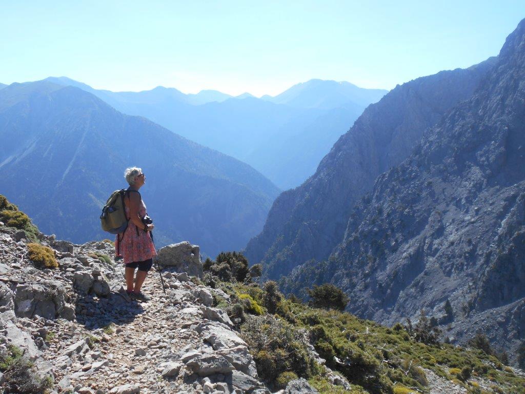
And that’s what we did earlier this summer. With an early start essential, we stayed overnight at the excellent Exari Hotel in Omalos, who provided breakfast and a lift up to Xyloscala before 8.30am. I’ve described the path up to Linoseli (and Gingilos) before – ‘Explore,’ April ’14 – so suffice to say that via the “rock arch” and ice-cold water of Linoseli spring, we reached the col in a little under two hours.
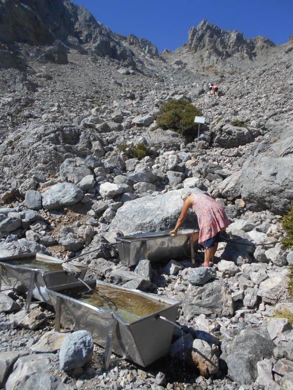
Linoseli springs
From the col/saddle, at 1700m, it’s left (to Gingilos) or right along the E4, very definitely not ahead ; a sign warns against any attempt to descend into the Tripiti or Klados gorges, where many have come to grief.
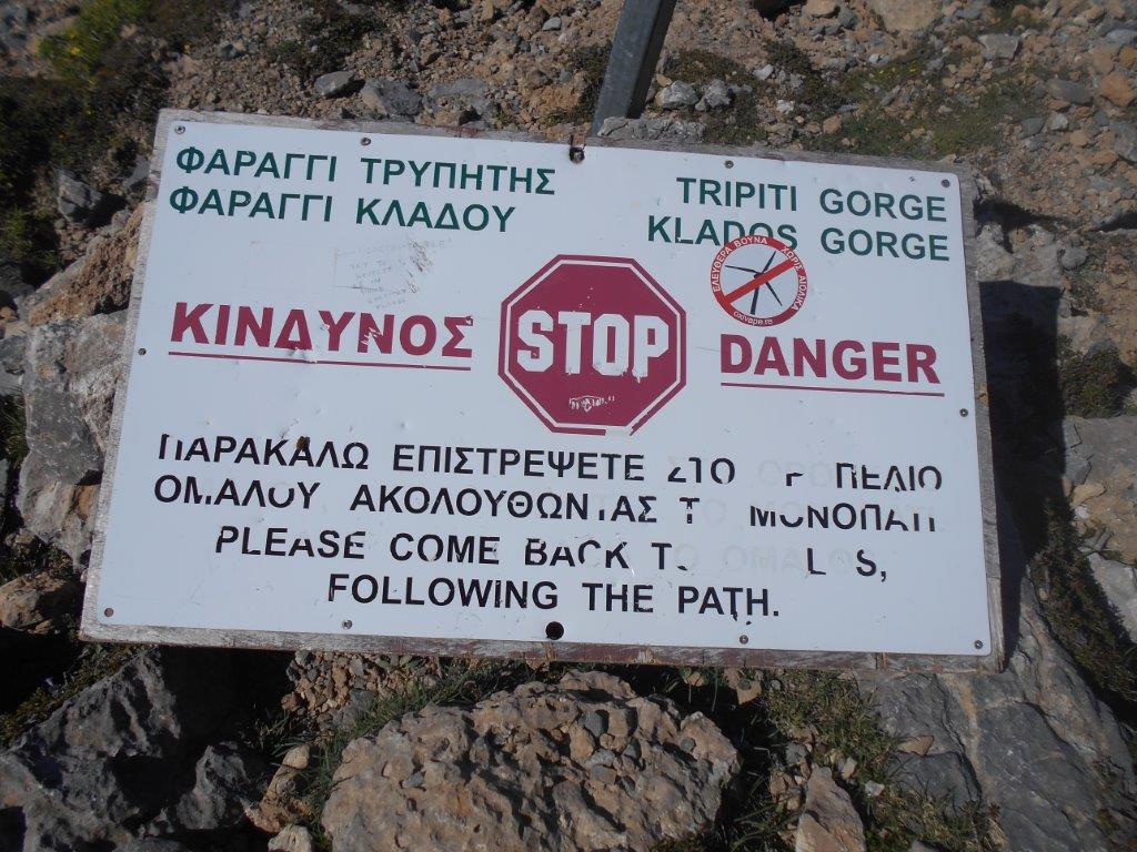
Linoseli warning
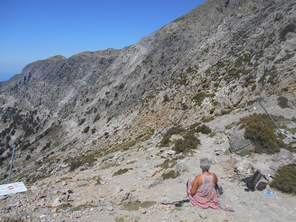
At Linoseli
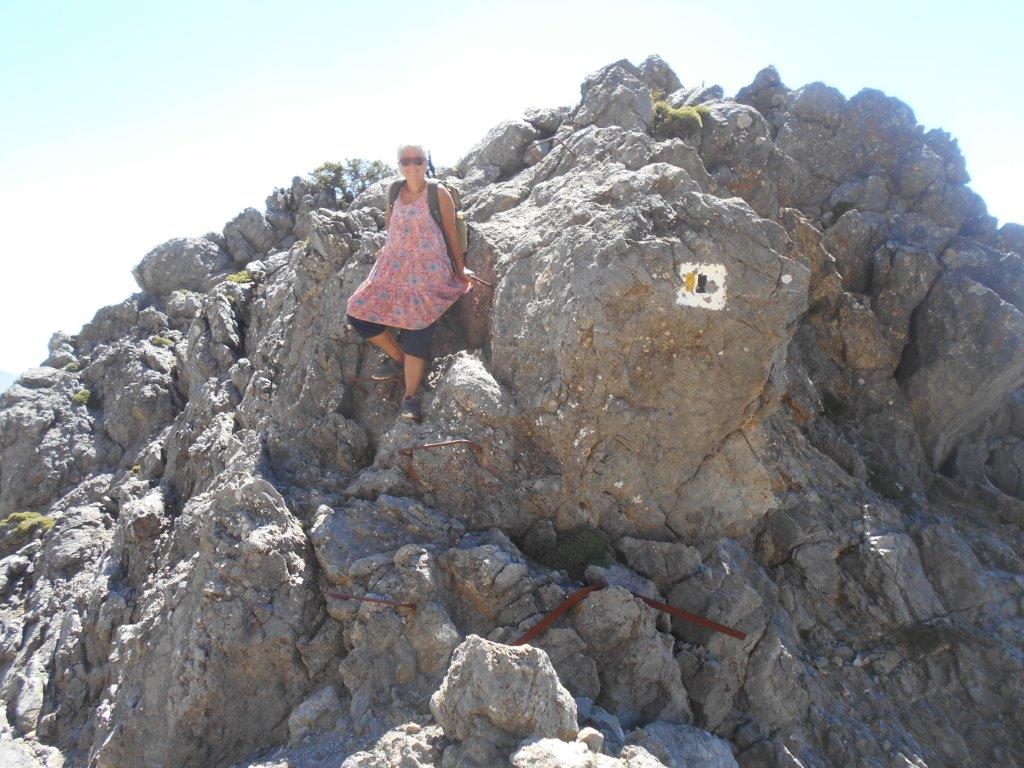
The E4 beyond doesn’t look easy, and it’s not ; waymarking is adequate, though constant looking ahead for paint on rocks, and an occasional pole, is essential. The ‘trail’ climbs, dips, then traverses, mostly on loose and dubious rocks . One awkward section was assisted by a fixed wire “handrail”, damaged and now unconnected to the rock after winter snow and ice. One similar soon after was in place, thankfully, but the hardest part, maybe 10m across with a frightening abyss below, was unprotected.
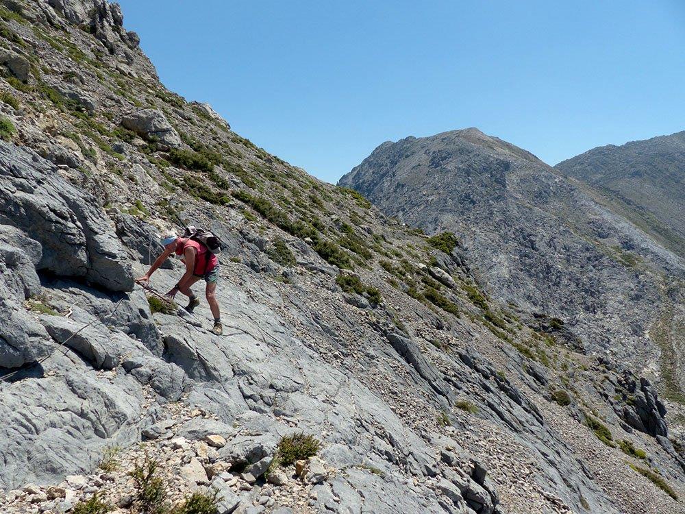
Bob concentrating hard
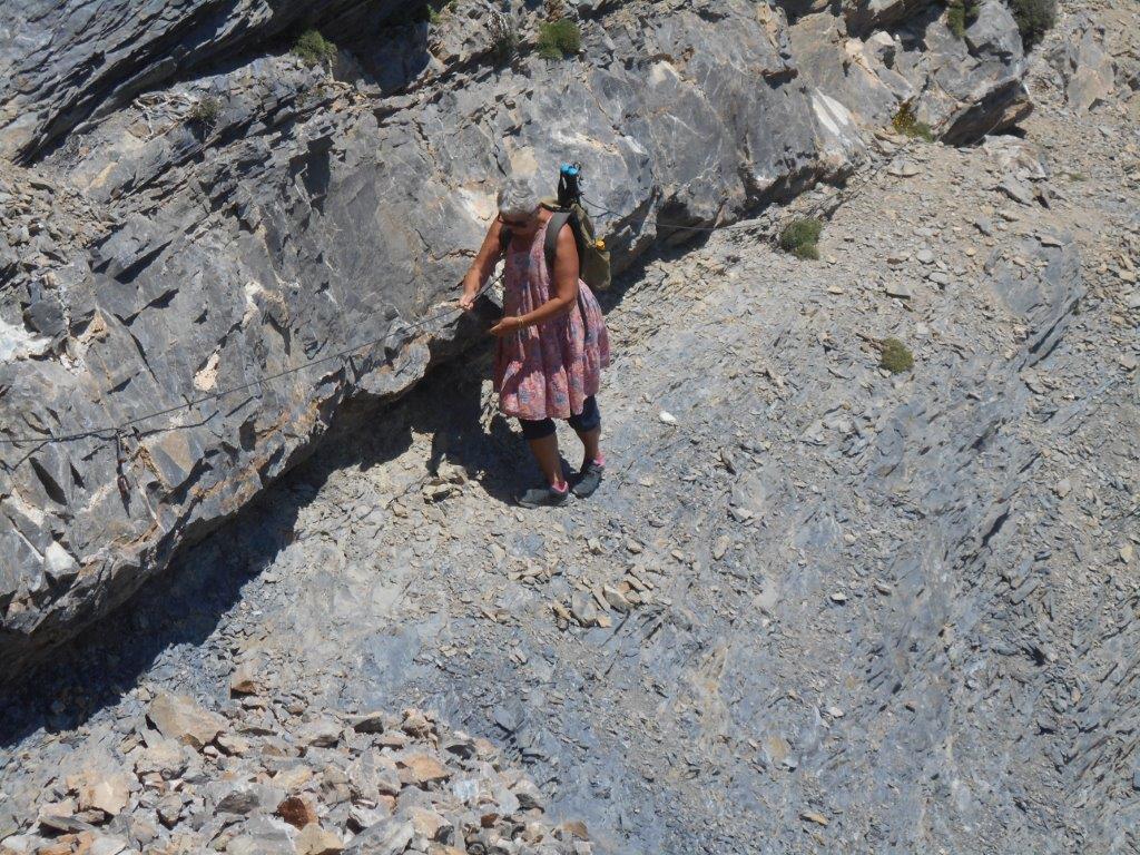
2nd wire traverse
Eventually we reached the ridge beyond, all difficulties were over, and we could relax. But still a long way to go, we weren’t even half-way. A long open valley came next, at the head of which was a spring/trough of fresh water, primarily for animals, but in an emergency could be a life-saver.
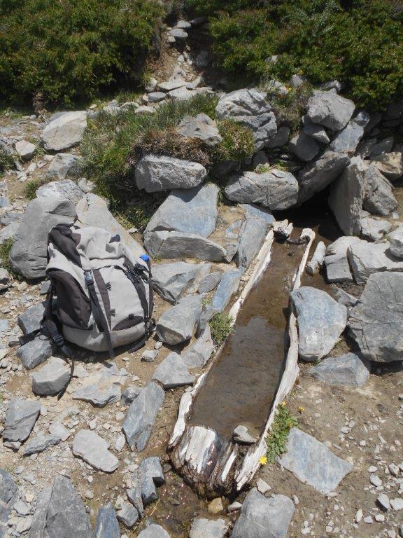
Lifesaver
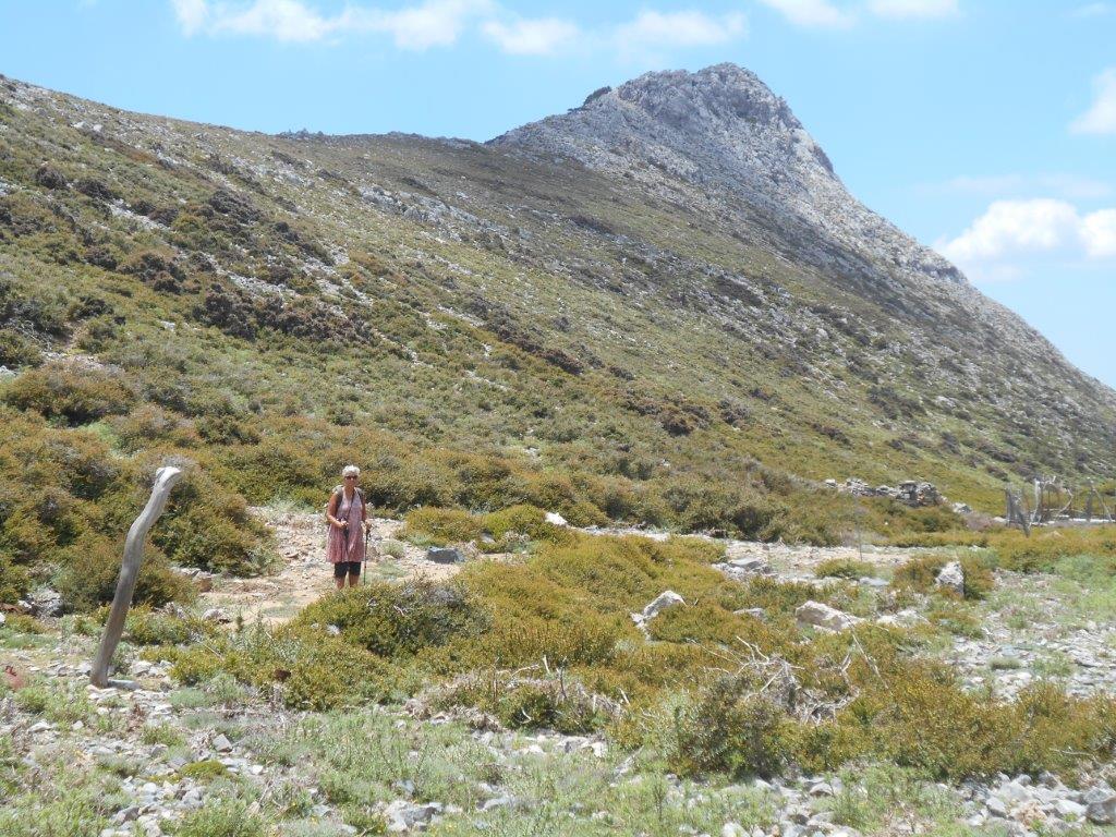
The valley narrows, the path running above a deep, dramatic ravine, a branch of Tripiti, then climbs over a ridge to the Achlada ‘mitata’ (cheese huts). On my last visit the concrete huts were open, and after a fire outside, we spent a cold October night indoors ; now they are firmly padlocked when not in use by summer shepherds.
Achlada
Here, on 15th November 1943, took place the “Battle of Achlada” when Cretan partisans, led by New Zealander Dudley Perkins, ambushed a German patrol intent on stealing sheep in the area. More than seventy years after “an incident still vivid in the memories of the men who took part ..” all was peaceful and the ‘mitata’ deserted, but these hills could tell some stories.
E4 via ferrata
From Achlada to Koustoyerako took us three hours, descending steadily along the riverbed below pine and kermes oak trees. At 1000m a.s.l (at Olisma) we joined the path from Ag. Theodori (see ‘Explore’ July ’14), where the E4 turns south to reach Ag Ekaterini chapel. And so down into Koustoyerako, and into the recently opened cafenion there. After a strenuous eight-hours from Xyloscala (“Panagia mou !” said Maria) we appreciated water, lemonade, cold coffee … and a rest.
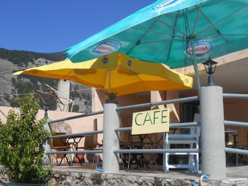
Koustoyerako cafe
I suggested taking the footpath down to Livadas, and from there on to Sougia, maybe two hours away. “Or,” countered Michelle, “I could call my friend Giorgos, and his taxi will take us there in twenty minutes.” A much better idea, which of course we took ……
Footnotes
Read about the Battle of Achlada in “Vasili – The Lion of Crete” – Murray Elliott pp. 152/160
and in “Crete – The Battle and the Resistance” – Antony Beevor pp.296/297
Giorgos Falagaris – Sougia Taxi – +30 28230 51485 Mobile +30 6972370480
Of course, don’t attempt this route …. “if the weather is unsettled, that is, if there is likely to be thick mist, rain or strong winds.” (The High Mountains of Crete)

Recent Comments